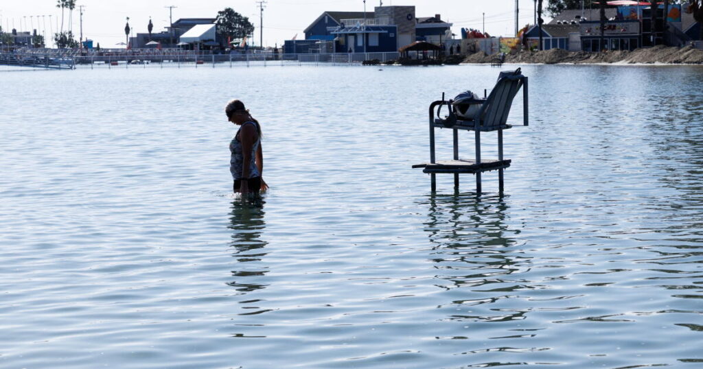
The significant coastal flooding that hit Southern California in recent days points to what a worst-case scenario would look like in an El Niño-fueled winter with sea levels expected to rise even farther.
Last week’s flooding was so bad because of two events that are expected to worsen over the next few months: a record-hot ocean raising sea levels combined with higher-than-normal tides. A third factor would be powerful storms that bring big waves.
How these three factors play out — and whether they occur simultaneously — will determine how punishing this winter will be for the coast.
The tides themselves were moderately high last week, but they, in combination with record ocean temperatures, were enough to push up sea levels significantly.
The average sea level was 1.4 feet higher than expected in San Diego, 1.3 feet higher in Los Angeles, and 1.1 feet higher in San Francisco, for the week ending Friday, according to an analysis of data provided by William Sweet, an oceanographer with the National Oceanic and Atmospheric Administration.
Indeed, sea levels reached record heights — not seen in more than a century of observations. All-time records for maximum sea levels were shattered in Los Angeles, San Diego Bay, Santa Barbara and La Jolla last week.
At the San Pedro gauge in L.A., the sea level reached 8.02 feet on Oct. 26 and 8.19 feet a day later, breaking the old record of 7.93 feet above the baseline (defined as the average daily lowest-water level observed between 1983 and 2001) — which happened on Jan. 10, 2005, during an El Niño winter.
Sea levels could get even higher with the arrival of king tides around Thanksgiving, Christmas and the Martin Luther King Jr. Day holidays.
Warmer water increases sea levels because the heat increases its volume. Unusually hot ocean water worsened the sea level rise that peaked during last week’s high tides. Those temperatures are expected to be higher than normal throughout the winter.
“The king tides are going to provide a larger trigger for flooding,” said Dillon Amaya, an assistant professor at North Carolina State University’s Department of Marine, Earth and Atmospheric Sciences. Plus, “the ocean is expected to remain warmer than average for at least through the spring.”
And the ocean remains quite hot. On Saturday, the sea surface temperature at Scripps Pier in La Jolla was 75.4 degrees — an astonishing 11.1 degrees above the historical average for Halloween. Saturday’s temperature is even higher than the highest average temperature for the entire year — around 70 degrees — and broke a record for the hottest Halloween in the record books, which go back to 1916.
Last week, 114 homes and other structures along the coast were damaged by seawater in Huntington Beach alone, mostly in the neighborhoods of Sunset Beach and Huntington Harbour, and flooded parts of Pacific Coast Highway. Flooding also hit beachside bars from Redondo Beach to Long Beach. In Northern California, Marin County experienced flooding of up to 2 feet in bayside communities, according to state officials.
The flooding and strong swells are already evidence of El Niño’s powerful impacts, but the threats are likely just beginning.
“Our waters have been so far above normal — a foot to a foot and a half above what we would normally expect, because of the warm waters and because of Kelvin waves,” said Robbie Munroe, meteorologist with the National Weather Service office in Oxnard.
Kelvin waves are a key feature to the developing El Niño: They move warm water slowly for thousands of miles from the western Pacific Ocean toward the eastern Pacific, just off the coast of Peru. The warm water then hits the coast, eventually shuttling warmer ocean water to offshore California.
Of all the risks El Niño poses to California, the risk of coastal flooding poses the highest level of certainty for later in the year, according to the weather service. Oceanic temperatures are continuing to rise in the part of the Pacific Ocean responsible for El Niño, and federal scientists say there’s an 83% chance this El Niño will be the strongest in the modern record, which dates to 1950.
The Kelvin waves are described as “coastally trapped” as they must follow the coastline once they hit the coast of the Americas, with the shoreline to the right in the Northern Hemisphere. They don’t crash on the shore, but they do raise ocean temperatures and raise the sea level, with their effects lasting for months before they eventually subside.
Kelvin waves are thought to be a big contributor to the flooding.
“Oceanic Kelvin waves are contributing to new/broken water level records along the California coast, including some of the highest readings in over a century,” the National Oceanic and Atmospheric Administration’s National Ocean Service said in a statement.
The most recent first Kelvin wave arrived around the same time that swells from former Hurricane Rachel hit in early October, and sent seawater crashing into homes on the Long Beach Peninsula and covered Newport Beach’s Balboa Peninsula with water.
It’s now apparent that another Kelvin wave swept along the Southern California coast last week, and is contributing to sea levels, in some spots depending on the time of the day, having risen nearly 2 feet above what would ordinarily be expected from just astronomically influenced tides, according to North Carolina State University’s Amaya.
The sea level rise being experienced now may be coming as quite a shock to some Californians, but in some ways, the sea level rise we’re seeing has been a long time coming.
“The sea level rise signal has been a lot lower here than, let’s say, on the East Coast or Gulf Coast,” oceanographer Sweet said. “That said, when El Niños occur, like one is occurring now — the super El Niño — you can get three decades’ worth of sea level rise in a month when these Kelvin waves come. It’s not there forever, but when it’s there, it” can cause erosion and flooding.
On top of that, there’s a good chance of large swells being whipped up by winter storms, said meteorologist Munroe, adding to the sea level. And while recently it’s been south-facing beaches that are getting hit the hardest, swells will probably transition to coming from the northwest to the southwest, depending on the storms’ orientation.
A big problem for California is that the coming king tides will be especially supersized. The astronomical tides will be among the highest considered possible for California, due to the arriving peaks of what are known as the 18.6-year lunar node tidal cycle and the 4.4-year lunar perigee tidal cycle, which arise from small changes in the orbit of the moon and affect tide-generating forces, according to Reinhard Flick, a researcher at the Scripps Institution of Oceanography at UC San Diego.
Over the course of a century, for instance, it’s rare in La Jolla to see an astronomical high tide come in at 7 feet or higher above the baseline (which is currently defined as the average daily lowest-water level observed between 1983 and 2001), according to data provided by Flick. But that’s set to happen on Nov. 25 (the day before Thanksgiving) and on Dec. 23, 24 and 25. And that prediction doesn’t factor in higher-than-expected sea levels due to the hotter ocean.
By contrast, last week’s tides weren’t even king tides, UC Agriculture and Natural Resources climate scientist Daniel Swain said. They were higher than average, but they weren’t the highest of the year, which is suggested when using the term “king tides.”
Last week’s “record-breaking water levels … are not being caused by maximal sun and moon alignment, as is implied in ‘king tide,’ ” Swain said in an email. In fact, it’s the “combination of only moderately high astronomical — sun and moon — high tides plus extraordinary/record-breaking ocean level increases,” fueled by the extreme marine heat wave and El Niño-fueled Kelvin waves. “That is, by far, the larger effect at present.”
Scientists say this winter could be a preview of California’s coastal future. Between 2000 and 2070, according to one estimate, there could be more than 1 foot of additional sea level rise in L.A. under an intermediate scenario, and nearly 3 feet under a high scenario.
“California has already experienced anywhere from 20 to 30 centimeters [8 to 12 inches] of background sea level rise. So this is just adding an additional foot on top of that,” Amaya said of the more recent increases in sea levels. “This is just a warning shot from a warmer future. This is kind of our new reality.”
El Niño’s impact is being felt inland, too. Extreme rainfall was hitting across Arizona and the Four Corners region that includes New Mexico, Utah and Colorado on Sunday. One culprit is “the absolutely ridiculous amount of moisture in the atmosphere,” which Swain said is largely due to an “exceptional and record-shattering marine heat wave along the Baja California coast,” which is the source of the moisture and is linked to both the extreme El Niño and climate change.
Times staff writers Jack Flemming and Stephanie Breijo contributed to this report.
The post What the El Niño worst-case scenario would look like in California appeared first on Los Angeles Times.