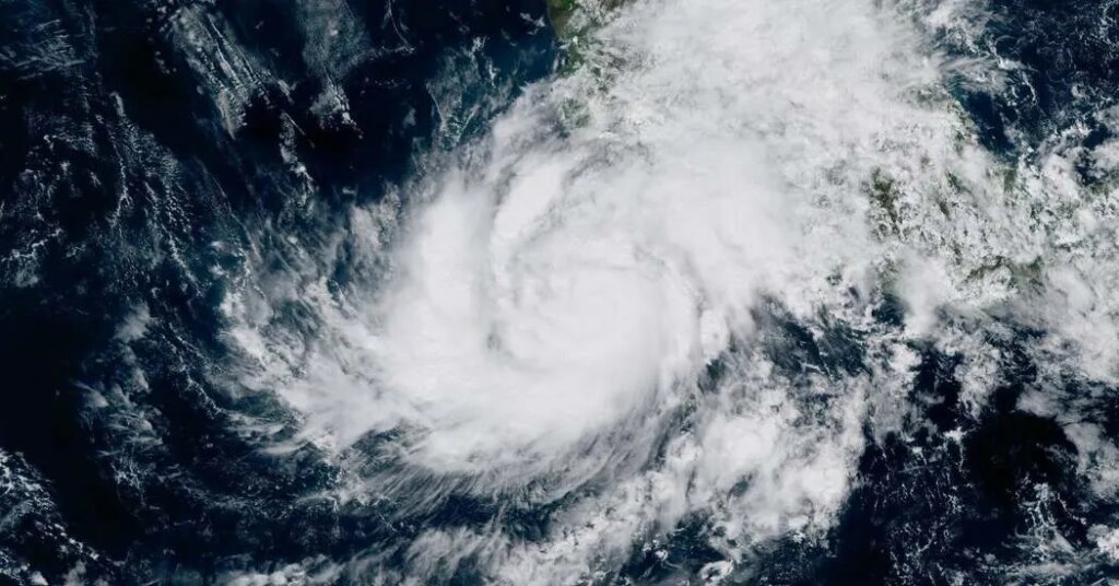
Three named storms are active across North America this weekend, an unusual confluence that has millions of people bracing for potentially severe effects.
While Hurricane Isaias barrels into the United States through the Gulf of Mexico, a pair of Pacific systems — Hurricane Simon and Tropical Storm Rachel — are tracking toward Mexico and the American Southwest. They bring with them the threat of rapid intensification and coastal flooding, but also potential relief from a brutal Southern California heat wave.
Key Things to Know
-
Hurricane Simon is rapidly intensifying off the west coast of Mexico, threatening the shoreline with dangerous winds, storm surge and heavy rainfall.
-
Tropical Storm Rachel could make landfall near the U.S.-Mexico border, bringing broad cloud cover that may knock down sweltering temperatures in Southern California.
-
High uncertainty remains for both Pacific paths because of complex atmospheric factors that make pinpointing precise local impacts difficult.
Hurricane Simon
Simon reached hurricane strength on Thursday and has been inching parallel to Mexico’s western coast.
Computer models that forecasters use to help them understand a storm’s movements have generally agreed that it will eventually turn northeast toward the shore, but a shift of just a few miles could alter the timing of landfall from as early as Saturday night to as late as early next week.
Regardless of the exact point of landfall, Simon will remain close enough to the coast as an extremely intense storm to deliver damaging winds, storm surge and heavy precipitation. The longer the system stays over open ocean water, the longer it will sustain its strength against the coast before weakening as it moves inland.
Simon is the latest in a notable stretch of rapidly intensifying Pacific storms this year, fueled largely by El Niño. If it reaches Category 5 intensity, it will be the first time that four Category 5 hurricanes have formed in the Central and Eastern Pacific in a single season — joining Genevieve, Lowell and Polo.
The primary engine driving these powerful storms is unusually warm ocean water off western Mexico. El Niño redistributes warm ocean water across the tropical Pacific, altering global weather patterns along the way. While El Niño typically suppresses hurricane development in the Atlantic, it acts as an incubator in the Eastern Pacific. Ocean temperatures near Hurricane Polo reached nearly 88 degrees Fahrenheit, about 3.5 degrees above average.
While scientists continue to debate how climate change influences the frequency and intensity of El Niño, global sea surface temperatures have been steadily rising for years as oceans absorb excess heat trapped in the atmosphere from greenhouse gases.
Tropical Storm Rachel
Farther north, Tropical Storm Rachel is being closely watched in Southern California, where residents have recently been enduring a heat wave.
While the storm is expected to move inland over northern Baja California late Saturday or early Sunday, the center could track very near the U.S.-Mexico border.
Kyle Wheeler, a meteorologist with the National Weather Service in San Diego, said Friday morning that Rachel’s current track is still uncertain, but some of its effects were expected to move into Southern California. Forecasters also noted recent computer models show a northward trend in Rachel’s trajectory.
This northward trend would affect the San Diego region with widespread rainfall accumulating in the lower elevation areas with a maximum of one to two inches expected in the mountains and wind gusts up to or greater than 39 miles per hour.
Broad cloud coverage from Rachel’s remnants during the day on Saturday could drop temperatures across Southern California by around 10 degrees compared with Friday.
Mr. Wheeler said a Pacific tropical storm making landfall in Southern California is a “pretty rare event.” He said direct impact only happens once every few years. The last major tropical storm to make landfall was Hilary in 2023.
Mr. Wheeler said the same level of impact from Hilary, which was a hurricane before it weakened to a tropical storm as it made landfall, is not expected for Rachel.
Rachel is forecast to remain a strong tropical storm as it makes landfall. Once inland, rapid weakening is expected as the system transitions into a post-tropical low over the Southwestern United States.
Alena Cerro contributed reporting.
The post With Isaias in the Gulf, 2 Pacific Storms Are Barreling Toward Mexico appeared first on New York Times.