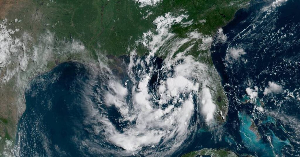
Tropical storm watches were in effect along the Gulf Coast of Florida on Sunday after a depression formed over the Gulf of Mexico and began churning north.
Forecasters said the depression, officially called Tropical Depression Two, was expected to continue moving slowly toward the northwest over the next day or two, before gradually turning west. The center of the system could then move near or along the northern Gulf Coast over the next several days.
The system is also expected to gradually strengthen, and could become a named tropical storm either on Sunday night or sometime on Monday. If the system does strengthen enough to earn a name, it would be Tropical Storm Bertha, the second of this year’s Atlantic hurricane season. A storm gets a name when wind speeds reach 39 miles per hour.
The season started on June 1 and runs through Nov. 30 and was predicted to have fewer storms than in recent years, according to the National Oceanic and Atmospheric Administration last month. This year’s only other named storm, Tropical Storm Arthur, dumped heavy rain along the western side of the Gulf Coast last month.
On Sunday morning, a tropical storm watch was in effect for the Florida Gulf Coast from the Ochlockonee River west to the Alabama state line. A tropical storm watch means that tropical storm conditions, including strong winds and heavy rain, are possible within the next 36 to 48 hours.
Forecasters said additional watches or warnings may be issued over the next day or two, as the system develops and its path becomes more certain. Strong winds could begin affecting the watch areas by late Monday, if the system continues to strengthen as expected.
Storm surge is also a risk along Florida’s Gulf Coast, especially if the peak surge arrives at the same time as high tide. Water levels could rise between one and three feet above ground from Indian Pass south to the Chassahowitzka River. The greatest risk of flooding would occur along the immediate coastline, forecasters said.
Heavy rainfall is also expected to be a hazard. Through Thursday, much of the eastern and central Gulf Coast — including western Florida and southern parts of Alabama, Mississippi and Louisiana — could receive between two and four inches of rainfall. Some isolated locations could receive up to eight inches. The heavy rainfall could lead to flash flooding, especially in urban areas.
The post Tropical Storm Watches Issued Along the Gulf Coast appeared first on New York Times.