The simmering summer heat that has baked the central United States for the last few days is shifting into the Northeast, threatening to transform a relatively comfortable week along the East Coast into something far more unpleasant.
“I would say sweltering,” said Bryan Ramsey, a meteorologist with the National Weather Service in New York, “but it’s not going to be the 100-degree heat I reserve for that word.”
Still, Mr. Ramsey — who earned his humidity credentials growing up in Houston before relocating to New York — noted that Thursday and Friday would be deeply uncomfortable, even “sultry.” The culprit is a thick air mass pushing behind a warm front, leaving people feeling sticky and damp and preventing the body from cooling naturally.
While this second week of June is prime time for the year’s first true warm spell, this setup mirrors an unseasonable stretch of 90-degree days that swept through the region in mid-April. This time, however, it arrives with a much heavier dose of tropical moisture, significantly intensifying how uncomfortable the temperature actually feels.
Storms could break up the heat.
High temperatures across much of the East Coast are expected to hover between 90 and 95 degrees.
“Some of the temperatures are near record values,” said Bob Oravec, a senior forecaster at the federal Weather Prediction Center. “It’s not super hot, but it’s still hot, so people should be cautious.”
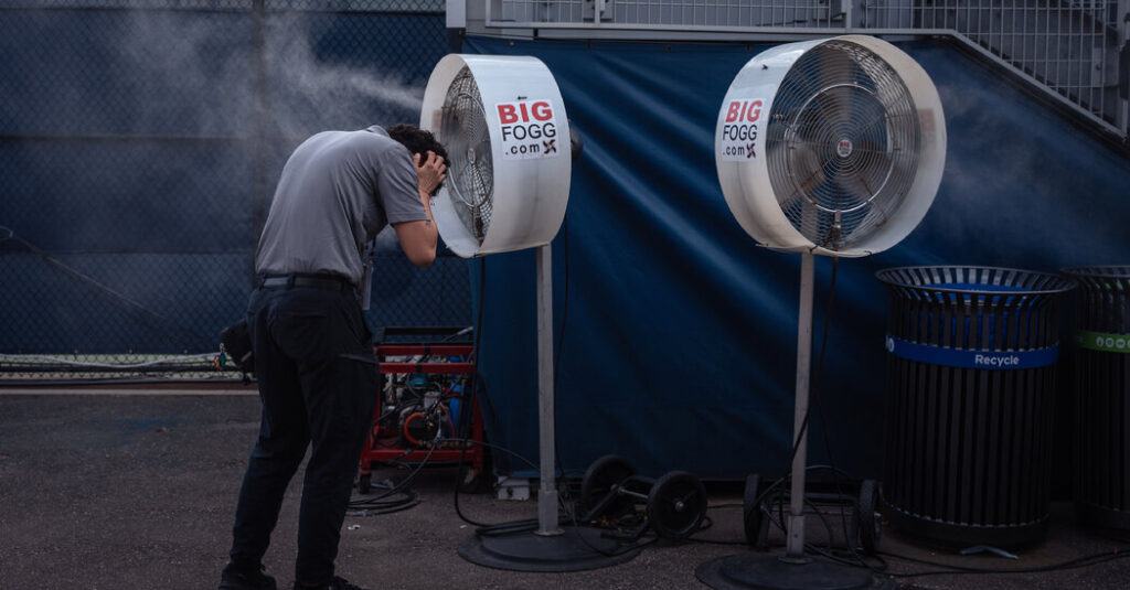
The combination of high temperatures and spiking humidity will place considerable stress on the body. From Thursday through Friday, millions of people across parts of Texas and all the way to Maine will face elevated risks of heat-related illnesses if they spend a lot of time outside, particularly in densely built urban centers where asphalt and concrete trap heat well into the evening.
The only reprieve from the heat may come in the form of late-afternoon thunderstorms, though they present danger of their own. Exactly when the peak afternoon heat breaks will depend heavily on where those downpours materialize, Mr. Ramsey said.
The atmospheric clash is expected to set off severe weather across the region, making Thursday and Friday afternoons particularly challenging for anyone with outdoor plans.
“It’s not just a passing shower, either,” Mr. Ramsey said. “We’ve got a risk of severe thunderstorms, damaging winds and large hail. We’re also messaging the possibility of isolated tornadoes.”
Outdoor sports and entertainment will bear the brunt of this volatile pattern.
“Anytime you do any activities outdoors, no matter what time of year it is, you’re always at the mercy of the weather,” Mr. Oravec said.
That reality will loom large over stadium crowds this week as Major League Baseball series continue and the World Cup gets underway. On Friday, as Canada faces Bosnia and Herzegovina in Toronto, fans can expect above-normal temperatures, high humidity and a threat of showers.
A slate of Friday evening baseball games — including the Atlanta Braves visiting the New York Mets, the Texas Rangers at the Boston Red Sox and the Mariners at the Nationals — will contend with stifling air and the possibility of lightning delays.
When will it cool off?
Relief will arrive by Saturday, courtesy of a cold front sweeping from west to east. While the front will do little to lower temperatures — highs will remain in the upper 80s to low 90s — it will push out the humidity.
The weekend air will lose its oppressive weight, making conditions far more tolerable for afternoon games in Boston and New York.
Sunday will remain mostly sunny and pleasant for the bulk of the day, though a secondary system arriving that afternoon could bring a renewed round of scattered storms.
The timing could disrupt outdoor events, including a World Cup match between Germany and Curaçao in Philadelphia and the UFC fight on the White House lawn.
The post A ‘Sultry’ Shift: Heat Creeps Into the Northeast appeared first on New York Times.