Smoke from fires burning in North Florida and southern Georgia was spreading across the Southeast this week.
Andy Snyder, a fire meteorologist with the U.S. Wildland Fire Service said the smoke was likely to continue for days, with the acrid air drifting as the winds shift and the fires continue to burn through a landscape that has been left dry and flammable by severe drought.
There will be days when the smoke hugs the ground and air quality levels are unhealthy, and days when it funnels into the higher levels of the atmosphere.
Here’s what to know about it:
Follow a map of the smoke forecast.
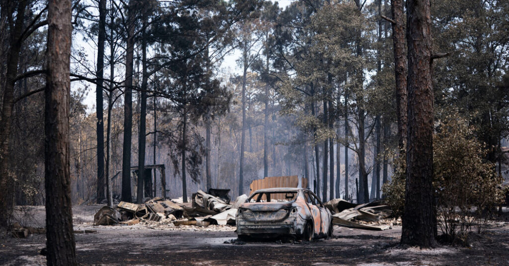
Dozens of fires were sparked in Georgia and Florida in the last week, but most of the smoke can be traced to four main fires that became more active on Monday and Tuesday and pumped out copious amounts of smoke.
The largest, the 30,000-acre Pineland Road fire in Georgia, “has been the major source of the smoke,” Mr. Synder said.
The smoke dispersed on Wednesday, spreading mainly between Florida, Georgia and South Carolina. On Thursday, it was expected to linger in the same areas, potentially pushing north over the Appalachian Mountains, Mr. Snyder said.
The National Weather Service office serving Atlanta warned that the air quality in the area could be unhealthy for people who are sensitive to ozone and smoke.
The smoke was high in the atmosphere over the city on Thursday morning, said Katie Martin, a meteorologist with the Weather Service.
Forecasters warned of ‘super fog.’
How bad the smoke becomes in the next few days will depend on the fires’ behavior and the weather.
A slight chance of thunderstorms on Friday and an even higher chance on Saturday will heighten the fire risk. Lightning strikes can ignite new fires and winds can spread existing ones, even as the storms bring rain.
The storms are unlikely to bring enough rain to extinguish the fires that have probably burned under the surface and deep into the organic soil, Mr. Snyder said.
“They’re expecting these to be long-term fires,” he said.
Humidity levels are expected to increase on Friday and through the weekend, which will help the fires burn less actively, but they bring another concern: super fog.
This dense, impenetrable fog forms when moisture and smoke are mixed with cooler air. It’s considered “super fog” by meteorologists when visibility levels drop below 10 feet, leading to dangerous conditions on roads.
“You can go from perfect visibility to zero feet in a very short distance,” Mr. Snyder said.
How to look up the air quality near you.
As the smoke intensifies and wanes again, the air quality can change quickly in any one place. Here’s a guide to understanding air quality readings and when they can become hazardous for different people.
The AirNow website and app, run by the Environmental Protection Agency, offers fire and smoke maps that are informed by data from portable sensors that track smoke plumes.
You can also put your city into the chart below:
Amy Graff is a Times reporter covering weather, wildfires and earthquakes.
The post Maps Show Smoke From Georgia Wildfires Spreading Across the Southeast appeared first on New York Times.