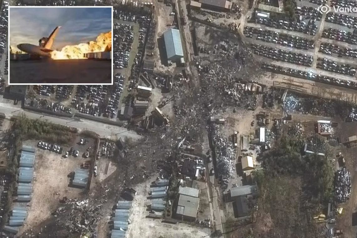
Shocking satellite images reveal the path of destruction left by the UPS cargo plane that crashed and bust into flames in Kentucky on Wednesday, leaving at least 12 people dead, including a child.
The before-and-after photos from Vantor, a satellite and data intelligence company, show a long black trail of scorched debris and torched vehicles at an industrial area just south of Muhammad Ali International Airport in Louisville.
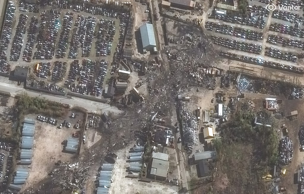
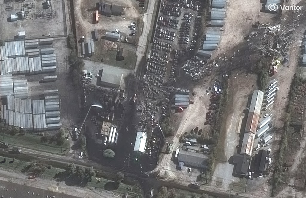
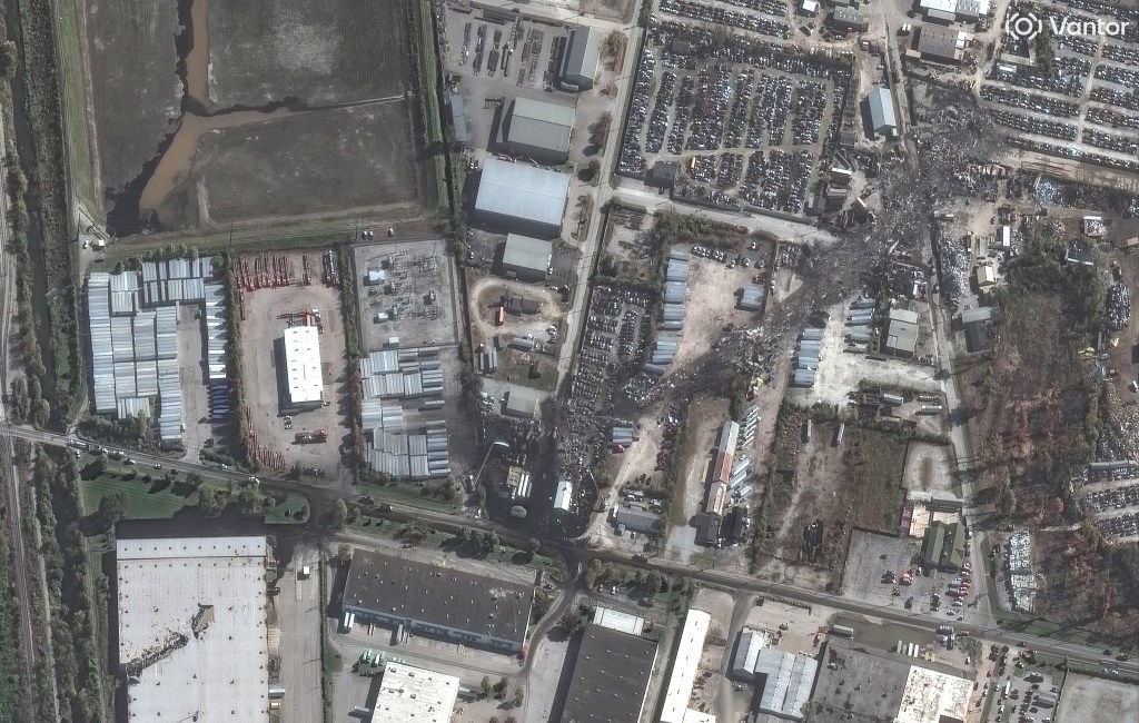
The images also showed a massive 300-foot gash on the top of a UPS warehouse that was struck by the plane as it came down shortly after takeoff from the company’s aviation hub.
The crash sparked a massive inferno that consumed the enormous aircraft and spread to nearby businesses.
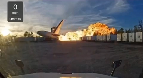
The jet was carrying about 50,000 gallons of fuel when it took off from the airport, with footage showing the plane’s left engine completely engulfed in hot flames as it sped down the runway for takeoff — before smashing back down moments after its nose lifted from the ground.

The National Transit Safety Board [NTSB] is investigating what caused the fire, which broke out on the plane’s wing, and why the engine fell off. The probe is likely to take more than a year, officials said.
With Post Wires
The post Shocking satellite images show trail of destruction after deadly UPS plane crash appeared first on New York Post.