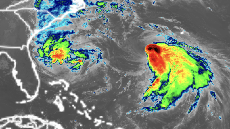
Imelda pulled away from the Bahamas Monday evening after lashing the islands with heavy rain, tropical storm-force winds and storm surge for two days.
As of early Tuesday, Imelda had sustained winds of 65 mph and was centered about 200 miles east of Cape Canaveral, Florida, according to the National Hurricane Center. The storm is expected reach hurricane strength on Tuesday.
Despite its center staying offshore, Imelda has already proven deadly. A 51-year-old man drowned in Volusia County, Florida, after being swept into the ocean by rip currents, the sheriff’s office said. In Cuba, the storm left two dead, Prime Minister Manuel Marrero said. One of those killed was a 60-year-old man who died when his home collapsed in a landslide caused by heavy rain, according to the Associated Press.
Localized flash flooding is still possible in the coastal Carolinas through Tuesday. Most places across the region can expect up to 2 inches of rain, with localized areas receiving up to 4 inches across southeast North Carolina.
Coastal flooding is also possible from Florida’s Space Coast to North Carolina’s Outer Banks, where onshore winds could push water 1 to 2 feet above normally dry ground at high tide.
Imelda is about to take a sharp right turn as Humberto yanks the storm eastward away from the shoreline. This anticipated interaction between the two storms is the main reason threats of flooding rain and damaging winds are decreasing for the US compared to concerns over the weekend.
So far this year, the US has avoided a direct hurricane landfall. Tropical Storm Chantal came ashore in South Carolina this July, but no storms have reached the coast at hurricane strength in 2025. If this streak holds, it would be the first season without a hurricane coming ashore in a decade.
Still, this season has been remarkable in another way: every hurricane so far — Erin, Gabrielle and Humberto — has reached major strength, a feat not seen this early since 1935. Major hurricanes are Category 3, 4 and 5 storms. Rapid intensification has become far more common in recent years as the planet warms due to fossil fuel pollution.
Bermuda faces a rare one-two punch
Bermuda is a sitting duck in the path of twin storms this week. Humberto is passing west of the island as a large, powerful hurricane Tuesday, bringing bands of rain, gusty winds and dangerous surf.
On the heels of Humberto, Imelda is expected to track even closer to Bermuda, with potential for a direct landfall and up to 4 inches of rain Wednesday into Thursday. The Bermuda Weather Service issued a hurricane watch for the archipelago Monday afternoon ahead of Imelda.
Two hurricanes in one week could deliver a punishing blow, even for the seasoned and storm-tested islands.
The post Imelda strengthens as US coast feels impacts. Bermuda prepares for twin storms appeared first on CNN.