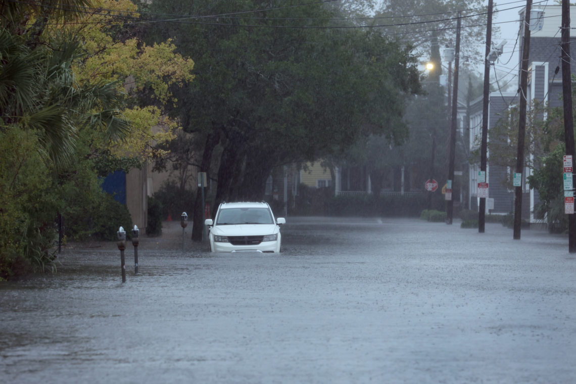
Hundreds of thousands of residents in Charleston, South Carolina, were urged to “act now” after National Weather Service (NWS) meteorologists issued urgent flash flood warnings for the area amid slow-moving thunderstorms and torrential rainfall.
Why It Matters
Flooding is the second deadliest weather hazard in the United States, behind extreme heat. The current storms in South Carolina come just after Hurricane Erin brought dangerous waves and life-threatening rip currents to the entire Eastern Seaboard earlier this week, although the ongoing storms aren’t related to the hurricane, NWS meteorologist Alex Trellinger told Newsweek.
What to Know
NWS Charleston issued flash flood warnings across multiple media platforms on Friday, urging people in Downtown Charleston to move vehicles to higher ground and warning that floodwaters could enter homes.
“ALERT: If you are in Downtown Charleston, consider moving to your car to higher ground now,” NWS Charleston posted on X on Friday afternoon. “The risk for flash flooding will increase rapidly very soon. Expect road closures to occur. Water may also enter homes, businesses and properties. Act now.”
As of 1:22 p.m. local time, over 40 roads were closed in Downtown Charleston because of flooding. Roads are also closed in Mount Pleasant and North Charleston.
The slow-moving thunderstorms stretched from North Charleston and Daniel Island south to Rockville and Kiawah Island. As much as 3 inches of rain has been reported in the area, with an additional 1 to 2 inches possible this afternoon.
“Flash flooding is ongoing in many areas and will continue. A new daily rainfall record has already been set at the Charleston International Airport,” NWS Charleston said in a flash flood warning.
As of 12:39 p.m. local time, the airport reported 2.95 inches of rain, which “smashes” the previous daily rainfall record for August 22, which was 1.58 inches set in 2008, NWS Charleston said in a post on X.
An additional .02 inches of rain has fallen at the airport since the post was made.
“Additional rainfall is likely,” NWS Charleston posted on X.
What People Are Saying
NWS Charleston, in a flash flood warning: “At 109 PM EDT, emergency management officials reported a number of flooded and closed roads in the Mount Pleasant area. Radar shows thunderstorms with torrential rainfall continuing to impact Mount Pleasant, Isle of Palms and Sullivans Island. An additional 1 to 2 inches could fall through 230 PM. The risk for additional flash flooding continues.”
Charleston Water, on X: “Avoid flood water! Stormwater contains high levels of bacteria, whether or not wastewater is involved.”
Fox 24 reporter Bill Burr, on X: “Swollen creeks and ponds in Shadowmoss Plantation are leading to flooded roads. A late morning storm dumped copious amounts of rain in a short period of time.”
What Happens Next
The flash flood warning was originally set to expire at 1:15 p.m. ET, but has since been extended to 2:30 p.m.
The post Urgent Flood Warning Issued for Hundreds of Thousands: ‘Act Now’ appeared first on Newsweek.