As the heat wave wanes in the Northeast and a cooldown is ushered in on Thursday, heavy rain could bring in flash flooding for cities along Interstate 95.
The rain and storms are bringing a flood risk to the Midwest, with areas like Chicago and Detroit as well as parts of Missouri on alert for flooding through Wednesday night.
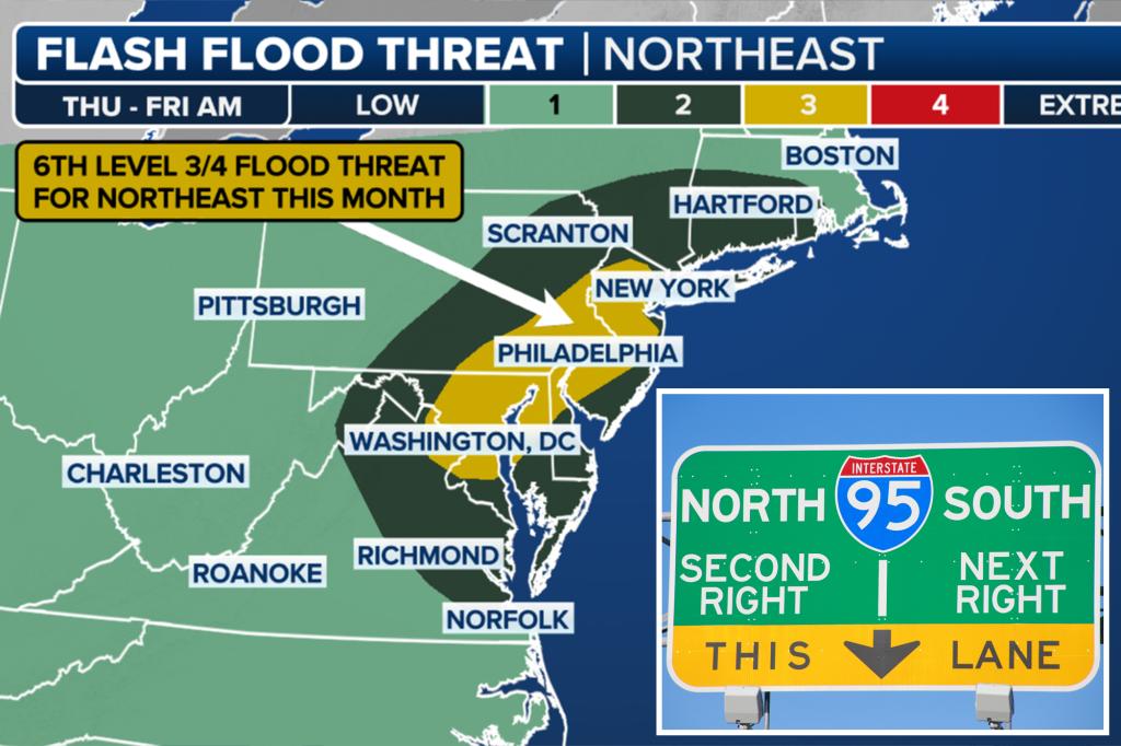
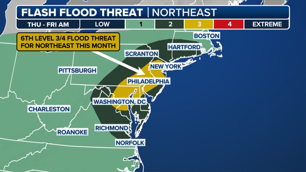
On Thursday, the flooding threat moves east into the Mid-Atlantic and Northeast.
NOAA’s Weather Prediction Center issued a level 3 out of 4 flash flooding risk for 23 million in the area, including those living in Washington, D.C., Baltimore and Philadelphia.
So far in July, portions of the Northeast have been under a level 3 flash flood risk six times.
Central and northern New Jersey are also under a moderate risk of flooding.
New York City is under a level 2 out of 4 flood risk.
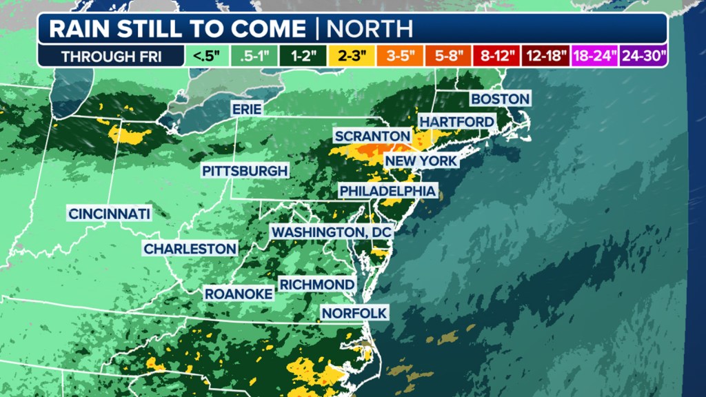
The rain and storms will focus along a strong but slow-moving cold front, with additional strength caused by the development of an area of low pressure along the front.
The FOX Forecast Center has high confidence that several inches of rain will fall over the area where storms linger the longest, with some totals reaching 3-5 inches.
Flood Watches are in effect for all of Connecticut and New Jersey, as well as southern New York, Washington, D.C. and Baltimore and eastern Pennsylvania.
Rain will linger into Friday morning, but a return to drier weather returns for the weekend.
The post Flash flood threat building for I-95 corridor in Northeast to end the workweek appeared first on New York Post.