
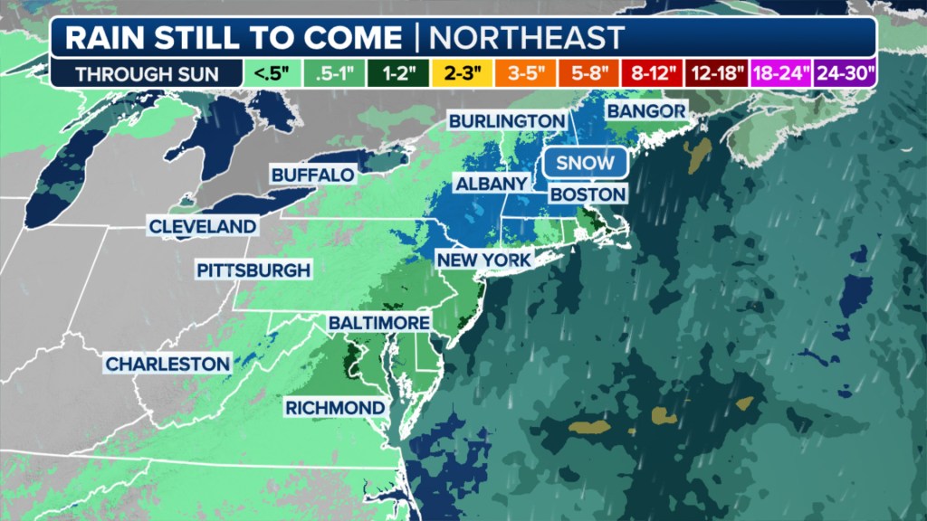
Widespread soaking rain and cold temperatures for mid-April are impacting the Northeast courtesy of a low-pressure system off the mid-Atlantic coast.
This is the second round of wet weather for many of these areas.
On Thursday, a different low-pressure system moved across the Great Lakes and into the Northeast, bringing rain and snow to higher elevations.
The potential for heavy rain prompted NOAA’s Weather Prediction Center to issue a Level 1 out of 4 flash flood threat from North Carolina to Delaware, covering some 14 million people.
In addition, the full Moon this weekend, combined with this system, could bring some coastal flooding as well.
Temperatures will stay chilly as well, with highs struggling to reach 50 degrees on Saturday in New York City.
Wet and cool conditions remain through Sunday before a brief warmup Monday and Tuesday, with more rain looming by the middle of next week.

A chilly and wet weather pattern will linger for most of the Northeast over the next 8-14 days, as well, according to the latest outlook from NOAA’s Climate Prediction Center.
The post Coastal storm on East Coast threatens flash flooding for 14M along I-95 corridor appeared first on New York Post.


