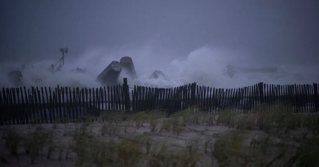
A slow-moving storm off the East Coast of the United States could bring several days of strong winds, coastal flooding and beach erosion, forecasters said, with parts of the Mid-Atlantic facing the greatest risk through later in the week.
The storm, which the Weather Prediction Center described as a nor’easter, developed off the coast of North Carolina early Sunday and is expected to linger offshore for much of the week. Forecasters said the greatest effects were expected from North Carolina to New Jersey.
The storm is not expected to be as strong as the nor’easter last month, but its slow movement could bring repeated winds and rough seas to coastal areas, said Frank Pereira, a meteorologist at the Weather Prediction Center.
“The expectation is it will continue to strengthen and not move much over the next few days. It just kind of sits there,” he said. “And it’s for that reason we’re expecting significant coastal impacts.”
The storm’s path later in the week, as well as the extent and location of its impacts, remained uncertain, as is common when predicting the track of coastal storms.
Forecast models differed on how quickly the storm would move away from the region and whether its effects could extend farther north. The National Hurricane Center was also monitoring the possibility that the storm could develop subtropical characteristics next week.
What we know
The storm developed early Sunday, Mr. Pereira said. It is technically a nor’easter, a term used to describe an offshore storm that moves along the Eastern Seaboard with winds that blow from the northeast.
Nor’easters in winter typically bring heavy snow, but that is not expected from this system. The main concerns are coastal flooding and beach erosion driven by persistent and strong onshore winds.
“I think right now we’re expecting the most significant impacts to extend from North Carolina, Virginia, Delaware to New Jersey,” Mr. Pereira said.
The strong winds, combined with the slow-moving storm, mean coastal communities could experience repeated periods of rough surf and flooding, especially around high tide.
The prolonged northeasterly winds were expected to cause water levels above normal along the coast, according to the office of the National Weather Service in Wakefield, Va. That could potentially bring widespread minor to moderate coastal flooding around high tide. Localized major flooding could not be ruled out if the storm strengthened or moved closer to shore, the office added.
Coastal flood watches were issued for parts of Maryland, Virginia and northeastern North Carolina from Monday afternoon through early Wednesday. Up to two feet of flooding above ground level was possible in low-lying areas near shorelines and tidal waterways.
Winds gusts exceeding 45 miles per hour are also possible along the immediate coastline, according to the Weather Prediction Center, especially across the Outer Banks and the Virginia Tidewater regions.
Heavy rain is not expected to be a primary concern because most of the precipitation should remain offshore. However, Mr. Pereira said, periods of heavy rain were possible along the immediate coast.
What remains uncertain
The storm’s eventual path and how long it will linger offshore are unclear, with forecast models differing on how quickly it will move away from the coast.
Mr. Pereira said the storm could become separated from the jet stream — a fast-moving ribbon of air high in the atmosphere that often helps steer weather systems, including nor’easters — allowing it to linger for several days. Forecast models differed on Sunday on how long that separation would last.
The storm was expected to move away from the region by next weekend, although Mr. Pereira said the forecast could change. If the storm moves farther offshore as it drifts north, the Northeast is not expected to experience impacts as significant as those forecast along parts of the Mid-Atlantic coast.
The New York office of the National Weather Service said that while confidence on the storm’s path was low, persistent northeasterly winds were expected through much of the week, with the possibility of minor coastal impacts by midweek.
Forecasters at the National Hurricane Center were also monitoring the possibility that the storm could develop subtropical characteristics next week. Subtropical storms have a mix of tropical and nontropical features, with thunderstorms and strong winds generally spread farther from the center than in a typical tropical storm.
This potential change in the storm’s structure would not necessarily change its potential hazards, Mr. Pereira said.
“The impacts, regardless of how it’s named or defined, are pretty much going to be the same along the coast,” he said.
The post Coastal Storm Threatens Mid-Atlantic With High Winds and Flooding appeared first on New York Times.