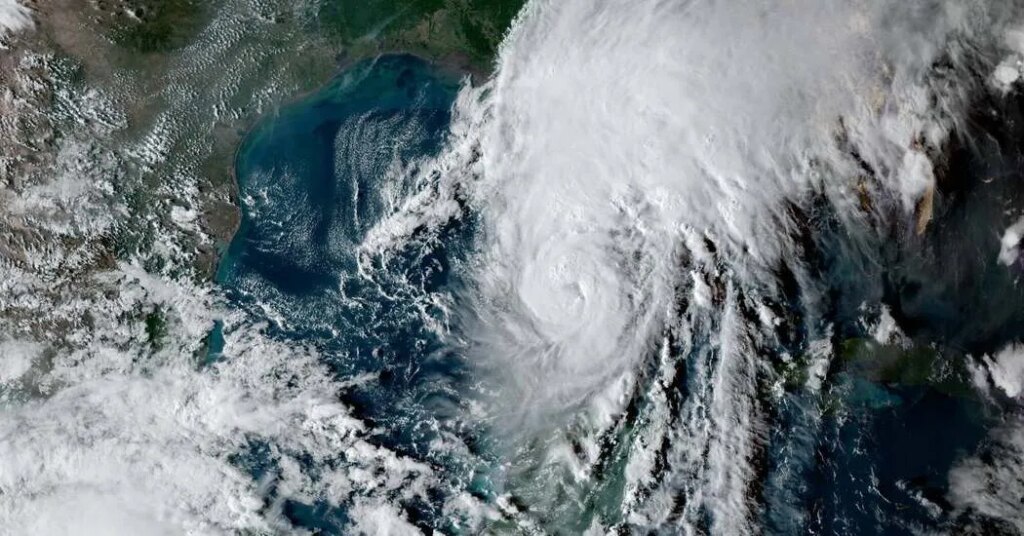
Hurricane Isaias surged into Category 3 on Friday, a remarkable increase in strength for a storm that only became a hurricane on Wednesday night.
The phenomenon of a storm growing so powerful so quickly is known to meteorologists as rapid intensification. It happens when a hurricane’s maximum sustained winds increase by at least 35 miles per hour within a 24-hour period (roughly a two-category jump on the Saffir-Simpson Hurricane Wind Scale).
El Niño, a global weather pattern that is reaching record strength this fall, typically creates a unfavorable environment for storms in the Atlantic. It has led to remarkably few tropical storms this year and, until Isaias, no hurricanes.
But Isaias survived that environment, drawing on the Gulf of Mexico’s abundant ocean heat to rapidly intensify.
Until now, wind shear, the scientific term for the shift in wind speed and direction with altitude, had kept this season’s Atlantic storms from strengthening. But Isaias formed in a brief window of relaxed winds, a reprieve that may end as the storm nears landfall. Returning shear could weaken the hurricane, but it could also spread its damaging winds over a wider geographic area.
While Isaias’s rapid intensification is not directly attributable to El Niño, the climate pattern did help set the stage. In the Eastern Pacific, relaxed atmospheric conditions and warm ocean waters have fueled rampant rapid intensification this season, leading to three Category 5 storms there.
Forecasters watching the Atlantic have repeatedly warned that it takes only one storm threading the needle to bring the possibility of catastrophe.
A 2023 study found that climate change was already driving a higher frequency of rapid intensification events. Globally, the frequency of rapid intensification within 250 miles of coastlines has nearly tripled since 1980. Even without El Niño, sea surface temperatures have been rising for years as the oceans absorb excess heat trapped in the atmosphere from greenhouse gases.
As Isaias churned through the Gulf on Friday, forecasters did not expect it keep strengthening to the absolute top of the hurricane wind scale.
Rapid strengthening nearer land is what hurricane specialists frequently call their worst nightmare. In October 2023, Hurricane Otis caught forecasters and coastal residents off guard when it intensified at a record pace before slamming into the resort city of Acapulco, Mexico, as a Category 5 hurricane, causing widespread destruction.
A similar surge occurred last month with Hurricane Polo in the Pacific, which within 24 hours shot to Category 5 from a tropical storm off Mexico’s coast.
Wind shear will most likely prevent Isaias from reaching that worst-case tier, but a the storm remains a daunting threat.
And that threat may recur. After an El Niño winter, the climate pattern typically wanes as Atlantic waters warm, often leading to more hurricane activity the next year.
The post Hurricane Isaias Surged in Intensity in a Few Hours. Here’s How. appeared first on New York Times.