A whirlwind of tropical activity stirred up the Pacific Ocean this week, and meteorologists were watching closely as storms were expected to bring heavy rain and flooding to Hawaii and Mexico.
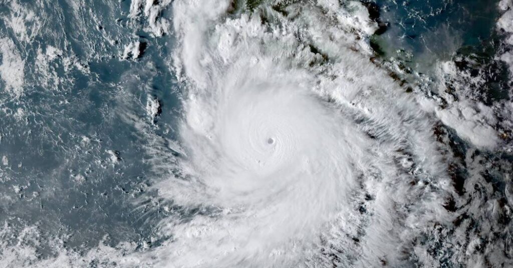
A supercharged hurricane named Polo led the pack, barreling over the ocean along the coast of southwest Mexico. Nearby, one nascent system was on the cusp of strengthening into a named storm, and another, Tropical Storm Odalys, spun over the open Pacific hundreds of miles to the west. Even farther west, another storm was in the early stages of developing near Hawaii.
“It’s really busy out there,” said Phil Klotzbach, a hurricane researcher at Colorado State University.
Hawaii could get soaked this week.
Torrential showers about 500 miles southeast of Hawaii were expected to develop into a storm and bring a chance of heavy rain to the island chain in the coming days.
Late Tuesday, it remained unclear how strong the storm would get and which path it would take. The computerized models that help meteorologists predict future weather showed myriad possibilities.
“The model spread is huge,” said Stephen Parker, a meteorologist with the National Weather Service office in Honolulu. “It’s driving us nuts. We don’t know where this storm is going to go.”
Despite the uncertainty, the Weather Service sounded the alarm bells, as it became increasingly clear that in many of the possible scenarios, the Big Island was at risk of life-threatening flooding, with the potential for 20 to 30 inches of rain to fall there from Wednesday through Saturday.
The rain could start on the east side of the Big Island as early as Wednesday afternoon, with the heaviest rain likely on the island Thursday and Friday. The rain was also likely to spread to Maui, and the chance for heavy rain on both islands was expected to continue through Saturday.
A tropical storm is named when its sustained winds reach 39 miles per hour. On Tuesday, it was uncertain whether this system would reach that strength. If it does, it will be named Nolo.
“A lot of our guidance shows it becoming a named tropical storm in the next few days,” Philippe Papin, a senior hurricane specialist at the National Hurricane Center, said on Tuesday. “We’re obviously keeping a close eye on this as it could get pretty close to the Hawaiian Islands in the next four or five days”
Two other named storms, Lala and Lowell, neared the islands earlier this season. Though they didn’t cross onto land, both reached hurricane strength and their effects were significant, with Lala soaking the Big Island and Lowell pummeling Kauai.
Polo intensified into one of the strongest hurricanes ever.
Hurricane Polo burst out of the gate with remarkable strength this week, intensifying from a tropical storm into a Category 5 hurricane within 24 hours.
Its central pressure, one way experts calculate the intensity of a hurricane, was measured at an extremely low value of 892 millibars on Tuesday. This makes it the second-most intense hurricane on record in the eastern Pacific Ocean, trailing Hurricane Patricia in 2015, with a pressure that got as low as 872 millibars, Mr. Klotzbach said.
Some good news: though the storm is powerful, it was expected to stay mostly over the ocean, traveling parallel to the coastline of southwest Mexico. But forecasters warned it was still likely to bring heavy rainfall that could set off flooding and mudslides, particularly in the mountains, through Thursday. Rainfall totals of three to eight inches are possible in the Mexican states of Guerrero and Michoacán, while two to four inches are expected in portions of Oaxaca, Colima and Jalisco. Strong winds and large waves on the coast are also expected.
A tropical storm warning was in effect for portions of southwest Mexico, and a less urgent tropical storm watch extended west of the coast.
To the west of Polo, Tropical Storm Odalys was spinning over the Pacific Ocean. While this storm was not expected to approach land, it could interact with Polo.
“It might pull Polo further to the north while Odalys could be pulled to the south,” Mr. Papin said. “It depends on how close they get together and the overall intensity of those circulations.”
Regardless of what happens, Odalys was not expected to bring harm to any land areas.
The Pacific hurricane season has been busy.
Few storms have formed in the Atlantic Ocean this hurricane season, but the Pacific has been busy.
The Atlantic has seen only six named storms so far, half the number in a normal season. By comparison, 17 storms have developed in the Eastern Pacific. This is two more than the region normally gets through its entire season, and the number could go up with more than two months to go.
it can all be explained by El Niño. The weather pattern, which developed in the spring and strengthened through the summer, typically stifles tropical activity in the Atlantic while fueling storms in the Pacific.
El Niño is a natural cycle that occurs every few years, changing precipitation and temperature patterns around the globe. It occurs when the Pacific Ocean heats up near the Equator and the prevailing winds there relax, even reverse, allowing the warmer waters to move east.
Ocean temperatures are also rising overall because of climate change, which in turn helps tropical systems intensify more quickly as storms pick up more energy from the warmer ocean water.
“El Niño warms the sea surface temperatures across the eastern portion of the Pacific, and that’s extra fuel for those storms,” Mr. Papin said.
The post ‘It’s Really Busy Out There’: Storms in the Pacific Threaten Hawaii and Mexico appeared first on New York Times.