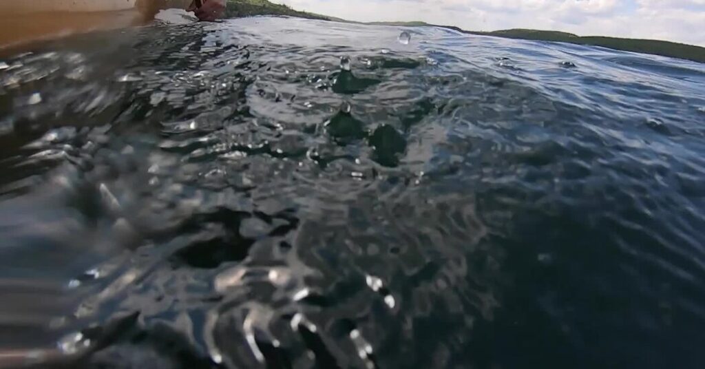
Saganaga Lake was so calm that I could see boulders 10 feet below the surface. The water reflected a mirror image of the clouds above as my partner, Brian, and I paddled between earth and sky. On the horizon, a forest of white pine, spruce and cedar delineated the northern shoreline, in Canada. The border between the two nations floated in the middle of this vast lake, one of more than 1,100 within Minnesota’s roadless, 1.1-million-acre Boundary Waters Canoe Area Wilderness.
It was warm for mid-September — high 70s. We found a campsite on a small island dwarfed by a towering white pine. We quickly hauled up the canoe and jumped into the lake. I lost my breath, embracing the numbing water and letting it strip away 48 hours of grime.
What a difference a day makes. The previous afternoon we were stormbound, sitting under a tarp hastily strung between pines, watching lightning flash around us as rivulets of rainwater slowly flooded our campsite. Every so often a red-eyed loon would break the lake’s surface carrying a minnow in her beak to feed her chick.
But a nagging concern kept pulling me from the present: The beauty of this thriving ecosystem is increasingly shrouded by the threat of a proposed copper and nickel mine within the Rainy River watershed, which encompasses most of the Boundary Waters. Environmental groups warn that sulfuric acid, a byproduct of the mining operation, could contaminate the water and endanger everything living in it.
I grew up in northern Minnesota and have been paddling these lakes since I was a young child, first with my parents and four siblings, and later guiding teenagers out of a camp based on Sea Gull Lake. Now I paddle whenever I can string together a few free days and secure a permit.
A Pristine Ecosystem
Every year more than 150,000 people use the Boundary Waters, making it the most heavily visited wilderness area in the United States. At the height of summer, campsites on popular lakes can be in high demand. But “heavily visited” is a relative term; Glacier National Park, also roughly one million acres, welcomed 3.1 million visitors in 2025.
Designated a federal wilderness in 1964, the Boundary Waters stretches 150 miles along the international border and sits within the three-million-acre Superior National Forest.
The wilderness also sits within the five-million-acre 1854 Treaty Area, lands that the Ojibwe ceded to the federal government four years before Minnesota became a state. In return the Ojibwe reserved the right to hunt, fish and gather there in perpetuity.
This still pristine ecosystem of forests, lakes and rivers supports big animals like moose, black bear and lynx — and an abundance of mosquitoes. It’s not uncommon to watch a bald eagle dive out of the sky to spear a walleye, or to be lulled to sleep by the haunting trill of a loon.
There are almost 100 entry points to the wilderness and 2,000 designated, first-come-first-served campsites. Some lakes are no bigger than a pond. Others take hours to paddle across.
Paddlers can find ancient petroglyphs, carved by the Indigenous inhabitants who used this natural superhighway to move with the seasons and trade with neighboring tribes. In the 1600s their trade partners expanded to include French voyageurs in search of beaver pelts. In the 19th century, Europeans began to settle in the region, including my great-grandfather, who left Sweden in 1883, homesteading a patch of forest 20 miles west of Ely, the western gateway to what is now the wilderness.
Wildfires, hurricane-force winds and other natural disasters have altered the landscape, but what has remained nearly constant is the purity of the water. The Minnesota Pollution Control Agency recently declared water within the Rainy River drainage as “immaculate.”
An Omnipresent Cloud
Immaculate water is not a given. An eyelid-shaped deposit, known as the Duluth Complex, that arcs through the Superior National Forest and portions of the Boundary Waters, reportedly holds one of the largest undeveloped masses of copper-nickel on earth.
Iron ore and its derivative, taconite, have been mined to near depletion in northern Minnesota. In 1978, the Boundary Waters Canoe Area Wilderness Act banned mining within the wilderness and established a 222,000-acre protected zone along entry corridors. More than a decade before the ban, the Bureau of Land Management issued two 20-year federal mineral leases on 4,800 acres of Forest Service land, one directly adjacent to the Boundary Waters and the other within five miles. Twin Metals Minnesota, a subsidiary of the Chilean mining giant Antofagasta, eventually acquired the leases, though efforts to mine were paused after the B.L.M. denied a third lease-renewal request in 2016, citing environmental risks.
Conservation groups, tribal entities, politicians and locals have been working together to permanently ban copper mining here for more than a decade, since the process for extracting the metal creates dangerous byproducts, namely sulfuric acid.
“The only way to permanently protect this great wilderness is through legislation that bans copper mining in its headwaters,” said Becky Rom, a retired lawyer who grew up in Ely and is the national chair of the nonprofit coalition Save the Boundary Waters, in an interview last fall.
Twin Metals takes a different stance. Kathy Graul, the company’s director of communications, wrote in an email that Twin Metals would have to undergo years of regulatory review before it could begin mining, and “must prove through this process that we can meet the stringent environmental standards” set by the state of Minnesota.
In mid-April, after a decade of back-and-forth political battles, Congress narrowly overturned a mining ban instituted by the Biden administration. In an email, Representative Pete Stauber, Republican of Minnesota, said he was thrilled that the Senate passed his resolution, citing the development of critical minerals, helium and other natural resources. “The passage of this legislation is not an automatic green light for any proposed project,” he wrote. “Now, established federal and state permitting processes will determine the outcome.”
The resolution prevents a future Department of Interior from issuing similar protections without new congressional authorization. In response to the vote, Ingrid Lyons, the executive director of Save the Boundary Waters, said that “Congress has set a dangerous precedent for America’s public lands across the country.”
Ultimately, it is a state agency, Minnesota’s Department of Natural Resources, that will grant or deny the permit to mine, a process that may take years. In the meantime, a bill is pending in the Minnesota Legislature that prohibits copper mining in the headwaters of the Boundary Waters. Minnesotans could also pass an amendment to their Constitution to enshrine such a prohibition.
Strings of Islands and Intimidating Expanses
The beauty of the Boundary Waters is that excursions can be epic, weekslong adventures or short overnight trips to one lake. Brian and I had only a long weekend. Our plan was to paddle and portage roughly 20 miles through a chain of lakes, stopping to swim when the spirit moved us.
After a late start on the first day, under a bluebird sky with a light headwind, we met up at noon on Sea Gull Lake with Jim Wiinanen, 78, my old boss and the former director of a youth camp where I worked. Jim first set foot in the Boundary Waters in 1963 and hasn’t strayed far since, living 60 miles away in Grand Marais. Among other wilderness skills, Jim taught me how to use a compass, which feels quaint in the age of GPS, but is still invaluable when route-finding on a lake immersed in fog.
When I led canoe trips out of Sea Gull Lake in the early 1990s, we’d leave the comfort and safety of camp behind, paddling the narrow maze between the mainland and a string of islands that was lined by towering white pines and fragrant cedar. I felt exuberant and free until the 3,958-acre lake opened into an immense and intimidating expanse, at which point it would sink in that I was responsible for the health and well-being of eight other people, sometimes for up to two weeks.
Parts of Sea Gull’s shoreline are still densely forested. But a series of weather events — including powerful windstorms in 1999 and major fires in 2005, 2006 and 2007 — have drastically altered thousands of acres of forest, leaving behind a sparse, alien landscape of broken, charred trees.
Paddling Sea Gull Lake after the fires was gut-wrenching. Slowly, life has bounced back. I marveled at the clusters of young birch standing 15 feet high as we ate lunch at an island campsite near the southwestern corner of the lake.
“We are blessed with a natural system that from the beginning has absorbed catastrophic changes,” Jim said, diving into a turkey sandwich. “The ecosystem may not look the same, but it’s still there.”
We ate in silence, enjoying the warm rays of a weakening September sun. Inevitably we circled back — as most conversations in these parts do — to the omnipresent cloud of sulfide-ore copper mining.
“The scary part is the water,” Jim said. “ You probably won’t see the mercury accumulation, and you probably won’t see sulfuric acid accumulation. But how can anything live here if the lakes are poisoned?”
If you go:
How to reserve a permit: Plan your trip early. Permits are required between May 1 and Sept. 30, and quotas limit the number of visitors. Reservations on Recreation.gov open in the morning on the last Wednesday of January. The most popular put-ins go within minutes, so have a backup plan. Group size is limited to nine people and four canoes.
How to get there: The western gateway to the Boundary Waters is Ely; the eastern gateway is Grand Marais, which marks the beginning of the Gunflint Trail, a scenic byway; and there are multiple points of entry in between. Seasoned outfitters in both towns and along the Gunflint Trail offer every level of service, from canoe rentals to fully guided trips.
What to bring: Come prepared for a wide range of temperatures from May through September, from below freezing to 90 degrees. Bring layers, rain gear, tick and mosquito repellent, sturdy shoes and an extra dry pair for the campsite. Fisher or McKenzie maps, both of which are waterproof and show designated campsites and portages, are essential, as is a compass or a dedicated GPS device, which is usually more durable than a smartphone.
The post Immaculate Wilderness, Uncertain Future: Paddling the Boundary Waters appeared first on New York Times.