PHOENIX — After thunderstorms with heavy rainfall in the morning, the Valley is expected to dry out on Sunday afternoon before possibly receiving some rainfall overnight.
“Most of the rainfall is slowly sagging to the south of the (Phoenix) area,” Meteorologist Gabriel Lojero with the National Weather Service (NWS) in Phoenix told KTAR News 92.3 FM on Sunday morning. “So, it looks like things are going to improve a lot as we head into the afternoon and as we head into the evening hours.”
Lojero noted that metro Phoenix could receive additional showers headed into the overnight hours, but that the rainfall wouldn’t be as intense or widespread as it was on Sunday morning.
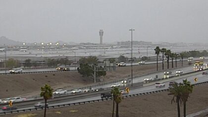
According to the meteorologist, Phoenix Sky Harbor International Airport — which NWS uses for the city’s official readings — has received 1.96 inches of rain since midnight, breaking the previous daily rainfall record for Oct. 12 (0.32).
Will the Valley get anymore rainfall during the week?
There is a possibility for rain on Monday afternoon, according to Lojero.

“Most of the heaviest rain at this time looks like it’s going to be just east of Phoenix or across the foothills and higher terrain areas,” Lojero said.
Lojero noted that with the additional rainfall, flash flood issues might arise on Monday due to the ground being saturated from weekend weather.
There is a flood watch through Monday evening. It was originally supposed to be through Sunday evening but NWS extended it.
However, metro Phoenix is expected to dry out on Tuesday.
The high temperatures during the week are supposed to be below average in the 80s and the overnight lows are expected to dip into the 60s.
KTAR News 92.3 FM’s Troy Barrett contributed to this report.
The post Valley expected to dry out before receiving possible overnight rainfall appeared first on KTAR.