
Sea level rise is speeding up in parts of the United States, with Southeastern and Gulf Coast cities showing the most pronounced acceleration.
New data released by William & Mary’s Batten School and the Virginia Institute of Marine Science (VIMS), mapped by Newsweek, show that almost every coastal city in the nation has seen an increase in sea level in 2024.
Why It Matters
The U.S.’s coastline is densely populated and will be vulnerable to more frequent and intense flooding, coastal erosion, and the loss of critical infrastructure as sea levels continue to rise.
These changes will profoundly impact life in some of the country’s largest cities and could even lead to displaced communities.
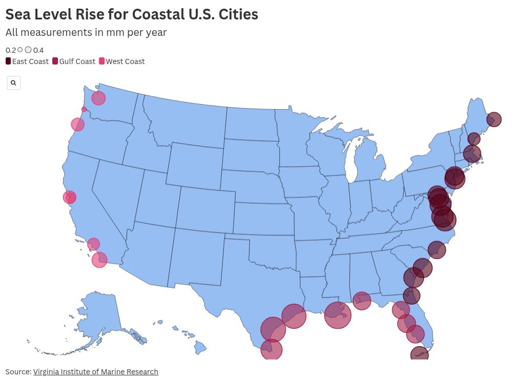
What To Know
The 2024 sea level analysis, based on 55 years of data from tide gauges across 36 U.S. coastal communities, uses historical measurements at specific locations, meaning each city has a specific sea level increase.
The fastest rates of sea level rise are in Gulf states, like Texas and Louisiana, but many of the East Coast cities like Norfolk, Virginia, and Solomons Island, Maryland, are also seeing rapid acceleration, due to patterns of water distribution related to glacial melt from the Greenland ice sheet.
The city with the largest sea level rise was Grand Isle, Louisiana, which saw a rise of over 8 millimeters a year. However, the city itself is on a barrier island, meaning it is already predisposed to rising water levels.
The largest mainland sea level rise was reported in Rockport, Texas, which recorded a 7.1 millimeter rise in 2024.
Most West Coast locations, meanwhile, have remained relatively stable despite past projections showing a faster increase. The only city to report a decreasing sea level was Crescent City, California, which saw a drop of 0.7 millimeters.
Other large West Coast cities, like Seattle, recorded a comparatively low increase of just 2 millimeters.
What People Are Saying
Molly Mitchell, assistant professor at the Batten School of Coastal & Marine Sciences and VIMS, said: “Compared to other predictions based on satellite data and global computer models, our reports are created using observed tide gauge data from the past 55 years and reflect the exact experience at the location of the gauge. The annual release of the report cards allows coastal regions to examine if past trends are changing and alter their planning accordingly.”
What Happens Next?
If sea levels continue to rise, urban areas may have to consider taking drastic action to prevent flooding and other disruption to city life. Some cities, such as San Francisco, are already taking this approach with the construction of flood barriers.
The post Map Shows US Cities Where Sea Level Rise Is Accelerating appeared first on Newsweek.


