Winter weather warnings have been issued for parts of Colorado and Wyoming on Wednesday, with forecasts predicting up to 10 inches of snow.
The National Weather Service (NWS) said that heavy snowfall combined with strong winds could lead to hazardous driving conditions and road closures.
In some areas, the agency said hazardous and slippery road conditions could impact morning commutes on Wednesday.
What To Know
A winter storm warning has been issued for mountainous regions of central Colorado. This means that a “significant combination of hazardous weather is occurring or imminent.”
The NWS said that up to 10 inches of snow could fall in the Rocky Mountain National Park, the Medicine Bow Mountains, the Summit County Mountains, the Mosquito Range and the Indian Peaks Wilderness.
Up to six inches of snow could fall on Pikes Peak, Sangre de Cristo Mountains and Wet Mountains at high elevations. Meanwhile, up to three inches of snow could fall in the eastern Sawatch Range mountains and Rampart Range.
“Roads, including mountain passes, will likely become slick and hazardous. Heavy wet snow may cause tree and power line damage,” the NWS said.
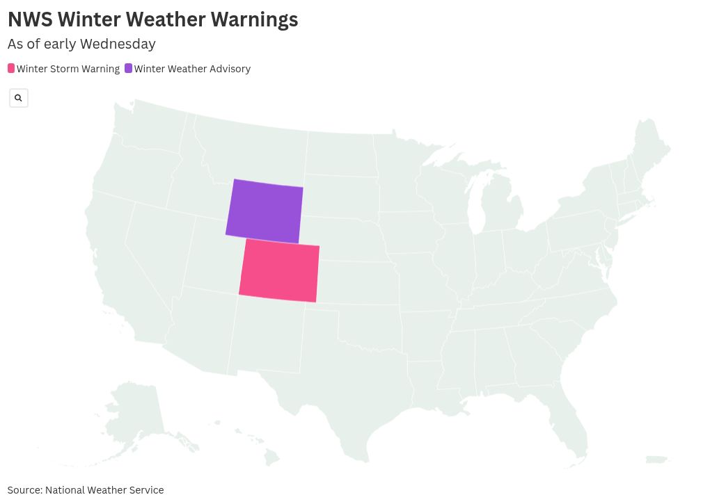
Meanwhile, a winter weather advisory is also in effect for a small pocket of southern Wyoming. This means freezing rain or snow are “expected to cause a significant inconvenience, but not serious enough to warrant a warning.”
Up to six inches of snow are forecast to fall on the Snowy Range above 8,500 feet.
“Outdoor recreation could become dangerous to those caught unprepared for hazardous winter conditions,” the NWS said. “Hunters, hikers, and snowmobilers may become disoriented and lost due to low visibility in falling and blowing snow.”
What People Are Saying
The NWS office in Pueblo, Colorado, wrote on X, formerly Twitter, on Tuesday: “Snow will continue along the higher terrain through tomorrow, with occasional periods of lower elevation snow, especially along the Palmer Divide. Snow will be heavy and wet across the region.”
NWS Cheyenne, Wyoming, wrote on X on Tuesday: “A winter weather advisory has been issued for the Snowy Range. Accumulating snow will mainly be confined to the eastern side of the range above 8,500 feet in elevation. A few inches of slushy accumulation will also be possible over the I-80 summit.”
NWS Boulder, Colorado, wrote on X on Wednesday: “Periods of snow will continue in the mountains today with showers and scattered thunderstorms at lower elevations. Snow levels will drop down to 6,500 feet this morning but then rise above 7,500 feet by afternoon.”
What Happens Next
The latest winter storm warnings and winter weather advisories are in effect until noon MT on Wednesday.
The post Winter Weather Warnings In 2 States As 10 Inches of Snow To Hit appeared first on Newsweek.