
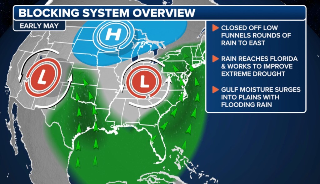
A rather unusual weather pattern for early May is setting up across the US, and forecasters warn that it will lead to a stagnant pattern with prolonged periods of warmth in some areas and steady rain in others.
The pattern, known as the “Omega block,” is named after the Greek letter Ω and disrupts the usual zonal flow of weather systems.
As a result, two distinct regions of precipitation are expected to dominate the workweek: one stretching from the Southwest to the southern Plains and Gulf Coast, with another impacting the Northeast and mid-Atlantic.
“Plenty of moisture will be underneath those lows,” FOX Weather Meteorologist Jane Minar said. “It’s a slow-moving pattern that will kind of keep us locked in place with rain.”
Computer forecast models indicate a widespread 3-6 inches of rainfall across the South, with isolated areas possibly receiving even more.
The rain may also be accompanied by strong thunderstorms, some of which could reach severe levels.
Cities such as New Orleans; Jackson, Mississippi; and Alexandria, Louisiana, are either in or near the bull’s-eye for where the heaviest precipitation is expected to fall in the week ahead.
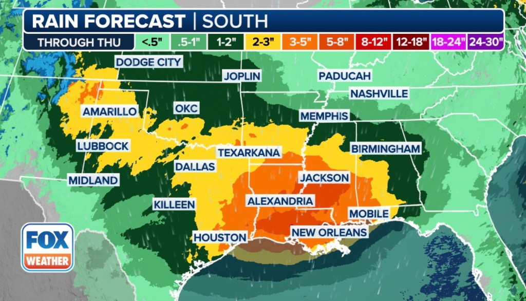
Some communities in the region are especially vulnerable, as many have already experienced torrential rainfall in recent weeks.
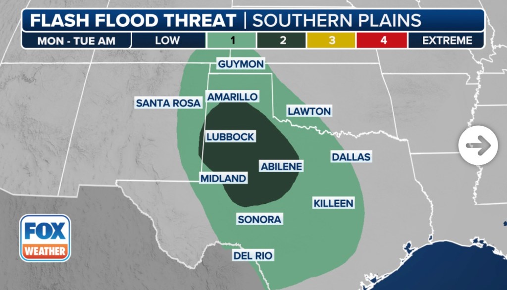
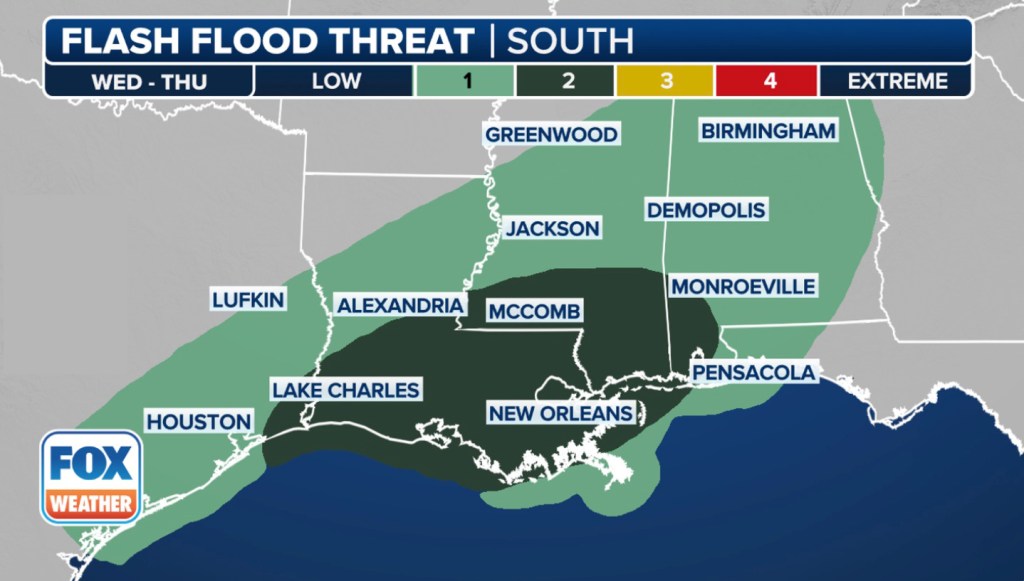
The FOX Forecast Center warned that saturated ground and elevated river levels will increase the risk of flooding, especially in low-lying or poorly drained areas.
According to NOAA’s Weather Prediction Center (WPC), the highest flood risk is expected from Tuesday evening through early Wednesday, when more than 35 million people across the southern US will be under Level 2 to Level 3 flash flood threats on the WPC’s 4-point risk scale.
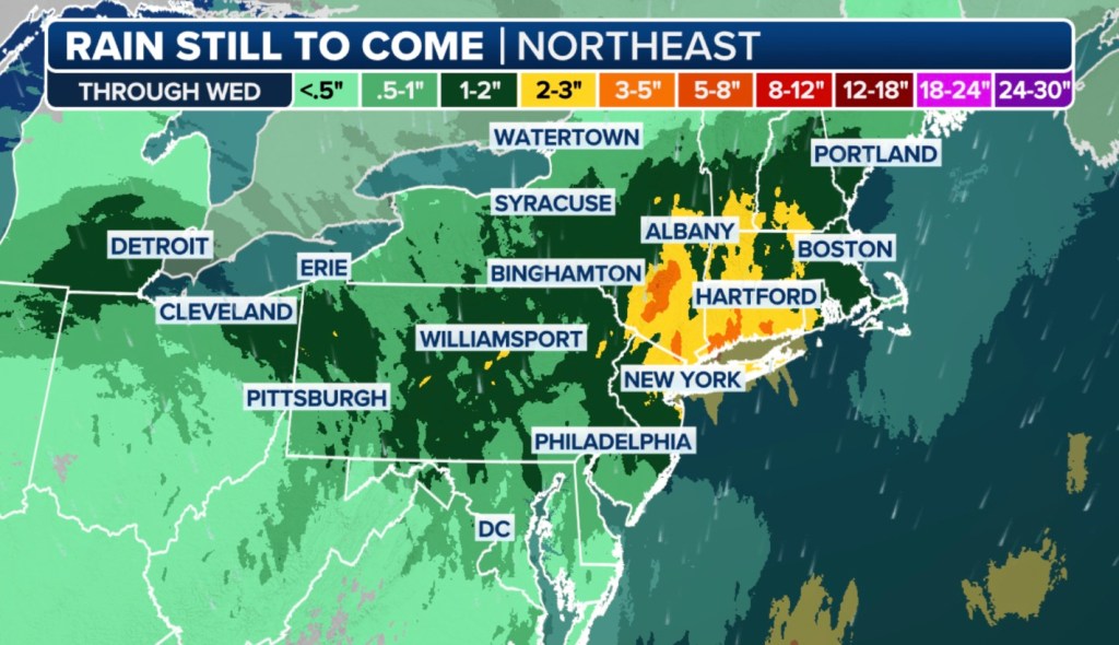
In contrast, the Northeast stands to benefit from the incoming precipitation. Computer forecast models predict 1-3 inches of rain across the Interstate 95 corridor, with locally higher amounts of up to 5 inches possible in portions of New York and Connecticut.
The rainfall could provide welcome relief to regions experiencing moderate to severe drought along the Eastern Seaboard.
This type of pattern is not known to produce extensive severe weather outbreaks, as the dynamics aren’t in place, but localized bouts with hail and damaging wind gusts are possible.
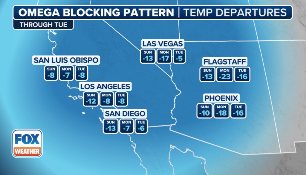
Meanwhile, regions outside the influence of the low-pressure systems will experience drier air and temperatures that will vary significantly.
The northern Plains are expected to see highs climb into the 70s and 80s, while parts of the Southwest, including cities like Las Vegas and Los Angeles, may struggle to reach their average highs for early May.
“It’ll feel more like Christmas in Los Angeles and the Fourth of July in Fargo,” Minar noted.
Looking ahead, forecasters anticipate that the jet stream will begin to shift by the upcoming weekend, allowing a return to a more typical springtime weather pattern across a large section of the country.
The post Northeast facing flood threats this week due to unusual weather pattern appeared first on New York Post.


