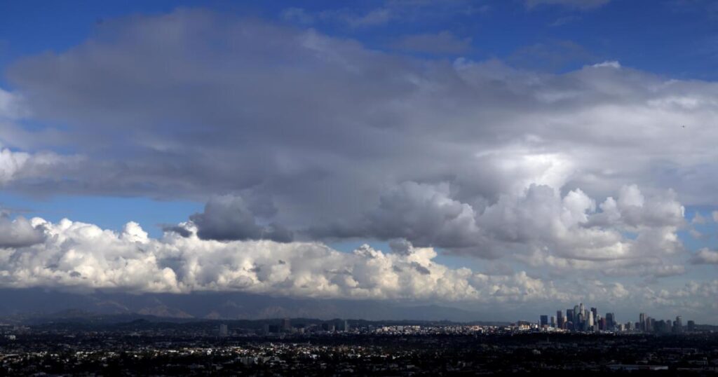
Don’t put away those umbrellas just yet: Even more rain is expected to hit Los Angeles on Thursday, continuing what’s been an unusually early and wet start to the rainy season.
About half an inch to an inch of rain is forecast to fall throughout the coastal and valleys areas of Los Angeles County. Although not nearly as potent as the storm that soaked the region over the weekend, rain could be strong enough to force the cancellation of outdoor events, according to the National Weather Service office in Oxnard.
Higher rain totals, in the neighborhood of 1 to 2 inches, are expected in the foothills and mountains.
There’s a 10% to 20% chance of rain Thursday morning in Los Angeles County, but that’ll rise to 60% to 70% by the afternoon, and 80% to 100% by the evening. There’s also a 60% to 70% chance of rain through Friday morning, and a 30% to 50% chance later on Friday.
Showers could persist all the way into Saturday morning in L.A. County, but the rest of the weekend “is expected to be dry but cool,” the weather service said. The rest of the Thanksgiving week is expected to be dry, and temperatures will warm up, with highs in many areas in the mid-60s to low 70s, the weather service said.
It’s likely that Thursday’s storm will be more beneficial than hazardous, helping to further put a damper on the autumn fire season. But the rain could cause minor road flooding and trigger some rockslides and mudslides, with ice and snow on mountain roads.
And there is still a small chance — about 10% to 20% — that rain totals could be twice as much as the more widely expected forecast.
The uncertainty is due to the nature of the storm, which is fueled by a “cut-off low,” meaning it is cut off from the jet stream and spins unpredictably like a top, making it hard to predict whether the system will slow down over L.A. and dump more rain than expected.
Heavier downpours might materialize in some locations, forecasters said. There is a 3-in-5 chance that rain rates of half an inch per hour could develop between Pasadena and the border of L.A. and Orange counties from 10 p.m. Thursday through 3 a.m. Friday.
Rain falling at a rate of half an inch or more poses a risk of mudslides and debris flow.
A debris flow is a type of landslide that is caused when heavy rain starts rushing downhill and picks up mud and debris. A. minor debris flow can cover roads and driveways with muck, while major debris flows can send boulders and cars sliding at speeds of up to 35 mph and send a wall of mud crashing into homes and businesses.
“While the overall risk for burn scar debris flow is low, it’s certainly not zero,” the weather service said.
This latest storm is not expected to bring snow to the Grapevine section of the 5 Freeway, which reaches an elevation of 4,144 feet at the Tejon Pass.
But there is the possibility of heavy, wet snow and accumulations of up to 8 inches above 6,000 feet for a swath of the San Gabriel Mountains in L.A. County, including Mt. Baldy and Wrightwood. A winter storm watch is expected between Thursday afternoon and Saturday morning.
Heavy snow could start falling as early as Thursday morning in the mountains of San Bernardino and Riverside counties, including at Big Bear, with 2 to 6 inches possible at 6,500 feet; 6 to 12 inches at 7,000 to 8,000 feet; and 12 to 18 inches above 8,000 feet. A winter storm watch for that area was expected from Thursday morning through Saturday morning.
In Orange County, San Diego County and the Inland Empire, showers are expected to begin as early as Thursday morning and become widespread and heavier Thursday night and Friday morning.
Thunderstorms will be a possibility during this time, the weather service office in San Diego said.
The recent parade of storms has fueled a wetter-than-normal fall across Southern California, dramatically reducing the risk of wildfires and probably bringing an early end to the annual fire season.
Since the start of the water year on Oct. 1, 4.89 inches of rain has fallen in downtown L.A. — five times more than the average for this time of year, and one-third of the average annual rainfall. Last year at this time, only 0.07 of an inch had fallen since the start of the water year.
Forecasters have said that it takes 3 to 4 inches of rain in the lower elevations to effectively end high fire season in Southern California.
In November alone, 3.48 inches of rain has fallen on downtown L.A. — nearly 10 times the average for this point in the month. That’s the wettest November for downtown L.A. in more than 40 years, trailing 1982, when 4.41 inches of rain fell.
The wettest November on record for downtown L.A. occurred in 1965, when 9.68 inches fell.
This November has also been the wettest at Santa Barbara Airport since records began being tracked in 1941, according to meteorologist John Dumas of the weather service’s Oxnard office.
The weather service said 8.42 inches of rain has fallen there. That places this November just outside the 20 wettest calendar months ever recorded at the airport, Dumas said.
Over the weekend, Santa Barbara County’s roads were caked with mud and trees were uprooted amid heavy rain, but no major injuries were reported.
The post More rain is heading for Los Angeles. When will the Southern California storms end? appeared first on Los Angeles Times.