The stretch of severe winter weather that the D.C. area just endured felt as if it belonged to another era. In recent years, many winters have been muted, with conditions more mild as a result of the steady influence of human-caused climate change. This winter has been different.
For nearly 20 days, temperatures rarely rose above freezing, while wind chills repeatedly flirted with zero. Creeks, ponds and even larger waterways froze to extents not seen in many years.
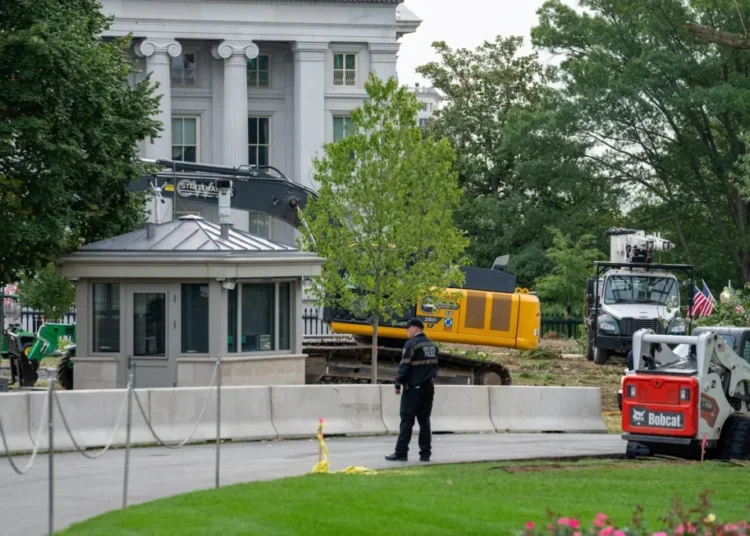
There was only one major winter storm, arriving just as the cold snap set in. But the prolonged deep freeze transformed its snow and ice into immovable, glacier-like slabs that still clog some roads and sidewalks. In response, several jurisdictions have resorted to heavy equipment to clear them.
That “snowcrete” — named for its rock-hard consistency — is finally poised to begin a long, slow fade. Temperatures are expected to climb above freezing each day in the D.C. area for the foreseeable future, with some days next week reaching the 50s or higher.
Before long, the conversation will shift again — this time to cherry blossom bloom dates.
The upcoming thaw
Temperatures are set to climb well into the 40s on Tuesday and Wednesday before stepping back somewhat Thursday and into the weekend. Beyond that, next week could turn markedly milder.
The average of computer-model guidance projects highs near or above 50 on most days next week, and it’s one or two days may flirt with 60. Overnight lows could also remain above freezing on many nights.
That said, computer models sometimes exaggerate warm-ups — only to be undercut by sneaky cold fronts dropping in from the north. Confidence in temperature forecasts also drops substantially beyond about 7 to 10 days.
There are some hints the pattern could turn cooler again toward the end of February, but there are no signals for anything remotely as intense as the cold we just endured.
When the snowcrete may melt
Because of the persistence of the cold over the past two and a half weeks, the snowpack has proven especially stubborn. It has compacted and solidified into the dense snowcrete, making it far more resistant to melting than a typical snowfall. Still, the upcoming thaw does portend the snowpack’s gradual demise.
While melting will likely take longer than many expect, at least some should occur each day this week. Colder nights later in the week will allow portions of the snowpack to refreeze and reconsolidate, but bare patches should steadily expand — especially in sunnier, less shaded areas.
Looking ahead, there is potential for a soaking rain over the weekend (there is an outside chance of frozen precipitation depending on the storm track; stay tuned for forecast updates), which could significantly accelerate the breakdown of the snowcrete. If the rain is followed by sustained mild weather next week — with highs in the 50s and lows staying above freezing — it could spell the end of the snowpack in most locations. Larger plowed piles, however, are likely to linger much longer, possibly well into March.
Ice on area waterways, reminiscent of another era, has probably peaked
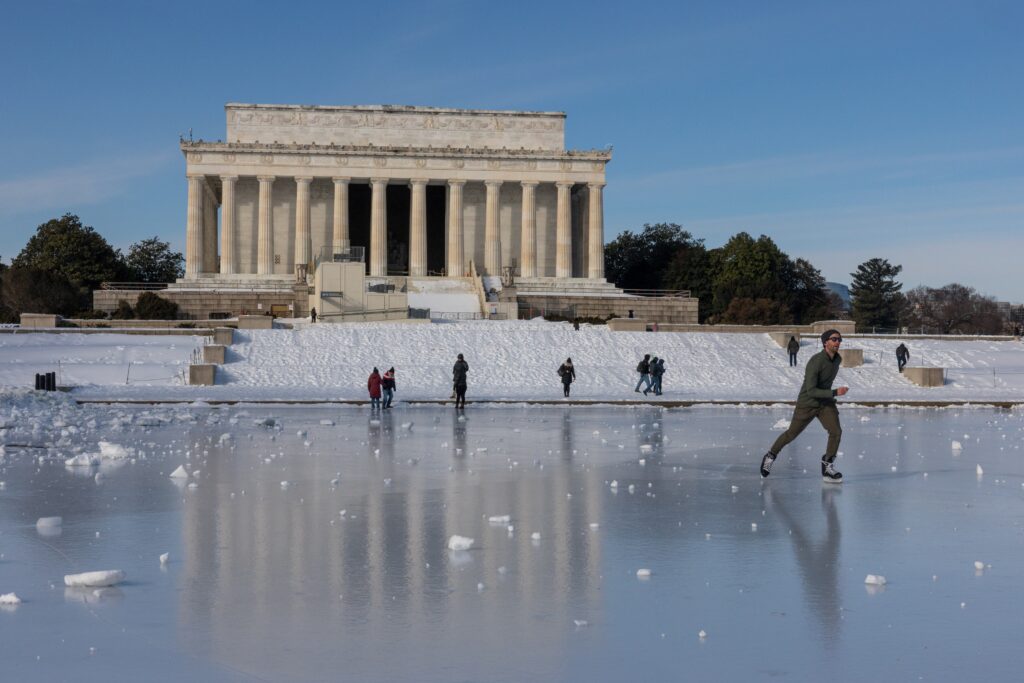
As the thaw begins, ice cover on area waterways stands at its most extensive level in decades — a striking throwback. As of Monday, ice covered 38.4 percent of the Chesapeake and Delaware bays and the Potomac River, the highest coverage observed so far this season.
A majority of the Potomac River is ice-covered, except closer to its mouth where some open water persists. Around D.C., coverage ranges from 90 to nearly 100 percent, with particularly thick ice in smaller coves and tributaries. Much of the northern Chesapeake Bay is frozen as well, along with a majority of the Delaware Bay.
If not for roaring northwest winds over the weekend — which tend to fracture and disperse ice — coverage might have been even more extensive. In the Chesapeake Bay, much of the thickest ice was pushed toward the Eastern Shore.
Smaller lakes and ponds across the region are completely frozen, prompting scenes of people skating and playing hockey — images that have become increasingly uncommon in recent winters. The National Weather Service recommends there be at least four inches of ice to safely support a person, although currents beneath river ice make the main stems of rivers especially dangerous.
With the milder weather expected over the next week or two, ice will thin and retreat, increasing the risk for anyone venturing onto frozen waterways.
The cold and snow cover in perspective
Over the past two weeks, the region’s weather has more closely resembled what’s typical in Milwaukee, according to the Southeast Regional Climate Center.
The 17-day period ending Monday averaged 23.2 degrees, nearly 15 degrees below normal — ranking among the coldest such stretches since the 1970s. It was the coldest comparable period since December 1989, when temperatures averaged 22.6 degrees. That winter also marked the last time Washington endured nine or more consecutive days below freezing.
The prolonged cold has helped preserve snow and ice. As of early Tuesday, two inches of snowcrete remained on the ground at Reagan National Airport, marking the 17th-straight day with at least two inches of snow cover. That surpasses the 16-day streak in February 2010 that followed a pair of blockbuster snowstorms and ties for the ninth-longest such streak on record — the longest since December 1989, when the streak reached 20 days.
With temperatures expected to climb above freezing in the days ahead, the snow cover should gradually erode, although the streak could extend another day or two.
Taking everything together — the cold and the snow — and the longevity, the Midwest Regional Climate Center ranks this winter’s severity as “extreme” and the harshest in at least the last decade
Will there be more winters like this?
Human-caused climate change has generally tempered the severity of winters in D.C. Eight of the past 10 winters have featured warmer-than-normal temperatures and below-average snowfall. This winter, marked by its unrelenting cold, stands out as an exception — but it is unlikely to be a preview of winters to come.
Average winter temperatures in Washington have risen about 6 degrees since the late 1800s, sharply reducing the odds of seasons like this one. Still, this winter is a reminder that, once in a great while, the region can experience a punishing cold spell even in a warming climate. Just don’t expect skating on area waterways to become the new normal.
The post D.C. will finally thaw after its coldest, iciest stretch in decades appeared first on Washington Post.