When our analysis showed that what Westerners call a “hill” would generally qualify as a “mountain” in the rest of the country, many of you pleaded with us to do the same thing for water. Let’s see how it shook out!
“What is the difference between a river and any other name one might give to a stream of water? In the western U.S., for instance, there are streams referred to as rivers that seem laughably small compared to rivers in the East.”
— Michael Santella in Knoxville, Tennessee
What a conveniently thematic question! To answer, we cracked open the National Hydrography Dataset, a modern monument built over decades by the U.S. Geological Survey, the Environmental Protection Agency and dozens of allied groups.
In it, we found almost 180,000 stream-like objects for which there were corresponding names in the Geographic Names Information System — the official source for the names of almost a million summits, springs, slopes and seas in America.
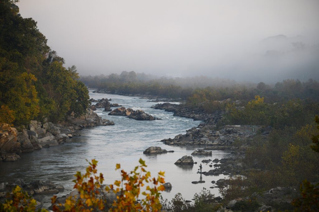
And it turns out that, much to our delight, U.S. stream names rule. Sure, we default to “creek” in most of the country. But push aside the creek curtain and we see a Cambrian explosion of words early Americans used for ribbons of running water.
New England preferred “brook,” while Pennsylvania and its other neighbors went for “run.” The South and much of the Midwest preferred “branch.” In the Desert Southwest, an oft-interrupted stream would become an “arroyo” or “wash.”
And that’s before we get to the obscure hipster regionalisms, such as the archaic Dutch “kill” in old New Amsterdam, the salt-inspired “lick” in the Appalachian highlands, “rio” in New Mexico and “naokwa̱i̱de” in Idaho. The last qualifies as both quite old and quite new: It’s a Shoshone term that returned to the landscape when the Biden administration helped rename places that previously referenced a slur against Native American women.
Almost all the terms we found, with the possible exceptions of “bayou” and “fork,” seem synonymous with creek. About 90 percent of the running waters in our dataset got named “creek” or one of its most popular synonyms, such as “brook,” “branch” or “run.” So, if you see a bit of moving water in the United States, it’s probably safe to just call it a creek (or crick, depending).
Unless, of course, it’s really big.
More than 90 percent of the 500 largest of the largest streamy objects in the U.S., judged by government estimates of average annual flow, are called “river” (or “fork”). Nationally, rivers’ reign only slows when we get to around the 2,000th-largest stream in the country — for you hydrology heads, that would place the cutoff around 350 cubic feet per second.
But that’s nationally. To get beyond that unitary polity, we split the streams by state and region based on where the mouth lies — we figured that’s a decent rule of thumb for where it would have been named. Some differences in river definition surfaced, particularly in the Upper Midwest.
But why in the world would that watery region have the lowest standards for what deserves to be called a river? Explanations evaded us, so we unleashed every data analyst’s favorite weapon: procrastination. We set steams aside and switched to our second question of the week. A question that would, ultimately, lead us to a clue.
What about lakes and ponds?
“What is the difference between a pond and a lake? After visiting Minnesota, a lot of so-called lakes seemed more like ponds.”
— Duncan Graham in Medford, Oregon
Belatedly, we’d like to step back and express a bit of gratitude. We’re thrilled to have stumbled into a previously untapped source of regional rivalry: the technical definitions of geographic features.
To answer Duncan’s leading question, we’ll return to our new best friend, the hydrography dataset. The version we used here includes about 7 million standing-water-related objects. Once we combined complicated water bodies and focused on those whose official names we’re sure of, we were left with about 120,000.
Most of those bodies of water, about 54 percent, have names that end in “lake” — or a variant, such as “Lac qui Parle” or “Lake of the Woods.”
Lakes dominate most states. But when we took them out of the equation, we noticed a simple truth about American bodies of water: Many of them are human products.
Ponds predominate, but only in the East. In much of the West, we love fishing or boating on “reservoirs.” Unless it’s the Southwest, in which case it’s all about “tanks” — a regional term for a man-made watering hole for livestock. In oddball Wisconsin, they often use “flowage” to describe a human-made lake (or marshy lakelike object).
Even in the Eastern Seaboard, where natural ponds predominate, “millponds” are such integral features of the landscape that it’s easy to forget they’re one of the original sources of clean energy.
The lesson? If folks used words other than “lake” or “pond” to describe a body of water, said body probably has been shaped by humans.
In much of the country, most bodies of water count as artificial, according to the USGS system. That includes millponds and reservoirs, but also existing lakes that have been impounded to make them more predictable and/or useful for industry or agriculture.
The exceptions to that rule include most states within easy driving distance of Canada, plus a few famously soggy Southern states such as Florida and Louisiana.
To keep this analysis consistent, we’ll focus on natural “lakes” and “ponds.” Those two workmanlike terms cover pretty much every brook and cranny of this vast nation.
The initial results didn’t inspire anyone. Judging by the national numbers, there’s no clean point at which a pond becomes a lake. Even the smallest cerulean smudges get the “lake” treatment more often than not.
But one part of America still respects the pond. In New England, using “lake” to describe natural water bodies doesn’t really become acceptable until about 350 acres in area, though “lake” doesn’t truly pass the pond until about 500 acres.
What the Census Bureau calls the Mid-Atlantic states (New York, Pennsylvania and New Jersey) are a bit lake-ier. Anything under 30 acres is a “pond”; anything between 30 and 100 acres is a toss-up. Above that size we’re mostly lookin’ at “lakes.”
In the West and Midwest, ponds are passé. Well over 90 percent of lake- and pond-esque water bodies of less than 100 acres in those regions get the “lake” designation, compared with just a quarter of similar features in the Northeast. The South is a bit more pond-friendly, but not much — about three-quarters of these small waters are still known as lakes down here.
How did New England become American’s pond powerhouse, and why didn’t the rest of the country follow suit? For answers, we called Robert “Thor” Thorson, a University of Connecticut geologist and author with a passion for ponds.
In his part of New England, he said, ponds tend to be what geologists call “kettles.” Known as potholes in Northern Prairie, kettles tend to resemble castaway cookware sunken into the land.
They’re born from forgotten chunks of ice, broken off and buried in the wake of ice-age glaciers as they retreated to Hudson Bay. As the ice age ended, those entombed, isolated icebergs melted and created sinkholes.
Every region seems to have picked a different evocative name for its kettles, but they all represent the same landform, Thorson told us. And he’d know — he road-tripped across 19 states to visit these Laurentide leftovers for his 2009 book, “Beyond Walden,” named for perhaps the most famous kettle of them all.
When they encountered kettles, English settlers called these familiar landforms ponds. Even when, as with Walden, the purported ponds met a common technical definition of lake: a body of water in which light doesn’t reach the bottom.
“Their idea of a lake is large, rocky, and deep, i.e., the Scottish ‘loch’ or the English Lake District, which are rock-carved glacial valleys,” Thorson told us. “The rest were called ponds, including salt ponds along the shore.”
In other words, if it was impressive, it wasn’t a pond. The pond PR problem seemed so serious that even Walden was marketed after the Civil War as Walden Lake to lure day trippers out from Boston. Until the “Walden Lake Grove Excursion Park,” and with it the peaceful pond’s loftier commercial ambitions, burned down in 1902.
Looking at our map again, we noticed that, as with rivers, the Upper Midwest — America’s Lakebasket — employs some of the loosest definitions of lake. Why did that region, in particular, have so much water and so few standards as to how to define it?
It all comes together
In desperation, we dug though individual lakes and rivers in Minnesota, Wisconsin and their neighbors. And that’s when we engaged our little gray cells and spotted le clue.
Or, more accurately, les cleux. Because staring back at us were scores of French names, from Big Bateau Lake in Michigan to Upper Des Lacs Lake in North Dakota.
You see, river and lake both came to English via our French friends. Pond, stream and brook, on the other hand, are Old English Germanic originals. (Creek complicates our lives a bit, as it appears to have come from Norse, but perhaps via the Normans.)
And when you look at the areas with the most expansive definition of lake and river — the Upper Midwest — the French influence becomes clear. We found confirmation in a secular scripture of American place-name studies, George Rippey Stewart’s 1945 opus, “Names on the Land.”
In its voluminous and luminous pages, the University of California at Berkeley professor and future sci-fi authorspins thousands of yarns as to how individual places get their names. And he can’t help but spot a few trends in the process.
He started with the pond problem but lost no time in tying it all together.
“The New Englanders had said pond usually and lake rarely,” Stewart wrote, “But in Virginia there were few bodies of water to be called either lakes or ponds. So, the Virginians easily took from the French the habit of saying lake, and all in the great valley, and farther to the west also, pond is seldom used except for something so insignificant as to hardly have a name at all.”
So, good news! We were only scooped on this one by a mere eight decades. The process was even more direct in the Upper Midwest, where Messieurs Marquette, Jolliet, La Salle, et al, named so much of the landscape. It’s hardly surprising that the land of Eau Claire, Fond du Lac and Detroit also tended to use French-origin words for its lakes and rivers.
Speaking of rivers, Stewart even has an answer for the predominance of “creek” in most of America, despite its rarity in Englands Olde and New. It happened because Virginia was settled from the outside in.
In its original sense, “creek” described a salty or brackish tidal stream. And early Virginians used it liberally as they encountered such features on the Tidewater coast. But it’s tough to judge a stream’s ultimate size from that vantage point, and they bestowed the name on watercourses that would, as colonists moved inland, begin to run clear and resemble the streams we know today.
This also explains the popularity of “branch” among the streams of this region. As the colonists worked their way upstream, they needed another name for their creek or river as it split, Stewart writes. “Fork” and “prong” evolved the same way.
Armed with his infinite insight, Stewart also pointed out something we’d never have noticed ourselves. With more recently named water bodies in particular, “a curious custom arose. A small and unimportant one was called merely Round Lake or Smith Lake, but a large or famous one would be called in the French fashion, Lake Tahoe or Lake Mead.”
And he’s right! The largest 3,000 or so lakes and reservoirs are about three times as likely to get the lake-first treatment — about a quarter of them earn such honors.
Hello, there! The Department of Data continues collecting queries. Tell us what piques your curiosity: Did colonists use technically correct names for each bog, marsh and fen? How do U.S. artists actually earn a living? Is it our imagination, or have chart-topping bands really cut back on those guitars? Just ask!
If your question appears in a column, we’ll send you an official Department of Data button and ID card. This week, we owe theme to Michael and Duncan — and all the others who suggested we pursue similar tacks.
The post What separates a lake from a pond? What about creeks and rivers? appeared first on Washington Post.