The D.C. area has just emerged from its longest uninterrupted stretch of freezing weather in more than 35 years. Temperatures did not rise above 32 degrees for a bone-numbing nine straight days — 233 consecutive hours — a feat unsurpassed since 1989.
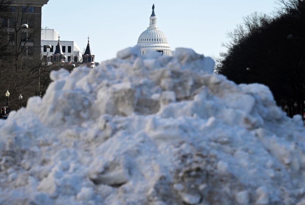
The prolonged cold, combined with a winter storm that dumped a dense mix of snow and ice, has produced one of the region’s most severe winter weather episodes in decades. The rock-hard conglomeration — dubbed “snowcrete” — continues to block roads and sidewalks in parts of the area, while some schools have remained closed for more than a week. The cold snap has also iced-over area waterways to an unusual extent.
Although the streak of freezing days has finally ended, winter’s grip has not.
Temperatures are expected to remain below normal for the rest of the week, and another punishing blast of cold is poised to arrive by the weekend. Readings are forecast to run about 20 degrees below normal, with dangerously low wind chill levels.
The streak of freezing days in perspective
The stretch of nine straight freezing days tied as the sixth longest instance on record and was the most enduring since a run of 10 such days in December 1989.
It began as an Arctic air swept in on Jan. 24 and only gently relented on Monday, when the mercury touched 33 degrees at 2 p.m. following 233 hours below freezing.
An equally long streak of morning lows in the teens was also unusual in our current climate. The nine consecutive days this cold tied for the ninth longest streak on record, tying a stretch in early 2018 and ending up longer than any other since 1994.
Snow has persisted for an unusual duration
The string of freezing temperatures has helped our snow and ice concoction last an uncommonly long time.
At least 4 inches of snow and sleet have covered the ground for nine straight days through Tuesday. The average for an entire winter with this much is just three to four days.
Four inches has covered the ground for the longest time since the winter of 2009-2010, D.C.’s snowiest on record, when it did so for 26 days.
Ice-covered water
This atypically long-lasting and frigid air mass has also caused thick ice to develop on area waterways to an extent not seen in years. Skaters have been spotted on the Reflecting Pool on the National Mall, the pond at Constitution Gardens and on various parts of the Chesapeake Bay and Ohio Canal.
As of Monday, ice covered 33 percent of the Chesapeake and Delaware bays, including the Potomac River. Much of the Potomac in the D.C. area is 90 to 100 percent covered.
The Monday report from the National Ice Center showed ice bunched up on the eastern side of the Chesapeake Bay, because of strong winds out of the northwest in previous days.
What comes next
Although highs will rise well into the 30s Tuesday and perhaps again Friday, the number of daytime hours above freezing this week will be limited. And then bitterly cold air will pour in late Friday after a powerful cold front, accompanied by possible snow showers, charges through the area.
Temperatures will plunge into the teens by Saturday morning with wind chills near zero. Highs both Saturday and Sunday will hover in the 20s. The wind will be brutal on Saturday in particular, with gusts over 30 mph.
Freezing highs will probably persist into Monday next week, so expect minimal melting of the snowcrete for another week or so. There is some chance we see some 50-degree weather by the end of next week, although confidence in the forecast that far into the future is low.
Our outlook for February, released Monday, suggests colder than average weather may return for the back half of the month.
The post D.C.’s longest freezing streak since 1989 ends, but more bitter cold looms appeared first on Washington Post.