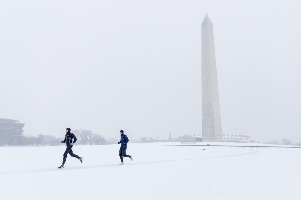
D.C. plunged to 13 degrees on Tuesday morning, while many locations in the region dipped into the single digits and below zero.
The frigid morning was part of a punishing cold snap that ramped up Saturday and may not relax until around Groundhog Day on Feb. 2. By some measures, it could rank among the most severe cold spells since the late 1800s.
The deep freeze helped set the stage for Sunday’s winter storm, and its persistence ensures the hefty snow and ice that fell will linger as thick cement-like slabs for at least the next 7 to 10 days.
The cold is now beginning to transform local waterways. Portions of the Potomac River are already icing over, and continued freezing could lead to unusual ice cover on parts of the Chesapeake Bay — a rare sight that last occurred in notable fashion in January 2018 and February 2015
@capitalweather Icy Potomac on approach to DCA this evening pic.twitter.com/5Hxr4yzEU6
— Quad City DJ (@RoverFun) January 27, 2026
Amid Tuesday morning’s bitter cold, wind chills dipped below zero, prompting a cold weather advisory from the National Weather Service. Yet another advisory is in effect for Wednesday morning and more are likely later this week as the conveyor belt of Arctic air keeps flowing.
How cold has it been?
Much of the area temperatures dropped into the single digits, with some even below zero on Tuesday morning. Washington Dulles International Airport dipped to 4 degrees while Manassas fell to minus-1.
Temperatures were somewhat milder than forecast in D.C. itself. The morning low of 13 — while 17 degrees below normal — fell shy of the record for the date.
The cold first roared in Friday night, sending temperatures into anywhere from the single digits to around 10 across the area. D.C.’s low of 10 was the coldest since Christmas Eve in 2022. The afternoon high of 22 that day was also the coldest since 2022.
The storm on Sunday arrived with temperatures in the teens, and they didn’t rise much higher. For an area that often struggles to fall to 32 degrees during winter storms, the entrenched cold was memorable.
The streak of three straight days with highs at or below 29 between Saturday and Monday already ranks among the longest streaks since 2000. And the fourth such day expected on Tuesday will tie for the most since then.
How cold it could get and how long it will last
A blend of computer models calls for six more consecutive days with highs in the 20s or lower.
As the next reinforcing shot of Arctic air arrives late Tuesday, wind chills will probably fall near and below minus-5 from Tuesday night into Wednesday morning.
The Weather Service expects to issue additional cold weather advisories through the week and this weekend. This is in large part due to nightly subzero wind chill. Thursday night and Friday night could feature wind chills of minus-10 or lower, even in D.C.
The coldest weather in this spell will probably occur Friday and Saturday, when highs may not escape the teens. Saturday’s record cold high of 22 from 1936 could be threatened.
There are high odds that the entire region, even including downtown D.C., will see temperatures plummet into the single digits in the nights to come, perhaps multiple times.
Record lows in D.C. are unlikely, largely because records late this week are extremely cold. Friday’s is minus-6 from 1873, for example. One record low in reach is on Feb. 1, when the minimum of 6 from 1935 could be challenged.
At Dulles Airport, the predicted low of 0 degrees on Friday would set a record there.
How this cold spell compares to the past
A streak of nine straight days with highs in the 20s or lower in D.C., projected by a blend of computer models, would tie for the third longest such streak on record and the lengthiest since 1936, when there were 10 days in a row. The longest stretch was 11 days in 1893.
The projected streak of 10 days with highs at or below 32 degrees would rank among the top-5 longest runs on record. A near-certain six days in a row at or below freezing will tie for the most since December 1989s ten.
For now, Groundhog Day is a good target for temperatures potentially rising above freezing again. However, some models suggest the streak of freezing days may extend until Feb. 3 or 4. If it reaches Feb. 4, it would match the longest such streak set in February 1895 and February 1936.
Abnormally low temperatures have also been unusually frequent and D.C. is poised to add many more to the tally. So far this month, it has dipped into the teens six times, the most in January since it happened 11 times in 2018.
And forecasts suggest D.C. will have at least two mornings with lows in the single digits, tying the most since January 2014. Before that, January 1994 had the most in recent decades with six.
Why is it so cold
The cold is the result of a persistent and unusually deep dip in the jet stream across eastern North America. The jet stream — which separates frigid Arctic air to the north from milder air to the south — is being forced southward by a strong zone of high pressure meandering between Greenland and Hudson Bay.
At the same time, high-pressure systems over Siberia and western North America are working in concert to funnel Siberian air through the polar regions and into eastern North America, where the jet stream is carrying it south.
In effect, vast stores of bitter cold from both the Canadian and Siberian Arctic are pouring into the eastern United States — and through the D.C. area.
There are no obvious signs this pattern will break down anytime soon.
Has global warming stopped?
A cold snap this enduring — potentially rivaling some dating back many decades — may prompt some to question global warming. But this outbreak does not change the long-term picture.
D.C.’s winter climate has warmed about 6 degrees since the late 1800s, and the overwhelming majority of record cold temperatures still date to the late 19th and early 20th centuries.
Globally, the planet continues to warm, and 2025 ranked as the planet’s third hottest year on record. While the central and eastern United States are shivering, many other parts of the world are experiencing unusually mild conditions.
This cold snap is a freak event, made possible only by an unusually persistent and rare configuration of large-scale weather features.
The post Extreme cold spell shaping up as one of D.C.’s longest in 150 years appeared first on Washington Post.