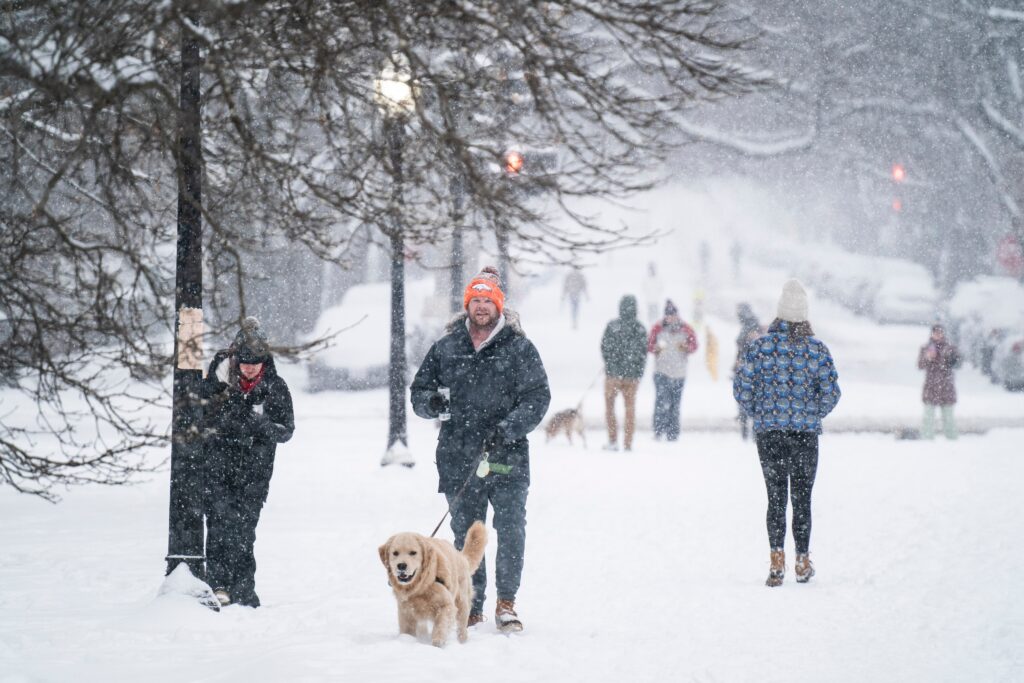
A massive and powerful winter storm remains on track to wallop the D.C. region this weekend, unloading disruptive amounts of snow and ice.
Frigid weather will precede, accompany and follow the storm, ensuring that snow and ice rapidly accumulate and remain on the ground for days.
Travel will probably be most difficult between predawn and midday Sunday, when snow and/or a mix of frozen precipitation may fall heavily, icing over roads and restricting visibility. Untreated roads may remain treacherous for days.
The storm, sweeping through the area between Saturday night and early Monday, is poised to have major impacts on roads, airports and businesses Sunday into next week, when many schools will likely close, possibly for multiple days.
The storm is predicted to produce dangerous amounts of snow and ice over a swath covering over 2,000 miles from the Southwest into southern New England.
In the D.C. area, the main forecast question is how much snow will fall and whether precipitation will change to an icy mix, coating the snow and trees and power lines with a hazardous glaze. Substantial snowfall of at least 4 to 8 inches is likely before any change to ice, most likely south and east of the Beltway. Areas that see all or mostly snow should receive at least 10 inches.
The National Weather Service office serving the region says it has “high confidence” in a major winter storm that will produce “plowable” snow. Winter storm watches are expected to be issued.
Based on the latest information, we would assign the following odds for different snowfall amounts in the Beltway area:
- At least 1 inch: 85 percent.
- At least 4 inches: 75 percent.
- At least 6 inches: 65 percent.
- At least 8 inches: 50 percent.
- At least 12 inches: 35 percent.
We would increase these percentages by 5 to 10 percent for areas north and west of the Beltway, where mostly snow may fall, and lower them by this amount to south and east, where sleet and freezing rain will probably lower snow totals.
What’s the timeline for the storm?
While subject to change, here’s an approximate timeline for the evolution of this storm (lowest temperatures in northwest areas, high temperatures in southeast areas):
4 to 10 p.m. Saturday: Chance of light snow, developing from southwest to northeast. Temperatures: 16 to 20.
10 p.m. Saturday to 4 a.m. Sunday: Snow increases in coverage and intensity from southwest to northeast. Accumulation begins immediately once snow is steady. Temperatures: 16 to 20.
4 a.m. to 10 a.m. Sunday: Snow, heavy at times. Rapid accumulation. Snow may gradually mix with and change to sleet and freezing rain, especially south and east of Beltway. Temperatures 15 to 20.
10 a.m. to 4 p.m. Sunday: Snow north and west of the Beltway may mix with sleet and freezing rain. A mix of snow, sleet and freezing rain near the Beltway. Mainly sleet and freezing rain south and east of the Beltway. Temperatures: 18 to 24.
4 to 10 p.m. Sunday: Mixed precipitation gradually diminishes from southwest to northeast. Temperatures: 20 to 25.
10 p.m. Sunday to 4 a.m. Monday: Lingering areas of mixed precipitation or freezing drizzle possible. Temperatures: 17 to 22.
How much snow could fall?
Here is how much snow different models are projecting for the Beltway area:
- UKMet: 12 inches.
- American AI model: 10 inches
- European model: 8 to 10 inches
- European AI model: 9 inches
- American model: 8 to 9 inches
- Canadian model: 8 inches
- German model: 7 inches
Most models suggest that snow will flip to sleet and/or freezing rain, especially near the Beltway and to the south and east, cutting back some on snow accumulations.
However, because of the low temperatures, the snow that falls before any changeover may be very powdery, allowing it to pile up quickly.
What remains uncertain about the forecast?
Whether, where and when snow changes to sleet and freezing rain constitute a major, unresolved forecast challenge. Most models suggest a change from snow to ice is probable as far northwest as the I-95 corridor between Sunday morning and afternoon. Some even suggest places as far northwest as Leesburg and Frederick could see some mixing.
The farther northwest and the faster any changeover to ice occurs, the more it will reduce the ceiling on snowfall throughout the region. At least 4 to 8 inches should fall in most places, but not much more in places where a flip occurs quickly — particularly south and east of the Beltway.
Why might some precipitation not fall as snow with such low temperatures?
With temperatures are forecast to be in the teens and 20s, it’s natural to wonder why ice may occur instead of snow. The reason has to do with temperatures at higher altitudes, a little more than 5,000 feet high. Models project a narrow warm layer aloft will surge north that will partially or completely melt snowflakes. But, as the partial snowflakes and droplets refreeze near or on the ground, sleet and freezing rain occur.
Could there be power outages?
In areas where substantial freezing rain accumulates, outages could occur because of its heft on trees and power lines. This could become a dangerous situation considering the prolonged, bitter cold expected following the storm. Areas toward Central Virginia and Southern Maryland are at the greatest risk of significant icing; it’s not a guarantee, but a possibility that we’ll monitor closely. (Note that the power outage risk is low in areas where snow changes to sleet, rather than freezing rain. Sleet pellets bounce off of rather than cling to trees and power lines.)
How cold will it be?
The Arctic air mass forecast to settle into the region will be notable for its intensity and longevity. “Dangerously cold wind chills and near record breaking temperatures will remain likely this weekend through early next week,” the Weather Service wrote.
After highs flirt with 50 on Thursday, cold air will begin to surge into the area Friday night when temperatures will plunge toward the low teens (even single digits in colder areas north and west of the Beltway).
Forecast highs over the weekend are only in the teens and 20s. If they hover in the teens, they would challenge calendar-day records.
Whatever snow falls will stick around for a long time. Predicted highs next week are mostly in the 20s, and lows at night would probably frequently fall into the teens and single digits. Wind chill near or even below zero will be possible at times.
Where might this storm rank historically?
If snowfall from this storm reaches the high end of projections, it could rank among the greats:
- To enter D.C.’s top 25 snowstorms, at least 10.8 inches would need to fall.
- To enter the top 10, at least 14.4 inches would need to fall.
- To enter the top five, at least 17.8 inches would need to fall.
Since the 17.8 inches during the Snowzilla storm in 2016 tied for D.C.’s fourth-biggest snowstorm, four snowfalls have surpassed 6 inches:
- 10.3 inches on Jan. 12-14, 2019.
- 6.9 inches on Jan. 3, 2022.
- 7.2 inches on Jan. 6, 2025.
- 6.4 inches on Feb. 11-12, 2025.
This storm has a chance to outdo all of these four.
In most recent historic storms to affect the D.C. area, the highest snow totals — sometimes substantially more than in D.C. itself — have occurred north and west of the Beltway.
D.C. averages 13.7 inches of snow per winter and has seen 1.5 inches so far. This storm could catapult its cumulative snowfall to near the seasonal norm.
How to prepare
With the storm three to four days away and confidence in a high-impact event, it’s time to think about taking action. If you have scheduled flights or appointments on Sunday, you might consider changing them. Most airlines will allow you to make changes free.
It’s a good time to stock up on groceries as well as snow-clearing supplies like shovels and salt.
You might also take steps to protect your home and yard from snow and ice (make sure your gutters are clear) and predicted extreme cold (protect your pipes).
“Have an emergency kit in the car including extra batteries, a flashlight, and blanket just in case you get stranded,” the Weather Service advises. “Make sure to refuel your car before the storm hits. Check on elderly friends/neighbors and don’t forget about your pets during this prolonged cold period.”
Read more about D.C.-area winter storms
Here’s how to measure snow like a pro
It is tough to predict when it will snow in Washington. Here’s why
Everything you ever wanted to know about snow in Washington, D.C.
Ice storms: Inside wintertime’s dreaded, frozen mess
Wes Junker, Ian Livingston, Jeff Halverson and Dan Stillman contributed to this report.
The post High-impact winter storm to slam D.C. area this weekend: What to expect appeared first on Washington Post.


