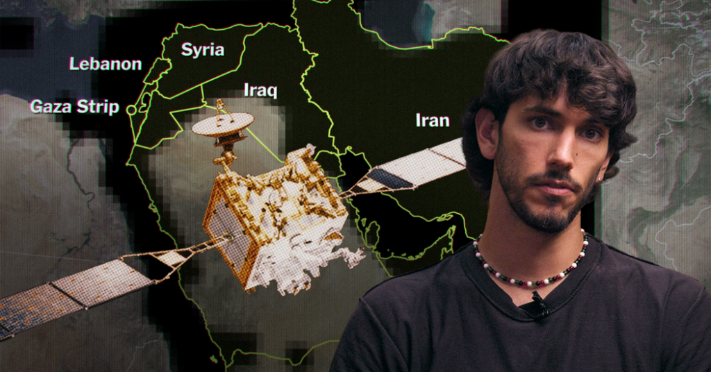
The U.S. government is trying to censor your view from space.
Ollie Ballinger, an open-source researcher and lecturer, uses satellite imagery to monitor conflicts around the world. But he says pressure from the government has prompted private companies to restrict access to images of places it may not want the public to see.
Why would companies listen to these requests? “Any pressure from the U.S. government carries a lot of weight for these companies,” Mr. Ballinger says, “because the American government is their biggest customer.”
In the Opinion video above, he reveals how these restrictions are limiting a vital tool for accountability and public safety and warns of a future in which governments have the power to control what the public can see and, ultimately, what it can know.
Below is an edited transcript of this video. We recommend watching it in its original form for the full effect. You can do so using the video player above.
Ollie Ballinger: Let me show you something the U.S. government doesn’t want you to see. The aftermath of American missile strikes on schools and homes, revealed by satellite imagery.
This view from space has been used to uncover destruction in Gaza, mass graves in Ukraine, internment camps in China and the Minab school strike in Iran. Journalists, humanitarian groups and researchers like me rely on satellite imagery to monitor conflicts, natural disasters and atrocities around the world.
Several months ago, I could go to multiple companies based in the U.S. and buy high quality images of the Middle East. But for much of this year, here’s what we’ve seen: a blackout. The U.S. government is pressuring private companies to censor satellite imagery. And that limits the public’s view of what’s happening in some of the most critical parts of the world.
In the early days of the Iran war, satellite imagery showed us details of American missile strikes on civilian targets. And it revealed the extent of damage to U.S. bases beyond what the Trump administration was admitting. But there was also concern, from both the administration and from members of Congress, that commercially available satellite imagery had been used by Iran to target U.S. troops.
Clip of U.S. House Armed Services Committee, March 25:
Representative Seth Moulton of Massachusetts: What are you doing, between the D.O.D. and the intelligence community, to work with these providers — many of whom have contracts with the U.S. government — to make sure we have better control over this?
William Adkins, National Reconnaissance Office deputy director: We have a strong partnership with our commercial providers. Their C.E.O.s meet with our leadership quarterly. We have an ongoing dialogue.
This email landed shortly after this exchange: It’s from Planet Labs, one of the biggest satellite companies in the world. They made it clear to their customers: They were restricting satellite imagery at the request of the U.S. government.
The other big player in this space, Vantor, began rolling out restrictions even earlier. They told us that they are just following their own policies. But any pressure from the U.S. government carries a lot of weight for these companies — because the American government is their biggest customer.
The blackouts imposed by U.S. companies were sweeping. They don’t just cover U.S. bases and troop positions. They cover much of the Gulf region, including Gaza, Lebanon and other places with conflict but with no official U.S. military presence. In the last couple of decades, open access to satellite images has become the norm. But this kind of censorship takes us back to a time when we had to take our governments at their word.
Archival clip of then-Secretary of State Colin Powell at the U.N.: Let me say a word about satellite images before I show a couple.
In 2003, Colin Powell justified the U.S. invasion of Iraq in part through the use of satellite imagery. He claimed that they showed evidence of weapons of mass destruction. At that time, governments had a near-monopoly on the view from above.
Powell: “The photos that I am about to show you are sometimes hard for the average person to interpret. But as I show you these images, I will try to capture and explain what they mean — what they indicate to our imagery specialists.”
In the case of Iraq, the story the government told was completely false. The result was decades of war. And now, we’re losing the ability to independently verify these sorts of claims.
Satellites have shrunk from the size of school buses to shoeboxes and now there are thousands of them taking photos from orbit, operated by companies all over the world. That means, even with U.S. restrictions, Iran can still view the pictures that it wants by using Chinese satellites.
Clip of Kevin O’Connell, former director, Office of Space Commerce: It makes sense that governments will reserve the right to control the dissemination of imagery in a crisis. I think the problem that we see is that as soon as the U.S. companies stopped providing satellite imagery, competitors — and specifically our adversaries, and the Chinese — were able to provide imagery in very short order of the exact same scenarios. And so when you ask the companies to control the imagery, are you actually having the effect that you want to have?
Meanwhile, researchers like me don’t have reliable access to that data. The imagery that the U.S. government is restricting is exactly the kind of imagery that we’ve been relying on for years.
Back in 2023, I built this tool to detect damage in Gaza. It uses a combination of freely available imagery from the European Space Agency and higher resolution imagery from American commercial providers to reveal details of damaged buildings and people killed in bombings. But for much of the year, we’ve seen this: I couldn’t tell you much about the kind of building that’s been damaged or the kind of bomb that’s been dropped.
When governments pressure private companies to withhold this kind of data, it sets a dangerous precedent for researchers like me who are investigating possible war crimes, for journalists making independent assessments of Iran’s nuclear program and aid groups figuring out where help is needed.
Clip of Rhiannan Price, a founder of Common Space: Satellite imagery helps you understand how to get to affected populations. Are there ways in which we need to make sure that refugee and internally displaced person camps are safe, that they are receiving the adequate resources that they need? These are just some of the questions that humanitarians are using high resolution satellite imagery for. When they don’t have access, it’s a real gap in terms of the information at every moment of a crisis.
Even environmental watchdogs rely on this data to protect rainforests.
Clip of Mark Fahey, Environmental Investigation Agency-U.S.: There’s no hiding these things from space. We have these territories in the Amazon that we work with, and now we can just scan the entire area using machine learning, find places that have the start of a pit and then order the high definition image. It is crazy, the vast amount of land that you can monitor once you have access to these things.”
Government censorship makes all of this work difficult or even impossible. And there’s reason to worry that the U.S. government is going to double down on these blackouts.
The House Intelligence Committee has asked the Pentagon, and the director of national intelligence, to come up with a new plan to regulate satellite companies that do business with the government. This could give the government new levers of control over the satellite imagery that the public relies on.
O’Connell: The United States has always been the world leader in commercial satellite imagery. When restrictions are put in place, that potentially dampens interest in buying access to those capabilities from American companies.
More government control over this industry would be a bad thing, especially under an administration that has consistently misled the public.
Reporter, off camera: Did the United States bomb a girls’ elementary school in southern Iran on the first day of the war and kill 175 people?
President Trump: No, in my opinion, based on what I’ve seen, that was done by Iran.
There’s a lot to lose when our view from space is blocked. And the public has a right to see the earth without government censorship.
The U.S. Department of Defense and National Reconnaissance Office declined to answer questions about requests for restricting commercial satellite imagery. Planet Labs has partly lifted restrictions on its imagery across the Middle East. As of Nov. 1, multiple companies, including Planet Labs and Vantor, are still restricting imagery over Gaza and southern Lebanon, where bombings and demolitions continue.
This video was produced by Zach Toombs. It was edited by Jennifer Smart. The associate producers are Amanda Su and Rebecca Shaid. The creative director was Kevin Clancy. Fact-checking by Julie Beer. Cinematography by Niall Kenny. The field producer was Veronika Silchenko. Audio mixing by Efim Shapiro. The postproduction manager is Mike Puretz. Audience strategy by Kristina Samulewski. The executive producer of Opinion Video is Erica Berenstein. The director of Opinion Video is Jonah M. Kessel. The director of audio engineering is Isaac Jones. The deputy director of Opinion Shows is Alison Bruzek. The director of Opinion Shows is Annie-Rose Strasser. The head of Times Opinion is Kathleen Kingsbury. Special thanks to Evident.
Opinion Video combines original reporting with creative storytelling to produce visually transformative commentary. Pitch a video guest essay here.
The Times is committed to publishing a diversity of letters to the editor. We’d like to hear what you think about this or any of our articles. Here are some tips. And here’s our email: [email protected].
Follow the New York Times Opinion section on Facebook, Instagram, TikTok, Bluesky, WhatsApp and Threads.
The post The View From Space the U.S. Government Doesn’t Want You to See appeared first on New York Times.