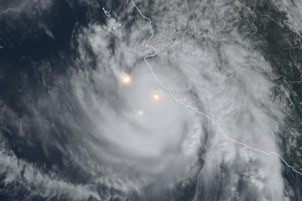
A record for tropical storm and hurricane activity has just been set in the eastern and central Pacific Ocean.
A hurricane near Mexico’s west coast, named Simon, cemented 2026’s place in the record books as the busiest year on record for storm activity in these ocean regions. That’s based on a measure of the cumulative duration of strong winds, surpassing the record set in 2018.
This level of activity has been described as “remarkable” by some meteorologists, and it highlights the power of the ongoing El Niño amid a wider ocean fever in the Pacific.
The western United States and Plains have felt the effects of several of these systems, either as a distant source of tropical moisture or as remnants sweeping across the region, raising the risk of flooding — a pattern expected to continue in the weeks ahead.
So far this season, the supercharged activity has fueled several hurricanes that have ravaged parts of Hawaii even as the close encounters sideswiped the islands.
The record comes on the heels of former Hurricane Rachel, whose remnants lashed the West on Sunday, with big waves crashing into homes in Long Beach, California, and numerous flash floods from San Diego to Las Vegas.
In Las Vegas, 1.08 inches of rain fell on Sunday — more than a quarter of its annual average — tying the daily record for October, according to the National Weather Service there. Some weather stations to the north and west of the city received 2 to 3 inches of rain, with several local reports of swift water rescues, including on the Las Vegas Strip.
Even Death Valley, the driest place in North America, received almost half an inch of rain at its visitor center. Annual average rainfall there is about two inches.
That storm will continue to drive flood risks across Arizona, Nevada and Utah on Monday.
Meanwhile, Hurricane Simon will skirt Mexico’s west coast early this week — and is expected to produce life-threatening flooding in several Mexican states, according to the National Hurricane Center, before some of its moisture becomes tangled in a wider disturbance tracking across the western United States.
That’s expected to contribute to the potential for severe storms from Texas to Missouri starting Tuesday, with that risk continuing through Thursday. That risk includes cities such as Wichita and Kansas City, Missouri.
There’s also a chance for flooding across that zone, particularly in western Texas and possibly New Mexico from Thursday into Friday, when a more direct moisture surge from Simon is expected.
And the Pacific will continue to add to its record-breaking season. The National Hurricane Center is flagging a 90 percent chance for a new tropical storm west of Mexico over the next week.
Several long-range forecast models show this next storm following a similar path across Mexico into Texas and the Plains next week, potentially driving more severe weather and floods.
The relative calm of the Atlantic hurricane season was recently disrupted by Isaias — the basin’s first and only hurricane this season, which made landfall near Destin, Florida, late Friday. The Atlantic will probably remain hurricane-free over the next week.
The post This hurricane season in the Pacific just set a record for activity appeared first on Washington Post.