Daniil Prokofev likes to optimize his time, so earlier this year, the 17-year-old decided to run home from school. Partly through his roughly 8-mile run, he realized he had made a mistake by “naively trusting Google Maps.”
The app led him to a busy road with no sidewalks, he said. It was getting dark and turning around would have added an extra three miles to the run, he said, so Prokofev continued, despite the heavy traffic.
“This was really dangerous,” Prokofev, a senior at Thomas Jefferson High School for Science and Technology in Alexandria, told The Washington Post in an interview.
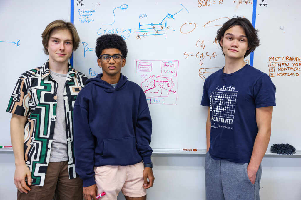
That experience became the inspiration for Prokofev and two of his friends, fellow seniors Isaac Leetyn, 18, and Ashwath Muppa, 17, to develop a program called SafeWalkr, which combines data from Fairfax County records, Google Maps imagery and street databases to map crosswalks, traffic volumes and sidewalk coverage. Their goal was to help Fairfax County students identify speedy and safe walking routes to their schools.
After months of work, SafeWalkr’s pilot program kicked off last week for hundreds of families who live within walking distance of 14 Fairfax County public schools. The launch was the product of “lots of late-night grinds,” Muppa said.
In September, a 13-year-old Fairfax County public school student was killed while riding a bike after being struck by a large truck. Two other students were involved in traffic incidents involving vehicles on the same day.
Prokofev, Leetyn and Muppa said they hope SafeWalkr helps their peers be safer when they walk or bike to school.
“Students should be focused primarily on school. They should be focused on having fun,” Leetyn said. “They shouldn’t be focused on getting struck by a vehicle. They shouldn’t have to worry about that when they walk to school.”
SafeWalkr represents an effort to combat a national problem: Pedestrian fatalities in the United States increased 72 percent between 2009 and 2024, according to the Washington-based nonprofit Smart Growth America. Traffic deaths are also up this year in Fairfax County.
For decades, the country’s transportation system has prioritized making sure cars can travel as fast as possible, at the expense of things that make walking safer, such as sidewalks, crosswalks and good lighting, said Heidi Simon, who co-wrote Smart Growth America’s 2026 report on pedestrian safety.
“The country is still very much in a pedestrian safety crisis, and we are not doing enough to get ourselves out of it,” Simon said. “When you are designing a road for speed, you are not designing a road for safety.”
Later in March, after Prokofev’s run, he, Leetyn and Muppa teamed up for their school’s 24-hour hackathon. Because most map programs are designed for drivers, they decided to make one focused on pedestrians.
“The most important thing, especially in the age of AI, is figuring out the right problem to focus on,” Prokofev said.
After pulling an all-nighter, the team presented their project and won the competition. They spent the next seven months fine-tuning SafeWalkr, using Python, JavaScript and C++ to write an algorithm that takes safety and speed into account.
“We are not re-creating Google Maps,” Prokofev said. “We’re trying to push the bounds of what kind of mapping software exists.”
SafeWalkr has features that other mapping programs don’t have, the students said. Their program tells users which streets have sidewalks, for instance, and it recommends which side of the road to walk on.
Mike Mukai, principal at Thomas Jefferson, said he walked to school while growing up in Virginia. Now he considers the practice to be a “lost art.”
Studies show the proportion of students who walk or bike to school in the United States has dropped significantly over the past few decades. In 1969, about 48 percent of K-8th grade students usually walked or biked to school, according to a report by the National Center for Safe Routes to School. In 2017, just over 10 percent of children walked or biked to school, according to a survey by the Federal Highway Administration.
“School used to be about finding the right answers, and now we have a generation of kids who are trying to find the right problems to fix,” Mukai said.
The timing of SafeWalkr was ideal for Becky Gray, who works on the Fairfax County Public Schools Safe Routes to School team. She said her team had been working to develop a static map of safe walking routes to the county’s schools when Mukai introduced the trio and SafeWalkr to her in the spring.
The three students and Gray worked together to refine SafeWalkr so it could be used by Fairfax County families.
“Some of the time I had to back them up because they were speaking so far over my head,” Gray said. “I’m like, ‘Okay, back it up, talk like regular guys.’”
Because Thomas Jefferson is a magnet school, Prokofev, Muppa and Leetyn all live too far away to walk. But depending on how the pilot program goes, Prokofev said they hope to expand to all 200 schools in Fairfax County — and then to other counties, too. Maybe, Prokofev said, the program could become a platform for anyone to use in their daily life, not just students walking to school.
“I mean,” he said with a smile, “if Google wants to buy us out.”
The post Students created a program to make walking safer — and schools are now using it appeared first on Washington Post.