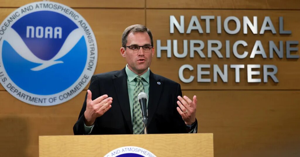
Tucked away inside a one-story concrete building dotted with satellite dishes in Miami is the headquarters of the National Hurricane Center.
During hurricane season, attention turns to the center and its director, Michael Brennan, as fresh forecasts are posted every six hours when a tropical storm or hurricane forms.
The center had been in Coral Gables, Fla., near Miami, but after Hurricane Andrew dealt Miami-Dade County a catastrophic blow in 1992, the office was heavily damaged and a stronger facility was needed.
In 1995, the center was built about 15 miles inland on the Florida International University campus.
Designed as a hurricane shelter, the facility withstood Hurricanes Katrina and Wilma in 2005 and staff members spent two nights there during Hurricane Irma in 2017.
“It’s a concrete bunker,” said Mr. Brennan, who became the director in 2023 and works in tandem with the Central Pacific Hurricane Center in Honolulu to cover the Pacific. “You can kind of get the whole staff in here, and everybody can be safe and we can continue to operate.”
Mr. Brennan, 49, a Virginia native, talked about hurricanes and what keeps him up at night.
The following is an edited and condensed version of that interview, which was conducted before Tropical Storm Isaias formed in the Gulf of Mexico on Wednesday.
What was your earliest interest in weather?
There was a big flood in western Virginia in November 1985. My grandmother lost her home in the flood. It was sort of the flood of record in the Roanoke Valley. I would have been 8 years old when that happened. So that was a pretty memorable moment from my early childhood of just seeing the impact that weather could have on a community and the amount of damage the flood can cause and the human impact of that.
The only exposure you had to meteorology was seeing local broadcast meteorologists. So that was something I was always interested in.
How big is your team?
In terms of hurricane center federal staff, there’s about 45, so the biggest part of that is our operations division and that includes the hurricane specialist unit. Right now, we have about 13 hurricane specialists on staff.
We’ve actually just hired some new staff in Hawaii. So we’ve been kind of combining forces here in Miami and Honolulu to cover that entire area all the way from the international date line into the Eastern Pacific and all the way to the Atlantic.
Do you have enough resources given federal funding cuts?
We have enough staff to cover, to meet all of our operational needs to do what we need to do. And as I did mention, we’ve actually been hiring some new staff here in the last six to nine months as we spin up this operation in Hawaii.
What are some differences between forecasting for the Atlantic and the Pacific?
The Atlantic basin, you can kind of get development all over the place. You can have long-track hurricanes that are storms that form right off the coast of Africa, like we would see at the peak of the hurricane season.
You can have storms form in the Gulf and the Caribbean off the East Coast. And this time of year, you can even have storms form up into the subtropics in the mid-latitudes because the water is very warm across much of the Atlantic basin.
On the Pacific side, most of the formation occurs at very low latitude. In the East Pacific, almost all the systems come from tropical waves that have moved all the way across the Atlantic and across Central America into the Pacific.
But the cold water in the Pacific comes a lot farther south than in the Atlantic, so the hurricane activity in the eastern Pacific, in particular, has a hard time getting much farther north than the Baja California peninsula of Mexico.
The other big thing that’s different is, in the Atlantic, we have a lot more data. We have aircraft reconnaissance we routinely fly into storms in the western half of the Atlantic. There’s a lot more buoy observations and ship observations and land-based stations and places like in the Caribbean or you know, the Lesser Antilles. You have radar.
You have a lot more data to work with in parts of the Atlantic, whereas, particularly in the eastern Pacific, is an area that’s pretty void of a lot of in-situ data.
There’s no land, there’s no islands there. There’s not a lot of radar. There’s very little ship traffic. There’s not a lot of buoys. We can occasionally fly hurricane hunter aircraft into hurricanes threatening the west coast of Mexico, and then also for storms threatening the Hawaiian Islands.
But largely, what we do in the Pacific is still based on your satellite imagery, satellite wind data, a lot of it remotely.
What is your worst-case scenario?
The worst-case scenario that you can think of is a storm that develops and strengthens very quickly near a populated area. I think we saw that in Otis, a couple of years ago in the eastern Pacific, the storm that hit Acapulco.
We went from a tropical depression to a Category 5 hurricane within a very short period of time and, you know, made a catastrophic landfall as a Category 5 storm, in a major metropolitan area.
What’s your outlook for the season?
The Atlantic side, I think it’s behaved a lot like you would expect a season to behave in a strong El Niño event. We’ve had a few short-lived, mostly weak storms in the Atlantic this year. We’ve got a lot of hurricane season left.
So I think my mind sits at the fact that, OK, it’s been a quiet season. We don’t want people to totally let their guard down about the rest of the season because we’ve had, you know, Hurricane Andrew is always the poster child event.
The post The National Hurricane Center’s Boss Keeps an Eye on the Storms appeared first on New York Times.