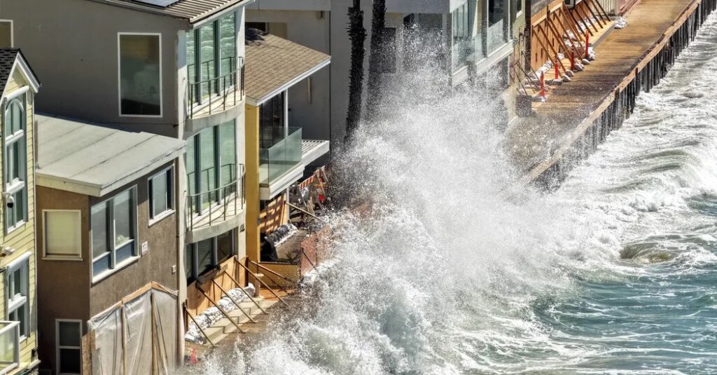
In the coming days, sea levels off Southern California are expected to begin rising by half a foot or more and then stay elevated for months, as an enormous pulse of wave energy generated by El Niño travels up the coast, lifting the water as it goes.
“It’s one of the first, if not the first indication that El Niño is here,” said Dillon Amaya, an assistant professor in the department of marine, earth and atmospheric sciences at North Carolina State University.
This pulse, known as a Kelvin wave, will boost the ocean’s height across an area extending 12 to 18 miles offshore. It is coming on top of several other factors that are raising the seas off California and increasing the threats from coastal flooding, erosion and saltwater intrusion.
Sea levels have already been abnormally high for months because of how warm the Pacific has been. Warm water occupies more volume than cool water does, and that’s one way human-caused climate change is raising the ocean’s height globally.
By unlucky coincidence, the tidal cycle off California will also be peaking in the coming months. And ocean swells are likely to be amped up this fall and winter by El Niño-fueled storms. (Hurricane Polo, one of the most intense hurricanes ever recorded in the eastern Pacific, made landfall on Tuesday in Mexico.)
“For us in California, really what causes overtopping and flooding are when waves arrive at high tide,” said Mark Merrifield, director of the Center for Climate Change Impacts and Adaptation at the Scripps Institution of Oceanography in La Jolla, Calif.
With so many elements stacking on top of one another to increase ocean heights, it’s “highly probable” that California will soon witness its highest sea levels ever recorded, Dr. Merrifield said.
Last week, Gov. Gavin Newsom, a Democrat, declared a state of emergency to prepare the state for El Niño. He directed agencies to position equipment like sandbags and pumps and to help local communities to prepare for coastal floods and landslides. The California National Guard has also been told to prepare for search and rescue efforts.
El Niño, the naturally recurring phenomenon in the Pacific, is starting to deliver a host of weather hazards across the planet, dumping extra rain in some regions and drying out others. This year’s El Niño is predicted to be the strongest on record, meaning its influence on temperatures, rainfall and storms could be especially stark.
For California, the boost to sea levels began nearly half a world away.
Normally, the trade winds blow from east to west over the tropical Pacific, pushing sun-warmed water toward Asia and holding it there. So deep is this bulge of balmy water that the ocean is typically about a meter higher off Indonesia than it is off Ecuador.
But during El Niño conditions, the trade winds are disrupted and weakened. The pileup of warm water in the western Pacific starts spilling eastward, toward the Americas, in what oceanographers call Kelvin waves. The name comes from Lord Kelvin, the 19th-century British physicist who first described such waves. (You might also know his name from the unit of temperature that bears it: the kelvin.)
These aren’t waves like the ones you’d see on a shoreline, cresting and crashing every few seconds. They aren’t tsunamis, either. Think instead of a vast, rolling procession of water, affecting the seas at depths of up to 650 feet.
“It’s thousands of square kilometers of water sloshing back all at once,” said Dr. Amaya, who tracks El Niño’s influence on sea levels. “There’s a lot of potential energy there.”
Bursts of wind can give the water an extra kick. That’s what happened in August: A two- to three-week-long series of stiff westerly winds out in the middle of the Pacific sent a strong Kelvin wave heaving east until it reached Peru and Ecuador around Sept. 1.
Blocked by the land of South America from continuing eastward, the energy in this wave has traveled along the coasts instead, one pulse heading north and another south. Earth’s rotation has kept the pulses pinned up against the shore. The northbound one crawled up the western coasts of Central America and Mexico and is expected to reach San Diego in early October, by Dr. Amaya’s calculations.
Left alone, this pulse would dampen over one to three months as it continued toward Alaska. But, as El Niño gains strength, further bursts of westerly wind could kick up three or four more such pulses that keep the ocean elevated through early next year, Dr. Amaya said.
Besides increasing threats onshore, the pulse of warm water could expose marine ecosystems to greater heat stress. It can also suppress the rise of cold, nutrient-rich water from the ocean depths. With these cold waters limited to smaller areas along the coasts, whales could wander closer to land in search of food, increasing the risk of deadly ship strikes and beaching.
The post A Kelvin Wave Is Heading Toward the California Coast, Bringing Trouble appeared first on New York Times.