Californians can be excused for being confused about the weather forecast.
Scientists in October said La Niña had arrived, which many associate with dry conditions, particularly in the Southland.
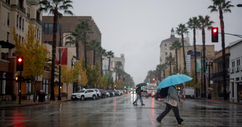
But we have instead experienced a very wet season — at least so far — with rain bringing much-needed moisture to the brush, likely putting an end to the autumn fire season, and helping to keep the state’s reservoirs in good shape.
So what is going on?
It is still true that La Niña tends to correlate with dry water years, which the National Weather Service defines as from Oct. 1 to Sept. 30.
During La Niña, the sea surface temperatures of the central and eastern Pacific Ocean cool. And the jet stream — the west-to-east band of wind in the atmosphere — shifts northward. This typically pushes winter storms toward the Pacific Northwest and Canada, while leaving swaths of California drier than average, especially in the south.
Out of 25 La Niñas since 1954, 15 have brought drier-than-normal conditions to California.
But La Niña “doesn’t always mean drought,” said meteorologist Jan Null, an adjunct professor at San Jose State University.
In fact, out of the seven La Niñas seen over the last 15 years, three were whoppers when it came to rain.
Powerful storms pounded California throughout 2010-11, building a snowpack so epic that ski resorts actually complained.
The 2016-17 La Niña season brought downtown L.A. 134% of its average annual rainfall. It was the second-wettest seasonin terms of statewide precipitation and single-handedly ended California’s punishing five-year drought.
So much rain fell that season that California’s second-largest reservoir, Lake Oroville, spilled over its brim. Mass evacuations were ordered amid fears a key retaining wall could collapse, sending floodwaters rushing into communities below — a tragedy that was ultimately averted.
But in San José, floodwaters did pour out of Coyote Creek and into many homes. The snowpack was so heavy that skiers were sailing down Sierra slopes in bikini tops and underwear in June.
The 2022-23 La Niña season was yet another drought-buster, marking the end of California’s driest three-year period on record.
Even so, Californians who lived through the 1980s and ’90s tend to think in absolutes about La Niña and its better-known counterpart, El Niño — with the former seemingly the “demon diva of drought” and the latter a herald of epic rains and floods.
The truth is La Niña and El Niño are by no means the only predictor of climate patterns going into California’s autumn-and-winter rain-and-snow season.
“El Niño/La Niña predictions are a bit like poker, where you may have a good hand, but when you draw the last card, you don’t get what you’re looking for,” said Marty Ralph, director of the Center for Western Weather and Water Extremes at the Scripps Institution of Oceanography at UC San Diego.
During El Niño, sea surface temperatures rise in the central and eastern Pacific. The jet stream moves south, pointing a potential fire hose of moisture straight at California, especially in the southern section of the state.
“We saw in the ’80s and ’90s really good correspondence between the El Niño/La Niña behaviors in Southern California precipitation anomalies — wet El Niños down here, and dry La Niñas,” Ralph said. “But interestingly, when we switched over to the 21st century, somehow, something changed.”
Some El Niños have been out of character for California, too. The driest water year in downtown Los Angeles’ recorded history, 2006-07, occurred during an El Niño. Then there was the “Godzilla” El Niño ahead of the 2015-16 water year that led to a below-average winter in Southern California and either average or above-average precipitation in Northern California despite its enormous strength in the ocean.
Ralph and his colleagues tried to figure out why certain La Niña and El Niño water years were, as they put it, “heretical” — acting with “radical deviation” to what they would expect.
What they found was that La Niña and El Niño do likely influence certain storms that hit California — but only the typical seasonal variety that originate from Alaska or north of Hawaii, Ralph said.
What La Niña and El Niño don’t affect, however, are “atmospheric rivers,” which can carry tremendous amounts of rain and snow to California from the tropics, Ralph said. The findings were reported in February in the journal Climate Dynamics.
Each atmospheric river can carry a boatload of water. Just four to five would result in an average rainy season for Southern California, Ralph said. Atmospheric rivers fueled the powerful storms that hit California this October and November.
An average atmospheric river transports more than double the flow of the Amazon River, according to the American Meteorological Society.
Atmospheric rivers, on average, account for up to 65% of the annual precipitation in Northern California. But there can be wild swings year to year, with atmospheric rivers contributing anywhere from 5% to 71% of Southern California’s annual precipitation, the report said.
Also meriting further study is whether climate change is upending the old rules of La Niña and El Niño, since atmospheric rivers “are projected to be increasingly greater contributors to total annual precipitation, boosting extreme precipitation and increasing the year-to-year variability of Western hydroclimate in the warming future,” the researchers wrote.
Officials have long warned that continued climate change could whipsaw California between precipitation extremes, with the state trending toward aridity, interspersed with exceptionally wet years.
“La Niña and El Niño are not the only player in the game,” Null said. “I think we need to add an appendix to that playbook. Part of that is climate change-driven. … There’s climate change in the DNA of every weather event that’s going on.”
California has seen unusually wet storms this autumn because of a persistent low-pressure system off the West Coast that stretched farther south than is typical for October and November. That system was able to tap into unusually potent precipitation in the deep tropics and dispatch atmospheric river storms to the state, said Jon Gottschalck, chief of the National Oceanic and Atmospheric Administration Climate Prediction Center’s Operational Prediction Branch.
Santa Barbara Airport has so far recorded its wettest start to the water year with 9.91 inches of rain, blowing past the previous record of 7 inches, according to the National Weather Service office in Oxnard.
Since Oct. 1, UCLA has netted 8.75 inches and downtown Los Angeles 6.94 inches — about half their average yearly totals.
Even famously and formidably dry Death Valley National Park saw its wettest November on record, recording 1.76 inches of rain, surpassing the previous high-water mark of 1.7 inches in 1923, according to Chris Outler, a meteorologist with the National Weather Service office in Las Vegas.
Las Vegas recorded its second-wettest September-October-November period this year, with 2.91 inches of rain.
The rainfall across Southern California was relatively heavy for this time of year, enough to dramatically tamp down wildfire risk, but not so heavy as to cause catastrophic landslides.
“It’s sort of a Goldilocks AR,” Ralph said.
But what hasn’t been ideal is how warm California has been. Ski resorts have been lamenting how the recent storms haven’t produced much snow. A healthy snowpack is key to California’s annual water supply, building up a seasonal icy reservoir in the mountains that no man-made lakes could ever hope to match.
The same low-pressure system off the coast that helped fuel recent atmospheric rivers is also pushing in air from areas to California’s west and southwest. That’s warmer than when air plunges into California from Alaska or Canada.
As a result, November’s temperatures have been “incredibly above normal” across the entire West, Gottschalck said. “There has been precipitation in Northern California … but it’s been too warm,” he said.
The early wet start to California’s rain-and-snow season also doesn’t necessarily mean “it’s going to be wet through the whole winter,” Gottschalck said. “It doesn’t work that way.”
Just look at the 2021-22 season — a La Niña. October 2021 was the fourth-wettest October in California history, courtesy of a Category 5 atmospheric river, the most destructive. But the following January-through-April was the driest such period on record in California. By April 2022, California’s snowpack was only 38% of its typical average.
There are no major rain or snowstorms in the forecast throughout early December in California as of now.
“Recent history has shown us that anything can happen during a California winter,” said Karla Nemeth, director of the California Department of Water Resources.
The post ‘A bit like poker,’ California’s wet winter brings La Niña/El Niño confusion appeared first on Los Angeles Times.