Katherine Dunn is the author of “Little Blue Dot: How GPS Shaped the Modern World” (Bloomsbury), from which this article is adapted.
Shortly after the burst of the dot-com bubble in 2000, a new type of Silicon Valley start-up began to crop up: companies specializing in GPS chips. At the time, GPS — the Global Positioning System, a constellation of satellites that provide location and time to receivers on Earth, courtesy of the American taxpayer — was still relatively niche for everyday people.
This small handful of companies was founded on the basis of two gambles. One was that, like any other chip, GPS chips — at the time, about the size of a postage stamp — would continue to get smaller and more powerful. The other was that GPS could fulfill a recent — and technically challenging — government order: make mobile phones trackable when calling emergency services.
Landlines were already trackable. Every landline phone number in the United States was linked to a database of addresses, which enabled dispatchers to know where to send ambulances or other emergency vehicles if an emergency caller hung up or didn’t know where they were.
Mobile phones available at the time didn’t have this capability, and by 1999 the Federal Communications Commission had issued a diktat: By 2001, mobile phones had to transmit a location when they called 911.
In the late 1990s the most obvious way to locate a mobile phone was to use triangulation from mobile phone masts, using the timing of the phone signals. But because the signals are traveling across the ground — rather than beamed down unobstructed from space — they can encounter all kinds of obstacles en route, making their location less accurate.
The runner-up method was GPS. Although this was more accurate — besides sending signals from orbit, GPS satellites also contain highly accurate atomic clocks — it posed other problems. Despite the fact that GPS chips had shrunk dramatically in recent years and could theoretically fit in a mobile phone, a chip still would quickly drain a phone’s battery.
The signal also had an annoying tendency to be unreliable both inside buildings and around skyscrapers. As the signals descended from space, they would bounce back and forth against buildings like a ping-pong ball on their way to the receiver, delaying the timing of their arrival and misidentifying the receiver’s location. (This phenomenon, called the “urban canyon effect,” remains an issue today.)
Still, these seemed like problems that competitive Silicon Valley engineers could solve, and there was a powerful financial incentive to do so. If every mobile phone needed to include a GPS chip by order of the American government, even if it was only used when someone called the emergency services, that was still an enormous market for chips.
Another problem, however, was selective availability. Selective availability was a policy of the U.S. government, for the sake of national security, to artificially degrade the accuracy of the civilian GPS signal. But in May 2000, President Bill Clinton ended the policy, arguing that this would help civilians and accelerate the system’s use by businesses. The decision gave the nascent GPS chip industry an enormous boost.
The most visible winners from the ending of selective availability were arguably the companies creating compact, affordable satellite navigation devices for cars: companies like Kansas City-based Garmin and later TomTom, based in the Netherlands. In 2007, Garmin, the market leader, had a market cap of nearly $26 billion, while TomTom, the European leader, had a market cap equivalent to almost $11 billion (about $42 billion and $18 billion today).
As Taiwanese manufacturers scrambled to fabricate GPS chips in the early and mid-2000s and satnav companies rushed to install them in their receivers, a GPS chip start-up in Silicon Valley called Global Locate was finessing another technical challenge. Making mobile phones trackable when they called 911 was one thing. But an engineer at Global Locate named Frank van Diggelen wondered: What if GPS chips in mobile phones could be useful outside of emergencies, for directions, in the same way as TomTom receivers in cars? This was a great idea in theory. But the chips were still too slow, and too power-hungry, to be much use as an everyday tool.
There was another concern, one based on human impatience: If it took too long for a receiver to “lock on” to GPS and determine its location — which was highly likely, since the GPS antenna in a phone is tiny, the signal is weak and the user is often inside a building — people tended to just give up. Van Diggelen figured he had about a couple of seconds to make a human stay.
The system van Diggelen and his colleagues designed to address both needs — mobile phone traceability and navigation — is called “assisted GPS.” To find its location, a phone’s chip first jumps back to the location of a landmark it most recently interacted with: a mobile phone mast, for example, or a WiFi hotspot. The chip then cross-references the longitude and latitude of that location with the so-called ephemeris data, the guide produced by the U.S. government on where all the GPS satellites are expected to be and when.
This head start meant the chip in the phone already knows where to look. Instead of going “wide” to scan the sky for the satellites, van Diggelen told me, it can “go deep,” homing in on where the satellite is expected to be so the tiny antenna in the phone can pick up its whisper and magnify it to more than a hundred times its usual strength, all while minimizing the impact on data and battery life.
A mobile phone could theoretically lock on to the GPS signal within milliseconds. And because the U.S. had turned off selective availability, van Diggelen and his colleagues realized that Global Locate could produce its own ephemeris data for days into the future, so a mobile phone wouldn’t be reliant on constant connectivity. This is why, if you open Google Maps on your phone right after you arrive in a new location, you can see your general location (usually on a mostly blank map) before you have local data coverage.
These are the first two pillars of assisted GPS: first, knowing where to look for the signal in advance, and second, having ephemeris data that is valid for a week into the future.
The third and most profound pillar deals with time. The ephemeris data tells you where a satellite is at a specific time, but usually this process takes around six seconds. As you’ll know if you’ve opened Google Maps looking for your location, the blue dot usually appears in only a second or two — six seconds would probably feel like an eternity.
This quick response is because van Diggelen realized it was possible to work out the time much faster by adding the motion of the GPS satellites into the GPS calculations. GPS uses four satellites to solve four unknown variables: the longitude, the latitude, the altitude and the receiver’s clock offset. Assisted GPS adds one more satellite and does a fifth equation that further refines the timing calculation. Counterintuitively, this helps the receiver calculate your position much faster, within one or two seconds.
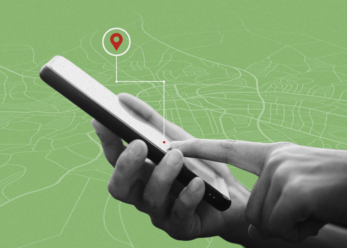
The late-2000s convergence of smartphones, tinier chips and this access to ultrafast, ultra-accurate GPS represents a feat of consumer tech perfection that is now so ubiquitous it’s easy to forget how revolutionary it once felt. It was the first time that many people saw their own location — via the intermediary of a block of glass, metal and computer chips, and thanks to U.S. government satellites and Silicon Valley — reflected back at them so clearly.
Sitting at the center of a touch screen as if they were at the center of the world, with streets and fields and mountains arrayed in neat, artificial colors around them, they looked different, too: like a little blue dot.
The post This little blue dot on your phone is a revolutionary invention appeared first on Washington Post.