Tropical Storm Arthur dissipated almost as quickly as it formed on Wednesday, but meteorologists’ concerns about it will linger much longer as flooding rains that began on Sunday will spread across the Gulf Coast for the rest of this week.
Forecasters at the Weather Prediction Center issued a very rare high risk for flooding rain for portions of Louisiana, Mississippi, Alabama and Florida.
Some of the deadliest and most destructive floods over the last decade have occurred in areas that forecasters said were at this rare level of risk. Even areas that don’t usually flood might — in this case in populated places like Biloxi and Hattiesburg in Mississippi, Mobile Ala., and Pensacola, Fla.
Both New Orleans and Atlanta were also facing excessive rain.
As the remnants of the storm moves northeast out of eastern Texas and through the Southeast, the counterclockwise wind flow around its center will continue to draw in what they call a “fetch of moisture” from the Gulf of Mexico. Once it drops over land as heavy rain, this moisture will lead to potentially life-threatening flash flooding through Friday, said Richard Bonn, a meteorologist with the Weather Prediction Center.
The area had already been hard hit with heavy rain in recent days, so larger rivers are already flooding, and soil is nearly saturated, so the new rain is expected to convert to runoff, resulting in more significant river, stream, and creek rises though Thursday morning, meteorologists said.
The weather models forecasters use are suggesting that rainfall totals in many areas of the highest risk area could exceed a foot — and some places could see closer to 20 inches.
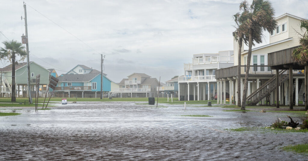
For Texas, Wednesday was the end of this storm. Even as the center moved near Houston, the worst conditions were still well out over the Gulf of Mexico. That was also what was concerning meteorologists: This area of more intense storms was moving along the coast that has now moved ashore into the Southeast.
These storms have also prompted flash flooding warnings already Thursday morning but also multiple tornado warnings. This area is also at least at some risk for the storms to produce quick spin up tornadoes or in some cases water spouts if a circulation forms over water.
There is even a possibility that Arthur will reorganize enough to re-form off the East Coast later in the week, but forecasters are still uncertain whether it will — and what form it will take if it does.
The post Forecasters Issue Rare Warning for Heavy Rain Across the Southeast appeared first on New York Times.