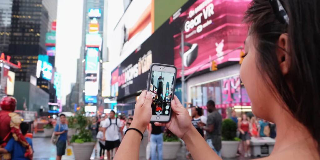
Pikachus at every street corner. Leveling up before getting into the gym. “Pokémon Go to the polls.” You remember this era well: Pokémon Go became a frenzy, with hundreds of millions taking to the streets for their chance to snap up the rare Azelf or special edition Charizard. Now, not only does it seem that Pokémon Go took the world by storm, but it also was using crowdsourced data to map it.
Over the past decade, Pokémon Go players voluntarily submitted photos and short videos of public landmarks, street corners, storefronts, and urban intersections—all coming together to create a dataset that now stands at 30 billion images captured at ground level, across nearly every major city on the planet. Niantic Spatial, the enterprise AI and mapping division spun from Niantic Inc., has spent years converting that trove into something the robotics industry has never seen before: a photorealistic, street-level, continuously updated model of the physical world, built specifically for robots.
That model is now being deployed to navigate Coco Robotics’ roughly 1,000 delivery bot fleet operating in cities across the country and around the world, including Los Angeles, Chicago, Miami, Jersey City, and Helsinki, logging millions of miles of deliveries to date. Brian McClendon, Niantic Spatial’s chief technology officer and one of the original creators of Google Earth, explains the data strategy plainly.
“We look at the player data as very high-quality ground training data for other lower-quality datasets,” McClendon told Fortune in a statement. “The long-term philosophy of Niantic Spatial is that we can solve these hard problems of localization, reconstruction, and semantics by using very concentrated places to train models and then use much more broadly available data at lower resolution to be able to localize, visualize, and understand from ‘bad’ data.”
The 30 billion Pokémon Go images aren’t just a map: They are a master key that unlocks the potential of how to create a real-world, real-time map. The player scans teach the model what precision looks like—it’s so precise, in fact, that it can even signal when the input is imperfect. It’s a strategy that positions Niantic Spatial less as a gaming company that pivoted and more as the most ambitious mapping operation ever assembled—one that was funded entirely by its own users’ enthusiasm for catching digital creatures.
Niantic Spatial’s Visual Positioning System, or VPS, solves a problem that has quietly stunted the autonomous delivery industry. GPS, the backbone of most navigation systems, doesn’t fare that well in dense urban environments, where tall buildings interfere with satellite signals. For a delivery robot that needs to drop food at a precise doorstep, being several feet off means unhappy customers complaining their burger is cold—or in their neighbor’s tummy. Instead, the VPS bypasses satellites entirely, comparing live camera feeds from the robot against its vast image database to determine position in real time.
“The model will work in real time, taking in images from the robot and comparing them to both publicly available as well as proprietary datasets we’ve collected to determine the robot’s global position and heading,” a Niantic Spatial spokesperson told Fortune in a statement. The company knew where this tech performs best: “Niantic Spatial’s VPS is particularly resilient in urban canyons where GPS performs badly.”
“Our initial VPS was built using scans that users choose to take in games—but no single source defines the model,” the Niantic Spatial spokesperson said. Player participation was always opt-in: users had to actively choose to submit a short video scan of a specific public landmark. Today, the model increasingly learns from the data Niantic Spatial’s enterprise customers generate themselves. The underlying engine—a large geospatial model, or LGM, trained on billions of posed images and hundreds of millions of real-world scans—powers three capabilities: reconstructing spaces as navigable 3D models, localizing machines within those spaces, and understanding environments semantically. As CEO John Hanke wrote in a recent blog post: “For the past several years, we’ve been building a large geospatial model that acts as a living, breathing map of the world, one that is native to robots and AI.”
For Coco CEO Zach Rash, the problem is with robots’ critical thinking skills (or lack thereof).
“Robots don’t have the same intuition yet as a human, where a human can understand, ‘My GPS isn’t really working, but I understand that’s probably the right place to go,’” Rash told Fortune. “We need the robot to have that sort of intuition.”
“When we go into really dense areas with high rises, that’s where the VPS solution can be really helpful,” Rash said. “Our GPS and our existing solutions might fail in that sort of environment.”
The stakes, he noted, are felt by customers at the very last moment of a delivery: “It is a terrible customer experience if the robot parks in the wrong place waiting to receive that order.”
“It’s very early with [Niantic Spatial], and I think we’re excited to collaborate with such an incredible team on figuring out how we add this toward existing technology to make the service better. VPS is an obvious one,” Rash continued. “They’re very good at doing this. If I can more precisely figure out where to drop off food, my customers will be happy.”
The post Pokémon Go players built a 30-billion-photo map that’s now training robots to deliver your pizza appeared first on Fortune.