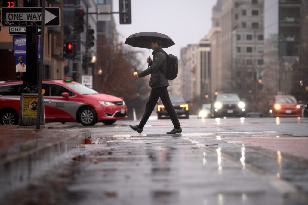
The D.C. area faced one of the most ominous thunderstorm forecasts in years. Violent wind gusts of 60 to 80 mph could topple trees and power lines. Tornadoes — possibly strong ones — were on the table.
In response, schools dismissed early and many businesses and government offices closed by midafternoon.
But much of the feared severe weather failed to materialize. The most widespread storms held off until after dark, and the anticipated tornado threat never developed.
Now some people are asking whether meteorologists got it wrong — and whether an apology is owed.
We believe the forecasts communicated the risks responsibly based on the information available at the time. But the experience also highlights something important: Even the best severe weather forecasts carry uncertainty, and we could have done a better job emphasizing that uncertainty.
Why the concern was justified
The available data on Sunday pointed toward a potentially dangerous setup.
The National Weather Service’s Storm Prediction Center placed the D.C. area in a Level 4 out of 5 severe storm risk — a designation reserved for days when widespread, dangerous storms are considered likely. It was the first time the region had received this risk level in more than two years.
When forecasters see a setup like that, the responsible course is to communicate the threat clearly and encourage preparedness. Had we downplayed the risk and severe storms had materialized, the consequences could have been worse.
Public forecasters rely heavily on the Storm Prediction Center’s outlooks, which are produced by some of the best severe-weather meteorologists in the world using state-of-the-art tools. That doesn’t mean the outlooks are perfect. Thunderstorms remain among the most difficult weather events to forecast.
Sometimes all the ingredients for severe storms appear to be present, yet the storms never fully develop.
Uncertainty was always part of the forecast
We did attempt to communicate that possibility.
On Saturday we wrote:
“As is often the case with potential thunderstorm events, exactly how widespread severe storms are and the places that will get hit hardest are difficult to pinpoint. There’s some possibility the storms don’t reach their potential if clouds and cool air linger on Monday, reducing available energy.”
And on Sunday:
“Even when many atmospheric ingredients are in place, it doesn’t always produce a widespread outbreak of severe weather in our region.”
In hindsight, we should have emphasized that uncertainty more consistently across all updates. Severe storms were possible — but they were never guaranteed.
At the same time, it’s difficult to know how much difference that would have made once the Level 4 risk began circulating widely on social media.
The challenge schools face
In recent years, many school systems have trended toward calling snow delays and cancellations the day before an expected storm. In a similar fashion, several districts in the region announced early dismissals on Sunday ahead of Monday’s severe weather threat.
But severe thunderstorms are often far harder to time and pinpoint than snowstorms. The exact arrival and coverage of storms can remain uncertain until the day of the event. That means decisions made too far in advance can backfire. In some cases, storms may arrive sooner than expected, raising the possibility of students being dismissed during the worst of the weather.
Forecasting always involves learning
Every major weather event becomes a learning opportunity.
After a poorly performing snow forecast in March 2013 — when we predicted 5 to 10 inches but little accumulated — we introduced “boom” and “bust” snowfall ranges to better communicate uncertainty in winter storm forecasts.
Monday’s storm setup highlights the need for similar tools when discussing severe thunderstorm threats.
The science behind the flawed forecast
Our team believes several factors limited the storm intensity Monday.
1. Limited storm fuel. Severe storms rely on buoyant energy generated by warm, humid air. Thick cloud cover persisted most of the day, limiting surface warming. Without those clouds, temperatures likely would have reached the 70s, creating a much more unstable atmosphere.
2. Early storms used up available energy. Multiple waves of storms moved through the region. The first line, which arrived late in the morning, consumed much of the limited atmospheric energy. Later storms — expected to be the main event — had less fuel available.
In essence, the first round of storms “stole the second round’s thunder.”
3. Conditions were unfavorable for strong downdrafts. While wind shear was strong enough to support rotating storms, the lowest 10,000 feet of the atmosphere were unusually moist, according to the morning weather balloon launch from Sterling, Virginia.
The most intense damaging winds typically form when rain falls through a layer of dry air beneath the storm, cooling the air and causing it to plunge downward. That process was limited Monday, reducing the likelihood of powerful downbursts reaching the surface.
What happened in the end
Ironically, the most widespread impact came later in the evening.
A narrow line of storms formed along the cold front and swept across the region with a “wall of wind” between 8 and 11 p.m. Gusts exceeded 45 mph in many areas, and Reagan National Airport recorded a 68-mph gust — the third strongest there in the past 30 years.
Several thousand power outages were reported across the region, along with scattered tree damage.
That cold front wind surge was the one aspect of the event that both forecast models and forecasters consistently predicted.
The post How the storm forecast that scared D.C. fell short appeared first on Washington Post.