A powerful Nor’easter was pummeling the Northeast on Monday, and was expected to create blizzard conditions across much of the region as it made its way up the coast.
Forecasters said that some areas were likely to see two feet or more of snow, creating dangerous or impossible travel, as well as power outages.
Early Monday, Marc Chenard, a meteorologist at the Weather Prediction Center, said “the worst of it” was unfolding during the morning commute over most areas between New York City and Boston. Blizzard warnings remained in effect from Delaware to southern Maine, where winds gusts of up to 75 miles per hour were forecast through Tuesday morning.
Mr. Chenard said conditions in New York City could expect to improve by late Monday morning.
Conditions were expected to improve first around Philadelphia and in portions of New Jersey, where snowfall totals had already exceeded two feet by Monday morning in Freehold. In Morrisville, Pa., outside Philadelphia, 21 inches had fallen as of 8 a.m.
Farther north and east, however, the storm was intensifying. Mr. Chenard said it was beginning to “ramp up” across Long Island, Connecticut, Rhode Island and southern Massachusetts, with snow falling at about three inches per hour.
“Boston will be the last one to clear,” he said. “And that likely won’t happen till later this afternoon there.”
The combination of intense snowfall and powerful winds is expected to create blizzard conditions throughout Monday. Bryan Ramsey, a meteorologist at the New York office of the National Weather Service, said official blizzard criteria — wind gusts over 35 miles per hour for at least three hours, along with visibility below a quarter of a mile — had already been met on Monday morning at both Newark Liberty International and Teterboro Airports.
Additional areas were likely to meet those conditions as the storm continued, with the greatest risk, he said, stretching from Long Island into parts of Connecticut, Rhode Island and Massachusetts.
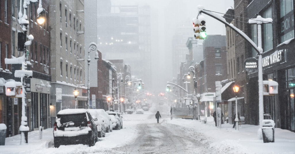
In New York City, 15.1 inches had been recorded in Central Park, the city’s official climate site, as of 7 a.m. Mr. Ramsey said those totals were expected to rise significantly through the morning. If snowfall in Central Park exceeds 20.9 inches, the storm could rank among the top five snowfalls in the city’s recorded history. The record for Central Park is 27.5 inches, set in January 2016.
Winds were also expected to remain strong, particularly along the coast, with gusts as high as 70 m.p.h. Mr. Chenard said Nantucket and Cape Cod had already recorded gusts above 60 m.p.h. early Monday.
Coastal flooding remained another significant hazard on Monday. Mr. Chenard said minor flooding was already affecting areas from southeastern Virginia to New Jersey.
Although the storm was expected to remain intense through much of Monday, Mr. Chenard said conditions would gradually improve later in the day.
“We’ll probably see some tapering into light snow by midafternoon,” he said, “then it’s pretty much exited by later tonight.”
Nazaneen Ghaffar is a Times reporter on the Weather team.
The post Winter Storm Remains Intense as It Blasts Region With Snow appeared first on New York Times.