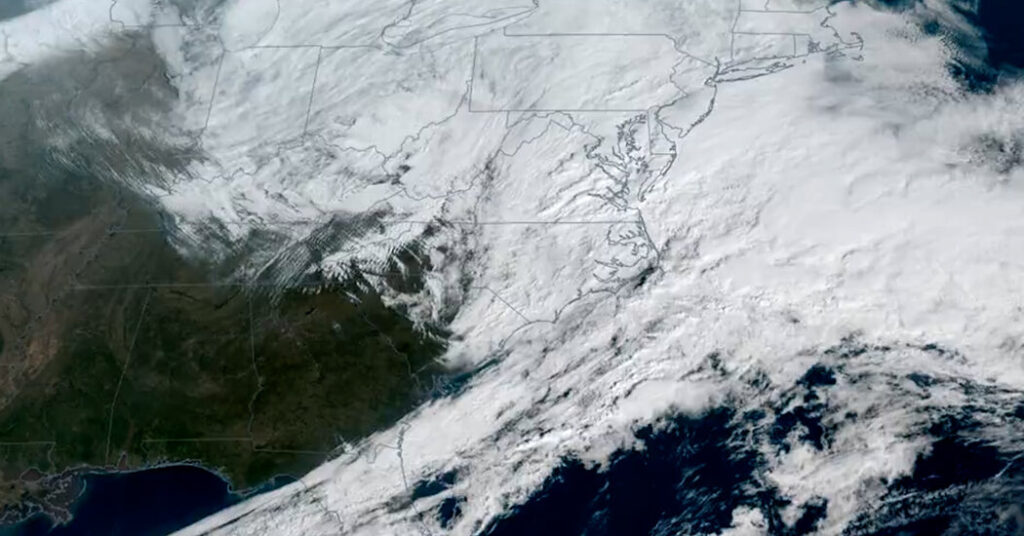
The storm heading for the Northeast United States could be seen from space this morning as it began to take on a comma-shaped cloud pattern, with the storm’s center just off the coast of the Carolinas.
Warm, moist air was pushing north and west around the right side of the storm; the cold-air boundary had a long tail stretching down through Florida and across the Gulf of Mexico.
Very cold air and strong winds were pushing south and west, to the left of the storm’s center, behind the cold front across the northern plains and the Midwest.
As the storm rapidly strengthens, it will move along the coast, forcing more moisture and strong winds onto the shore from the northeast (hence the name “nor’easter”), where they will collide with the freezing cold air that will eventually wrap around the low.
This is why the Northeast will see a rapid increase in snowfall rates later on Sunday and overnight. Bands of heavier snow will fall within the comma head of the storm, largely to the north and west of the center.
Judson Jones is a meteorologist and reporter for The Times who forecasts and covers extreme weather.
The post See the Storm Take Shape From Space appeared first on New York Times.