A brewing winter storm came into sharper focus on Friday, when forecasters became more certain that the Mid-Atlantic and Northeast could see significant snow this weekend.
As recently as Friday morning, forecasters had been fairly confident that at least some snow would fall. By the afternoon, said Cody Snell, a meteorologist with the Weather Prediction Center, the models that forecasters rely on to help fine-tune their work abruptly shifted to a far snowier outlook.
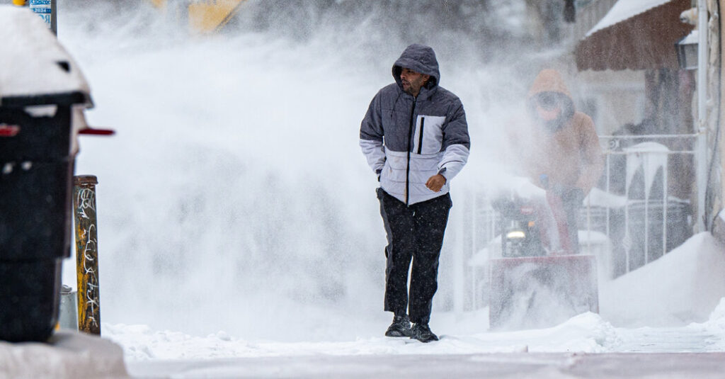
Emergency officials from Washington, D.C., to Boston were preparing for yet another storm in this winter without apparent end that could bring up over a foot of snow at its worst, along with strong whipping winds and potential coastal flooding.
The storm is expected to take shape overnight Saturday, with snow picking up through the day Sunday and lasting through Monday.
Mr. Snell said that between Boston and Philadelphia, there was a more than 50 percent probability of at least six inches of snow.
In and around New York City, Bill Goodman, a meteorologist with the National Weather Service, said his office was expecting between six to 12 inches, “and that could be conservative based on some of the latest stuff coming in.” He said those totals were likely to “stay steady or go up” as the forecast firmed up on Saturday.
Key Things to Know
-
The Saturday pivot: The storm’s path could still shift, which would change the amount of snow different locations would receive. Forecasters won’t have a firm grasp on the precise path until the storm system actually organizes off the coast on Saturday, or even early Sunday morning.
-
Wind and waves: This isn’t just a snow story. The storm could bring widespread and potentially damaging winds and coastal flooding, and even possible blizzard conditions in areas with the most snow and wind.
-
The strengthening factor: Meteorologists are watching the potential paths of two distinct energy systems high in the atmosphere; if they align perfectly near the coast, the storm will most likely strengthen rapidly, something forecasters said was more likely to occur based on the latest guidance Friday.
This forecast had once been what meteorologists call an outlier scenario. They knew a storm system forming off the Mid-Atlantic coast would most likely intensify rapidly on Sunday, but were uncertain if it would remain close enough to the major East Coast cities to bring measurable snow.
Now, they are preparing for blizzard conditions.
Mr. Snell called the storm a “a longer duration event,” with potentially 18 to 24 hours of snowfall. Wherever the worst bands of snow settle is where the highest snow totals might be.
Other factors in the overall totals are just how much warm air moves in with the storm, and when. Somewhere like Washington, D.C., could see a wintry mix or freezing rain before snow begins to fall, which would reduce the total snowfall by the end of the storm and make for slippery conditions on roads and sidewalks.
This snow will be a wet, heavy snow. It’s the kind that makes for better snowballs and snowmen, but it also can stick to trees and power lines, weighing them down and leading to outages. It also can be incredibly heavy to shovel.
Judson Jones is a meteorologist and reporter for The Times who forecasts and covers extreme weather.
The post Weekend Snowstorm Suddenly Looks More Serious for the Northeast appeared first on New York Times.