The scientists on the icebreaker Araon have traveled a long way to study Antarctica’s fast-shrinking Thwaites Glacier. But one team on the ship is conducting research with an eye toward someplace even farther from civilization — 1.8 billion miles farther.
For more than six hours on Friday, one of the Araon’s helicopters flew over Thwaites with three long radar antennas jutting from its belly. As the chopper battled strong winds, the radar peered into the cracked and wounded insides of the ice, which has been damaged from sliding so quickly out to sea.
These radar soundings will shed light on how the glacier is moving and breaking apart, and contributing to rising sea levels worldwide. They will also help scientists understand another ice-covered place: Europa, a moon of Jupiter that may support life.
In 2030, a NASA spacecraft is scheduled to reach Jupiter and then fly past Europa roughly 50 times over four years. Mounted on its solar arrays are radar antennas, which will scan the crevasses in Europa’s icy shell to understand whether they might play a role in making the moon habitable.
These cracks fascinate scientists because they might connect Europa’s frozen outer layer with the ocean beneath it. Radiation from Jupiter is constantly bombarding the moon’s icy surface, producing oxygen-bearing compounds known as oxidants. If those oxidants were to mix with chemicals in the ocean below, the resulting reactions could theoretically produce energy needed for life. For that to happen, though, the oxidants would need to somehow travel down through miles of ice to reach the salty water.
One way they might travel is through networks of large fractures, which is why scientists are studying the fractures at Thwaites first.
If scientists can better understand what radar echoes reveal about damaged ice on Earth, that should help them interpret the scans that will be beamed back from NASA’s Europa Clipper mission in the 2030s, said Chris Pierce, a glaciologist at Montana State University and lead scientist for the radar project at Thwaites.
In a region of Europa called Thera Macula, broken-up icebergs form features that scientists call chaos terrains. “If you look at satellite imagery of the western shelf of Thwaites, it’s pretty much the same,” Dr. Pierce said.
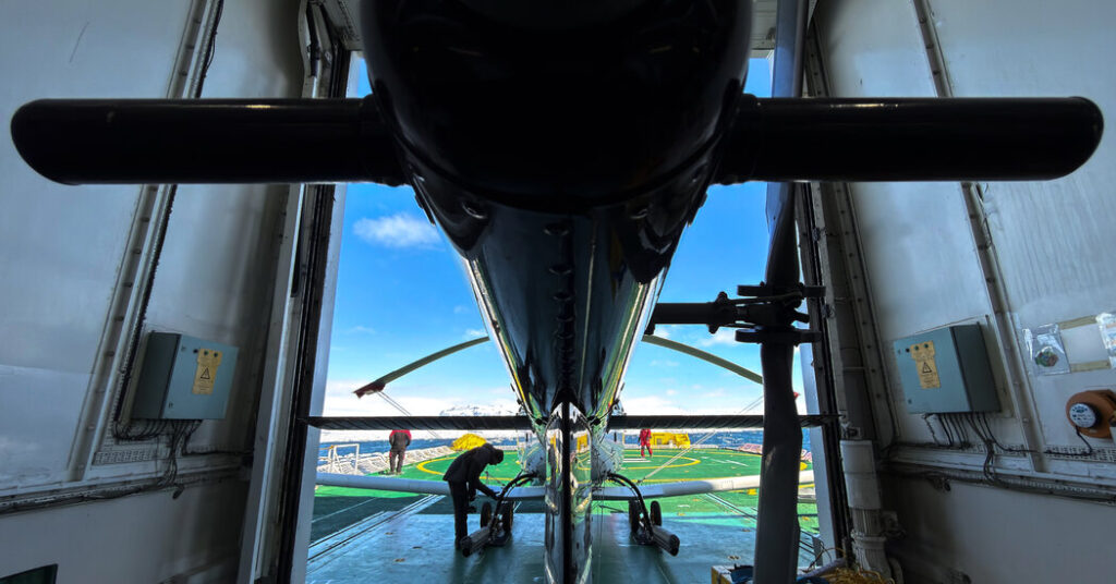
On Friday, Dan Adams, one of the pilots for the Thwaites expedition, flew the helicopter in long straight lines according to a flight plan that Dr. Pierce had drawn up. Dillon Buhl, an electrical engineer at the University of Texas Institute for Geophysics, sat in the back seat, monitoring a rack of equipment that was bristling with cables.
To scan the glacier most effectively, the radar must be flown over the ice at an even speed (60 knots, or 69 miles per hour) and altitude (1,640 feet, or 500 meters), with minimal rolling or pitching.
Keeping the helicopter on the flight path could be tough when the wind was gusting, Mr. Adams said. Otherwise, “it’s actually reasonably relaxing flying,” he said.
After the long flight, Mr. Buhl handed off the radar data to two colleagues aboard the ship, Jesse Houghton, a senior project manager for Europa Clipper’s radar at the University of Texas Institute for Geophysics, and Jason Bott, a student at the University of Texas at Austin.
The team worked late into the night, processing the data and turning the radar reflections into ghostly black-and-white images, each one showing a miles-long slice of Thwaites’s injured interior.
In the images, the glacier appeared to be streaked with fine, tree-ring-like layers, indicating the many thousands of winters over which the ice was built up by fallen snow. In general, these layers followed the contours of the bedrock underneath. In some places, though, the layers were out of sync. Something might be affecting the glacier’s base in those areas, Dr. Pierce said, potentially geothermal energy melting it from below.
The meltwater from such hot spots, and from the friction of the immense glacier sliding across craggy bedrock, can gather in channels and lakes beneath the ice. These bodies of water effectively make the bedrock slippery, allowing the glacier to move across it more easily. They also can release their water into the ocean in huge plumes, influencing where and how quickly the glacier’s floating ice melts.
As the ice of Thwaites’s core moves from land to sea, it speeds up considerably, causing it to fracture and split. From above, this transition is stark: Riding in a helicopter, you can see the glacier’s unblemished white plain give way to a wasteland of mottled alabaster cliffs and canyons. And once the ice is sitting on the ocean, water can start eating away at the cracks on its underside, deepening them.
In the radar pictures, these rifts and crevasses showed up as shimmery parabolas, though the round shape was an artifact from the scanning process. In reality, the cracks are pointy.
“Huge crevasse right there,” Mr. Bott said, pointing to an especially rotund parabola in one image.
“Yeah, there’s some monsters in here,” Dr. Pierce said.
All in all, Friday’s flight was a success. Mr. Adams and Mr. Buhl flew the radar a total of 310 miles over Thwaites, scanning the ice farther up the glacier than the group had ever managed to go by helicopter. (This is the fifth expedition in the past decade in which members of the group have scanned Thwaites by helicopter.)
Dr. Pierce and his colleagues have big goals for using radar to unlock deeper secrets about the ice’s structure and behavior, both in Antarctica and on Europa. At Thwaites, however, it’s the uncaring polar weather that ultimately decides how often and where the radar equipment can be taken into the skies.
Asked where else he might like to scan before our ship departs Antarctica next month, Dr. Pierce said: “There’s just a long list. So it really just comes down to, every day, where are we allowed to operate in? And what does that allow us to get done?”
Raymond Zhong reports on climate and environmental issues for The Times.
The post Scanning Ice for Monster Cracks, on This World and Another appeared first on New York Times.