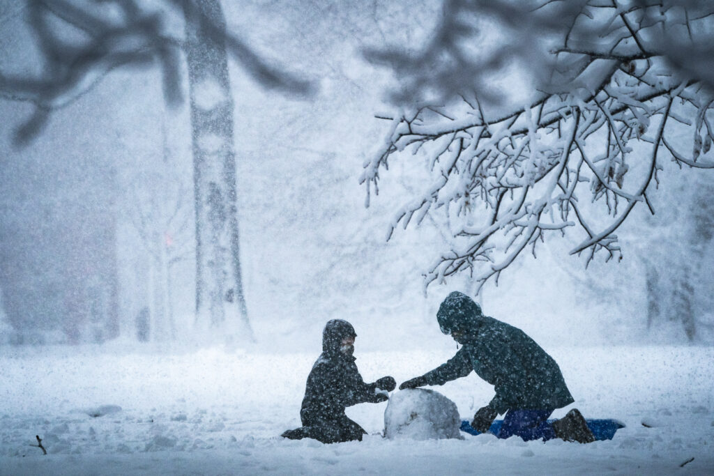
Frigid Arctic air has descended on the D.C. area, and now the region awaits one of the most severe winter storms it has faced in years. The storm, poised to produce a thick, cement-like combination of snow and ice into Sunday night, will be followed by a historically long cold spell that could extend beyond Groundhog Day.
The hazardous mix of frozen precipitation is expected to cause major disruptions to airports, businesses and travel from Sunday into next week. With historically cold weather following the storm, the region will take longer than normal to recover. Hard-to-reach neighborhood roads could remain snow- and ice-packed for days, forcing extended school closures.
The National Weather Service says the combination of snow, ice and cold present “a unique and significant risk to life and property” across the region.
A winter storm warning takes effect at 11 tonight, when snow will streak into the area and pile up quickly. Heavy snow will gradually flip to sleet Sunday morning, with most of the region expected to receive at least 5 inches. In areas southeast of D.C. toward Southern Maryland, the sleet may turn to freezing rain Sunday afternoon and evening, adding a perilous glaze atop the snow. As ice coats trees and power lines, “power outages and tree damage are likely,” the Weather Service cautions.
The most intense snow and sleet is expected between predawn and midday Sunday. Snowfall rates could reach 1 to 2 inches per hour, reducing visibility to below a half mile at times. “Travel could be nearly impossible,” the Weather Service warns.
The warning extends until 4 a.m. Monday as the storm pulls away. Virginia, Maryland and D.C. have all declared states of emergency.
Storm timeline
Here’s an approximate timeline for the evolution of this storm (lowest temperatures in northwest areas, higher temperatures in southeast areas):
10 p.m. tonight to 1 a.m. Sunday: Light snow develops from southwest to northeast. A coating possible, especially southwest of D.C. Temperatures: 16 to 20.
1 to 4 a.m. Sunday: Snow increases in coverage and intensity from southwest to northeast. Accumulation begins immediately once snow is steady. Temperatures: 15 to 19.
4 to 10 a.m. Sunday: Snow, heavy at times (expected rates up to 1 to 2 inches per hour), gradually mixes with and changes to sleet from south to north. Temperatures: 15 to 20.
10 a.m. to 4 p.m. Sunday: Sleet, heavy at times; some snow lingers in far northwest areas. Sleet probably changes to freezing rain south and east of Beltway by late afternoon. Temperatures: 19 to 25.
4 to 10 p.m. Sunday: Mix of sleet and freezing rain; more sleet north and west, more freezing rain south and east. Temperatures: 21 to 28.
10 p.m. Sunday to 2 a.m. Monday: Lingering areas of mixed precipitation or freezing drizzle possible as storm pulls away. Temperatures: 20 to 26.
What is the latest thinking on snow and ice amounts?
We continue to forecast 5 to 9 inches of snow and sleet in the Beltway area, with 7 to 13 inches in D.C.’s far northwest suburbs and about 4 to 7 inches southeast of the city.
With temperatures in the teens and 20s throughout the storm, no part of the region will escape substantial accumulations of frozen precipitation, leading to treacherous roads and walkways. Northwestern areas are likely to see a higher share of precipitation fall as snow, while southeastern areas receive more sleet and freezing rain. Many locations will pick up 1 to 3 inches of sleet — a significant amount — which is included in the snow-and-sleet totals shown on our forecast map.
Because it clings to and can snap trees and power lines, freezing rain is the most worrisome form of frozen precipitation. Once amounts exceed about a quarter-inch, the risk of power outages rises sharply. Southern Maryland faces the highest odds of reaching or exceeding that threshold, but it is not out of the question that troublesome icing creeps closer to the Beltway.
What’s changed about the forecast since Friday?
The forecast has largely locked in, with only minor changes since midday Friday. The main challenge remains timing the changeover from snow to sleet — and then sleet to freezing rain — at different locations. That transition matters greatly because it governs the risk of power outages. We’ve offered our best assessment of both timing (in the timeline above) and potential amounts (in the accumulation map), but this remains one of the most difficult aspects of the forecast.
How severe will the storm effects be?
This storm ranks as a Category 4 out of 5, or “severe,” on Capital Weather Gang’s winter storm impact scale. Although snow totals will not rival the all-time greats, the perilous combination of snow, ice and bitter cold before, during and after the storm means it is likely to have serious and prolonged effects. It is highly unusual for temperatures in D.C. to remain in the teens and 20s throughout a winter storm and then remain abnormally cold for more than a week.
The prospect of power outages in areas that receive heavy freezing rain amid this cold weather means this could turn into a dangerous, life-threatening situation.
All of the snow and ice will accumulate as it falls and, with freezing temperatures lingering, it may not melt for a week or more. The resulting conglomeration of frozen precipitation will be difficult to remove, meaning it will take much longer than normal for the region to recover.
The Weather Service has also rated this a storm a level 4 out of 5 or “major” on its Winter Storm Severity Index.
This may not be a storm remembered for generations, or a Category 5, but it is likely to take a meaningful toll.
How cold will it get?
The Arctic air mass settling into the region will be remarkable both for its intensity and its staying power.
After frigid lows near 10 and highs near 20 today, temperatures are only slightly less cold on Sunday as snow and ice pile up.
That snow and ice will linger for days. Highs next week are forecast to stay mostly in the 20s, with nighttime lows frequently falling into the teens and single digits. “Gusty winds next week will result in dangerously cold wind chills each night,” the National Weather Service wrote, dropping below zero at times.
If highs remain below 29 degrees for at least six consecutive days, it would mark the longest such streak since February 1979.
The predicted low of 5 degrees Tuesday would set a calendar-day record in D.C. and be the coldest temperature in more than a decade — tying for the lowest since 1994, alongside Feb. 20, 2015, and Feb. 5, 1996.
High temperatures may not rise above freezing until Groundhog Day on Feb. 2, a stretch of nine straight days. That would be the longest run of freezing highs since December 1989.
How to prepare
Today offers one final opportunity to prepare before the first flakes arrive late in the evening. Consider doing any last-minute grocery shopping and picking up snow-removal supplies. Make sure you have any medications you’ll need if you’re snowed in for several days.
In Southern Maryland, where freezing rain raises the risk of power outages, charge electronic devices — phones, tablets and rechargeable flashlights — and have a plan if you lose electricity. Brad Panovich, a meteorologist in Charlotte, has shared a helpful power-outage preparation list.
Take steps to protect your home and yard from snow and ice, such as clearing gutters, and from the extreme cold (protect your pipes).
“Have an emergency kit in the car including extra batteries, a flashlight, and blanket just in case you get stranded,” the Weather Service advises. “Make sure to refuel your car before the storm hits. Check on elderly friends/neighbors and don’t forget about your pets during this prolonged cold period.”
Once the snow and ice begin, shovel and salt frequently during the storm to ease removal. If you wait until after the storm, the cement-like mix will solidify and become much harder to clear.
Read more about D.C.-area winter storms
Here’s how to measure snow like a pro
It is tough to predict when it will snow in Washington. Here’s why
Everything you ever wanted to know about snow in Washington, D.C.
Ice storms: Inside wintertime’s dreaded, frozen mess
Wes Junker, Ian Livingston, Jeff Halverson and Dan Stillman contributed to this report.
The post Dangerous snow and ice storm set to hit D.C. region tonight appeared first on Washington Post.