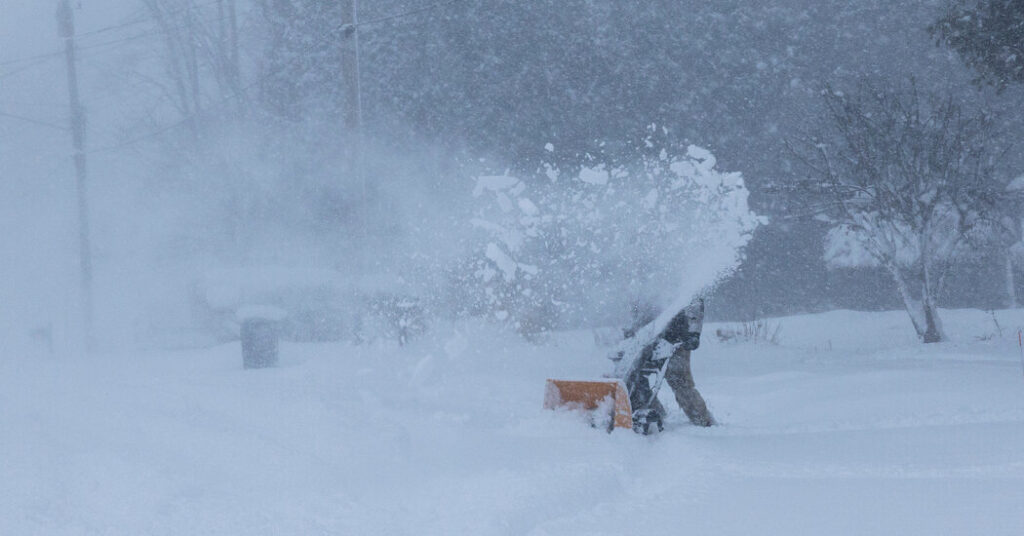
A winter storm will deliver a dangerous mix of sleet, freezing rain and heavy snow as it barrels across the country from the southern Rocky Mountains to New England from Friday into early next week.
More than 160 million people across the United States are expected to face winter weather hazards that could cripple their daily lives in coming days, as roads are covered in snow and ice and power lines break from the weight of accumulating ice, according to the National Weather Service’s Weather Prediction Center.
“This is clearly going to be a major winter storm,” said Richard Bann, one of the many meteorologists keeping a close eye on the impending storm at the prediction center, in College Park, Md.
Extremely cold air spilling into the United States from Canada will follow in the storm’s wake, potentially pushing travel delays and other impacts to infrastructure into early next week.
Here are five key things to know:
1: When and where the storm will hit
Friday: The storm is expected to form in the afternoon, emerging from the Southern Rockies and bringing scattered snow to Colorado and New Mexico before producing more widespread snow over the Southern Plains, across areas including Kansas, Oklahoma and the Texas Panhandle.
Saturday: The system is likely to have spread further into Texas overnight and into Arkansas and Tennessee by the morning, before pushing into the Midwest. It’s expected to reach northern Alabama, Georgia and the Carolinas by Saturday night. Locations farther north will receive snow, and areas to the south are expected to receive a mix of freezing rain and sleet.
Sunday: The wintry weather is expected to have reached the Mid-Atlantic by the early morning before spreading across the region into New England.
Monday: The snow will taper off in the Northeast, as cold air settles in behind the storm, from the Southern Plains to New England.
2: What’s worrying about this storm
While the storm is likely to bring every winter weather hazard possible, the two main effects are expected to be widespread heavy snow and ice accumulation.
Up to a foot of snow: Forecasters expect the storm to deliver mostly snow — over 12 inches in many cases — across a broad swath of the country, from the Southern Plains across the Ohio Valley and into the Mid-Atlantic and the Northeast. They warned that the snow could disrupt public transportation and cause delays and low visibility on roadways and at airports.
Potentially catastrophic ice accumulation: Just south of the snow, freezing rain and sleet are expected from central Texas east across Arkansas, through much of the Southeast and into southern Virginia. Ice could accumulate on trees and power lines, with widespread power outages possible.
“Freezing rain and ice make travel difficult, if not impossible,” Mr. Bann said.
3: What’s still uncertain
By Thursday night, forecasters said, all the ingredients were coming together for a major storm to form and barrel cross the country. The storm’s exact trajectory remained uncertain, with the possibility that it would wobble a little farther to the north or the south. Either could drastically change the anticipated effects.
Mr. Bann said it was also still unclear exactly where the dividing line between snow and freezing rain would fall. Computer models struggled to pin down just how far south the cold air that is needed for snow would travel.
The dividing line runs through states such as Arkansas, and if the cold air doesn’t reach far enough south, some of the places where forecasters are expecting snow could receive freezing rain or sleet instead. If the cold air travels farther south, some locations where freezing rain was expected could get snow.
4: How cold it will get
As this storm races across the country, an blast of cold air from Canada will spread across the eastern two-thirds of the United States over the weekend and into early next week.
From the Plains to the Northeast, communities will face “bitterly cold temperatures and dangerously cold wind chills,” the Weather Prediction Center said.
The wind chill in North Dakota could be as low as minus 50 degrees, while subzero wind chills could extend across the Southern Plains and portions of the Mississippi Valley and into the Mid-Atlantic.
“It’s going to be hazardous for humans to step outside,” Mr. Bann said.
It could even be dangerous indoors. If the storm causes widespread power outages, people might end up facing the cold conditions without heat.
Mr. Bann said that this storm could bring snow to areas lacking snow equipment and that the low temperatures could prevent melting, which means snow could affect roads for prolonged periods.
5: The role of climate change
The storm’s sprawling mix of freezing rain, ice and snow is the result of the collision of a cold mass of air from the Arctic with warm, moist air in the central United States. The cold air is being pushed south by the polar vortex, a ribbon of high-altitude, fast-moving air that typically circles the Arctic. Occasionally, it stretches into an oval shape, weakens and allows a blob cold air to spill south across North America.
That’s what’s happening this week.
Judah Cohen, a research scientist at the Massachusetts Institute of Technology, was a co-author of a study in the journal Science last year that found that the stretching of the polar vortex was linked to increased severe winter weather in the United States in the past decade.
Dr. Cohen said that higher Arctic temperatures had caused the melting of sea ice in the Barents and Kara Seas, just north of Norway and Russia. With less ice cover, the ocean is feeding more heat into the atmosphere, setting up a weather pattern that leads to bursts of extreme cold in North America.
This hypothesis that the Arctic, which has been warming several times faster than the rest of the planet for decades, is weakening the polar vortex isn’t shared by all scientists. Jason Furtado, an associate professor of meteorology at the University of Oklahoma, said it’s too early to make a connection between the two.
“The Arctic is certainly going to continue to warm,” Dr. Furtado said. “But the data is more mixed about whether or not these types of stretches in the polar vortex will actually continue to increase in frequency as well.”
Eric Niiler contributed reporting.
Amy Graff is a Times reporter covering weather, wildfires and earthquakes.
The post More Than 160 Million People Are in the Path of the Storm Set to Sweep the U.S. appeared first on New York Times.