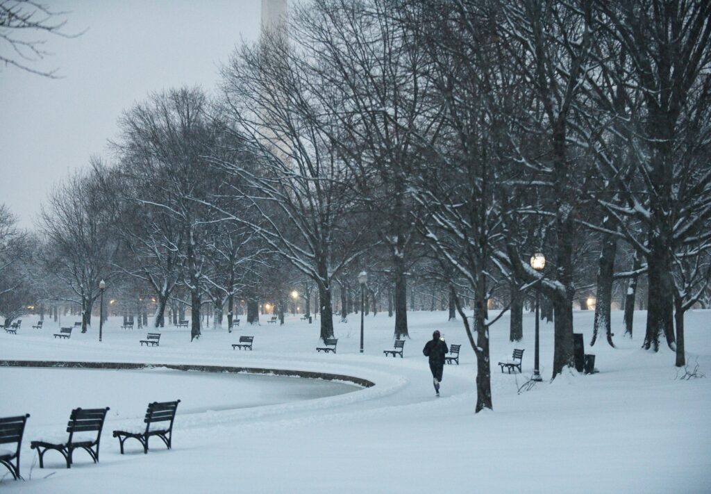
One of the most severe bouts of winter weather the D.C. area has faced in years is poised to begin late Friday, as a punishing cold spell arrives and is punctuated by a disruptive snow and ice storm this weekend.
Temperatures will plunge to near 10 degrees early Saturday. Then, from Saturday night through Sunday night, a powerful winter storm is expected to unload heavy snow and ice, turning roads and sidewalks treacherous and disrupting businesses and schools, potentially for days.
The National Weather Service has placed the area under a winter storm warning from 11 p.m. Saturday through 4 a.m. Monday, while Virginia has officially declared a state of emergency and Maryland a “state of preparedness.”
The potential for heavy amounts of ice that could lead to power outages has increased, especially south and east of the Beltway. “Power outages and tree damage are likely due to the ice,” the Weather Service wrote. “Travel could be nearly impossible. The hazardous conditions could impact the Monday morning commute.”
The storm may deliver 5 to 9 inches of snow and sleet in the Beltway area, topped by a glaze of freezing rain. Snow totals could be trimmed by icing, but this system — sweeping thousands of miles from the Southwest to southern New England — is shaping up as a prolific frozen-precipitation producer.
“The combination of heavy snow and ice alongside prolonged very cold temperatures presents a unique and significant risk to life and property across virtually the entire region,” the Weather Service wrote.
The Weather Service also issued a cold weather advisory from 8 p.m. Friday to 10 a.m. Saturday, as wind chills are expected to dive as low as minus-10 degrees ahead of the storm.
Once the storm ends, the mercury may not rise above freezing for a week or longer. At times, you may mistake D.C. for Alaska, slogging through a cement-like mix of snow and ice amid bitter winds.
Storm timeline
Here’s an approximate timeline for the evolution of this storm (lowest temperatures in northwest areas, higher temperatures in southeast areas):
8 p.m. Saturday to 11 p.m. Saturday: Chance of light snow, developing from southwest to northeast. A coating possible, especially southwest of D.C. Temperatures: 16 to 20.
11 p.m. Saturday to 4 a.m. Sunday: Snow increases in coverage and intensity from southwest to northeast. Accumulation begins immediately once snow is steady. Temperatures: 15 to 19.
4 to 10 a.m. Sunday: Snow, heavy at times (expected rates up to 1 to 2 inches per hour), gradually mixes with and changes to sleet from south to north. Temperatures: 15 to 20.
10 a.m. to 4 p.m. Sunday: Sleet, heavy at times; some snow in far northwest areas. Sleet probably changes to freezing rain south and east of Beltway by late afternoon. Temperatures: 19 to 25.
4 to 10 p.m. Sunday: Mix of sleet and freezing rain; more sleet north and west, more freezing rain south and east. Temperatures: 22 to 27.
10 p.m. Sunday to 2 a.m. Monday: Lingering areas of mixed precipitation or freezing drizzle possible as storm pulls away. Temperatures: 20 to 26.
What has changed about the forecast since Thursday?
The projected storm track has shifted more to the north and west, which means more mild air will enter the region at high altitudes, resulting in a shorter period of snow but a longer period of sleet and freezing rain. It also means even D.C.’s far north and west suburbs will probably see snow change to sleet. Substantial snowfall is still expected before the changeover, but more significant amounts of sleet and freezing rain are now forecast — this translates to a higher risk of power outages in the area.
Also, the storm timing has slowed slightly, meaning the onset of snow Saturday night may hold off until after 10 or 11 p.m. in the Beltway area, which may allow folks to hang onto any dinner plans and return safely home before conditions deteriorate.
Finally, model simulations have generally increased the overall precipitation output, increasing ice quantities in particular.
What is the latest thinking on snow and ice amounts?
Computer model projections for a combination of snow and sleet have largely converged in the 5- to 9-inch range in the Beltway area.
Because sleet falling on snow compacts the icy mix, areas well northwest of D.C. that receive less sleet have the best chance of totals nearer to the double digits.
South of the Beltway, where snow is likely to change to sleet earliest, the combination will pile up least but will be the most dense.
Computer simulations suggest about 1 to 3 inches of sleet on top of the snow that falls, with the highest sleet totals south and southwest of D.C.
Then there is the question of freezing rain. As the storm progresses, sleet is likely to mix with and change to freezing rain, especially in southern and eastern areas during the second half of Sunday. If freezing rain accumulates to more than 0.25 inches, impacts could become significant.
The weight of freezing rain can snap tree limbs and power lines, leading to power outages. Most projections for the Beltway area suggest 0.1 to 0.3 inches, but some areas could see more — particularly from around Fredericksburg into Southern Maryland, where the risk of disruptive amounts of ice is growing.
How severe will the storm effects be?
This storm ranks as a Category 4 out of 5, or “severe,” on Capital Weather Gang’s winter storm impact scale. Although snow totals will not rival the all-time greats, the perilous combination of snow, ice and bitter cold before, during and after the storm means it is likely to have serious and prolonged effects. It is highly unusual for temperatures in D.C. to remain in the teens and 20s throughout a winter storm and then stay that cold for several days afterward.
The prospect of power outages in areas that receive heavy freezing rain amid this cold weather could turn into a dangerous, life-threatening situation.
All of the snow and ice will accumulate as it falls and, with freezing temperatures lingering, it may not melt for a week or more. The resulting conglomeration of frozen precipitation will be difficult to remove, meaning it will take much longer than normal for the region to recover.
The Weather Service has also rated this a storm a level 4 out of 5 or “major” on its Winter Storm Severity Index.
This may not be a storm remembered for generations, or a Category 5, but it is likely to take a meaningful toll.
How cold will it get?
The Arctic air mass settling into the region will be remarkable both for its strength and staying power. “Dangerously cold wind chills and near record-breaking temperatures are likely,” the Weather Service wrote.
Cold air will surge in Friday night, with temperatures tumbling into the low teens, and even single digits in colder areas north and west of the Beltway. Wind chills are expected to drop below zero.
High temperatures this weekend will struggle into the teens and 20s, and if readings remain in the teens, they could challenge daily records.
Any snow and ice that fall are likely to linger for an extended time. Highs next week are forecast to remain mostly in the 20s, with nighttime lows frequently dipping into the teens and single digits. At times, wind chills may again fall near or below zero.
How to prepare
“Now is the time to make preparations for the storm,” the Weather Service wrote Friday. “This includes getting any necessary groceries or medicines that you may not be able to access this weekend into early next week due to any potential closure.”
If you have scheduled flights or appointments on Sunday, consider changing them. Most airlines will allow you to make changes at no cost.
Stock up on snow- and ice-clearing supplies like shovels and salt.
Take steps to protect your home and yard from snow and ice (make sure your gutters are clear) and extreme cold (protect your pipes).
“Have an emergency kit in the car including extra batteries, a flashlight, and blanket just in case you get stranded,” the Weather Service advised. “Make sure to refuel your car before the storm hits. Check on elderly friends/neighbors and don’t forget about your pets during this prolonged cold period.”
Once the snow and ice begin, shovel and salt frequently during the storm to ease removal. If you wait until after the storm, the conglomeration will solidify and be much harder to clear.
Read more about D.C.-area winter storms
Here’s how to measure snow like a pro
It is tough to predict when it will snow in Washington. Here’s why
Everything you ever wanted to know about snow in Washington, D.C.
Ice storms: Inside wintertime’s dreaded, frozen mess
Wes Junker, Ian Livingston, Jeff Halverson and Dan Stillman contributed to this report.
The post Ice, power outage risks grow as D.C. area braces for winter storm appeared first on Washington Post.