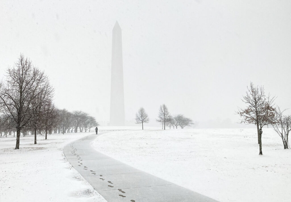
Chances are increasing that the D.C. area will experience one of its biggest winter storms in years between late Saturday and early Monday. The snow and perhaps ice, accompanied by bitter and long-lasting cold, could cause major disruptions to schools, airports and businesses Sunday into next week.
The chance of at least several inches of snow is high, and totals reaching the double digits are plausible. The storm could produce the most snow in D.C. since 2016 when a crippling blizzard, called Snowzilla, dumped 17 to 32 inches across the region.
The powerful winter storm will arrive after a blast of Arctic air sweeps from the Plains to the East Coast late this week, dropping temperatures into the teens. As the storm streaks northeastward toward the frigid air, it will unload a large swath of moderate to heavy snow from the southern Plains to the Mid-Atlantic. Farther south, a devastating ice storm may spread from Dallas to Atlanta into the Carolinas.
Computer models have come into relatively strong agreement that at least 6 inches is likely and that parts of the region could near or even surpass a foot. But with the storm still four to five days into the future, uncertainties remain. There is an increasing chance that snow could mix with and change to sleet and/or freezing rain for a time Sunday, lowering the ceiling on snow totals, especially south and east of D.C. There is also a possibility that the push of Arctic air suppresses the storm to the south, resulting in little snow — although the likelihood of that scenario is diminishing.
Based on the latest information, we would assign the following odds for different snowfall amounts in the D.C. area:
- At least 1 inch: 80 percent.
- At least 4 inches: 70 percent.
- At least 6 inches: 60 percent.
- At least 8 inches: 50 percent.
- At least 12 inches: 35 percent.
“Confidence of a significant winter storm across the region remains high Saturday into Sunday, but confidence in exact amounts of snow versus ice is lower especially south and east,” the National Weather Service office serving the region wrote Wednesday.
While subject to change, the storm timing would cause snow to break out late Saturday night, become heavy toward Sunday morning and then ease overnight Sunday. The snow could change to sleet and/or freezing rain for a time between Sunday morning and evening.
How much snow could fall?
Here is how much different models are projecting for the Beltway area:
- UKMet: 15 inches.
- European model: 13 to 15 inches (primary simulation) | 10 to 11 inches (system average).
- European AI model: 12 to 13 inches (primary simulation) | 14 to 15 inches (system average).
- Canadian model: 11 to 13 inches.
- American and American AI models: 10 to 11 inches (primary simulation and system average).
- German model: 8 to 9 inches.
The models showing the highest snow totals also suggest a brief change to sleet. Because sleet is counted as snow in these projections, those totals may be somewhat inflated.
On the other hand, because of the low temperatures, the snow that falls before any changeover may be very light and fluffy, allowing it to pile up quickly. For typical winter storms, with temperatures nearer freezing, D.C. gets 10 inches of snow for the equivalent of 1 inch of rain. But for this storm, the equivalent of 1 inch of rain might convert to closer to 15 inches of snow.
What’s changed about the forecast since Tuesday and what is still uncertain
Models have come into better agreement that this storm is unlikely to miss to the south. Two streams of energy — one coming from Canada and a second from Southern California — are predicted to merge, rather than remain apart, which will help direct vast amounts of moisture from the south and west into frigid air over the Mid-Atlantic.
The big uncertainty is whether there will be enough of an elevated warm layer coming north from the Gulf of Mexico to change the snow to sleet and then freezing rain. This scenario is now showing up in various model runs. But frozen precipitation will continue, even if that happens.
“Given the very cold air locked in at and near the surface with strong Arctic high pressure anchored firmly to our north, plain rain is highly unlikely anywhere in the region,” the Weather Service wrote Wednesday. “It will therefore come down to snow versus ice, both of which could be significant and highly impactful across a widespread area.”
The tendency for any mild air to surge north could be reversed if a new zone of low pressure rapidly develops near the coast, drawing north winds southward. Then, most of the precipitation might fall as snow.
How cold will it be?
The Arctic air mass forecast to settle into the region will be notable for its intensity and longevity. “Frigid temperatures are looking like a virtual certainty this weekend into early next week,” the Weather Service wrote Wednesday.
After highs flirt with 50 on Thursday, cold air will begin to surge into the area Friday night when temperatures will plunge toward the low teens (even single digits in colder areas north and west of the Beltway).
Forecast highs over the weekend are only in the teens to low 20s. If they hover in the teens, they would challenge calendar-day records.
Whatever snow falls will stick around for a long time. Predicted highs next week are mostly in the 20s, and lows at night would probably frequently fall into the teens and single digits (in colder areas away from D.C.). Wind chill near or even below zero will be possible at times.
Where might this storm rank historically?
If snowfall from this storm reaches the high end of projections, it could rank among the greats:
- To enter D.C.’s top 25 snowstorms, at least 10.8 inches would need to fall.
- To enter the top 10, at least 14.4 inches would need to fall.
- To enter the top five, at least 17.8 inches would need to fall.
Since the 17.8 inches during the Snowzilla storm in 2016 tied for D.C.’s fourth-biggest snowstorm, four snowfalls have surpassed 6 inches:
- 10.3 inches on Jan. 12-14, 2019.
- 6.9 inches on Jan. 3, 2022.
- 7.2 inches on Jan. 6, 2025.
- 6.4 inches on Feb. 11-12, 2025.
This storm has a chance to outdo all of these four.
In most recent historic storms to affect the D.C. area, the highest snow totals — sometimes substantially more than in D.C. itself — have occurred north and west of the Beltway.
D.C. averages 13.7 inches of snow per winter and has seen 1.5 inches so far. This storm could catapult its cumulative snowfall to near the seasonal norm.
How to prepare
With the storm four to five days away, there is time for the forecast to change, and it’s a bit early to change plans such as scheduled flights or appointments. But you might begin to think about having a Plan B if a major storm materializes Sunday and Monday.
Now is not a bad time to shop for snow-clearing supplies like shovels and salt before a possible big rush.
By Thursday or Friday, we will have higher confidence in the forecast, and that will be the time to begin consider shifting plans if significant snow and ice are still predicted. And we imagine plenty of folks will be headed to grocery stores.
We will post detailed briefings on the storm each day — assuming it remains a threat — and will also post updates on social media (on X, Blueskyand Facebook).
Ian Livingston, Dan Stillman and Jeff Halverson contributed to this report.
The post Odds rising for one of D.C.’s biggest winter storms in years this weekend appeared first on Washington Post.