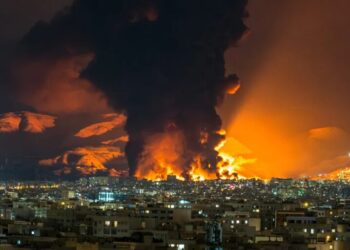
New satellite imagery shows the damage to Fuerte Tiuna, or Fort Tiuna, the military complex where U.S. forces captured the Venezuelan president, Nicolás Maduro, on Saturday.
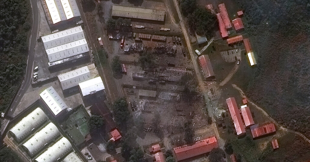
Fuerte Tiuna, Venezuela’s largest military base, is built into a mountainside in the south of the capital, Caracas. The base consists primarily of military installations with fortifications and roads winding around the compound.
Before-and-after imagery released on Sunday by Vantor, a Colorado-based space technology company formerly known as Maxar Intelligence, shows that at least five buildings at the complex were destroyed by U.S. forces. Cargo containers, military trucks and trailers were near these structures, although it is not clear what they contained.
A gate and security building in a wooded area near the compound were also destroyed.
Sanjana Varghese is a reporter on The Times’s Visual Investigations team, specializing in the use of advanced digital techniques to analyze visual evidence.
The post Satellite Imagery Reveals Damage to Venezuelan Base Where Maduro Was Captured appeared first on New York Times.