Yet another storm is set to smack California this weekend, bringing more wind and rain to a region where a steady flow of storms since mid-December has soaked the landscape, causing landslides and flooding.
The storm had already brought flooding to parts of Northern California on Friday, and officials across the San Francisco Bay Area were bracing for more on Saturday as the rain coincided with exceptionally high tides.
The storm is also expected to bring heavy snow across the Sierra Nevada, where the National Weather Service issued warnings advising drivers to prepare for “major travel delays” from Friday night into Monday.
Most of the state has received above-normal precipitation this season, and another one to six inches of rain is forecast to fall into Monday morning, with up to five feet of snow possible in the Sierra Nevada.
Mike Wofford, a meteorologist with the National Weather Service office in Oxnard, Calif., described the next system as “routine” compared with some of the more severe storms this season, including the New Year’s Day soaker that flooded roadways in San Diego and a record-setting rainstorm that doused Southern California over Christmas.
“We’ve had a lot of rain, so things are mushy out there,” Mr. Wofford said. “So it won’t take much to get a little water on the roads.”
Flooding along the coast in Northern California
The storm was already blowing into Northern California on Friday, bringing a mix of rain and wind that will continue through the weekend and into Monday.
The timing of the storm coincides with the king tides, exceptionally high tides that occur when the moon, sun and Earth align and create a stronger gravitational pull on the oceans. Coastal flood warnings were issued for portions of Northern California, including the San Francisco Bay shoreline, which is expected to see its highest tide since 1998 on Saturday morning.
In Marin County, where low-lying areas are particularly vulnerable to high tides, NBC reported that flooding had inundated some houses and vehicles on Friday.
In rural Humboldt County to the north, local officials urged people to avoid an area around Eureka, where high tides were also causing flooding.
San Francisco could see gusts of up to 50 miles per hour on Saturday, and the city is likely to amass 1.5 inches of rain through Monday morning. San Francisco has already recorded 9.64 inches of rain since Oct. 1. That’s a little more than an inch above the normal amount for this time of year, but not nearly as drastic an overshoot as in Southern California, where four times the usual amount of rain has fallen.
More rain coming to a waterlogged Southern California
California receives most of its annual rainfall in the winter, but it has been an especially wet few months in Southern California. Since Oct. 1, Los Angeles has recorded nearly 13 inches of precipitation, more than three times the four inches it would typically see this time of year. At least another inch is expected from this weekend’s storm.
That has led to widespread flooding, as cities struggle to manage the precipitation from one storm before the next hits.
Rain on Thursday in San Diego was so significant that roads in some neighborhoods flooded quickly enough that water poured into businesses and homes, and parked cars began floating away. As rain pelted the region, teams rescued people who were stranded in their cars by rapidly rising floodwaters.
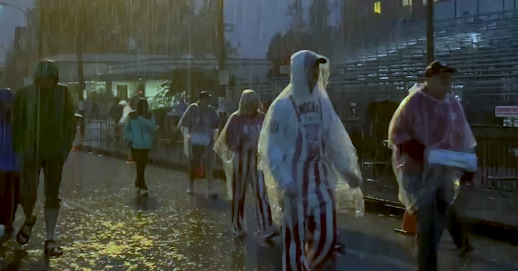
In Los Angeles, the annual Rose Parade was soggy for the first time in years. On the morning of New Year’s Day, spectators crouched under umbrellas and wore ponchos as they watched colorful floats, mariachi bands and dancers go by.
About one in 10 New Year’s Day holidays in the Los Angeles area see some rain, but it is typically less than half an inch. Before this year, the last time it had rained more than an inch here on New Year’s Day was in 1934, according to the Weather Service.
For some, the rain on the parade, which was established in 1890 to showcase L.A.’s famously mild weather, felt like a bad omen — yet another sign of how the city is being reshaped by extreme weather. In early January of last year, the city had recorded only 0.16 inches of rain since October, and the dry weather had fueled some of the most catastrophic fires in the city’s history.
“Not only did the gods create fire last year they’re actually raining on our literal parade,” said Fernando Guerra, a professor at Loyola Marymount University.
This next system is poised to push into Central and Southern California on Saturday, bringing a risk of flooding, rock slides and mudslides. Winds could knock over trees in soil made more unstable by the saturation of recent storms. Downtown Los Angeles is predicted to receive up to an inch of rain, but up to six inches could fall in the coastal mountains of Southern California.
While many of this season’s storms have hit an area between Santa Barbara and Los Angeles Counties, Mr. Wofford said that this one would likely be more focused to the north, including San Luis Obispo County.
Amy Graff is a Times reporter covering weather, wildfires and earthquakes.
The post California Cannot Catch a Break as Another Storm Moves In appeared first on New York Times.