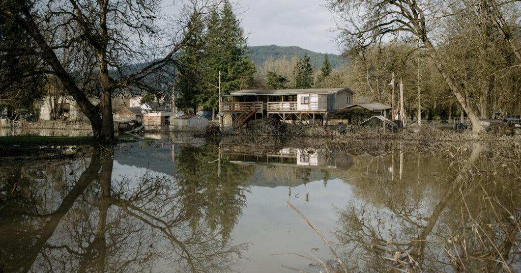
More storms sweeping across Washington State have prompted warnings from forecasters that the region may face additional flooding this week.
Floodwaters had begun a slow retreat after downpours last week sent rivers to record levels and forced tens of thousands to flee their homes. But more rain fell as a storm moved through the area on Monday, and a second, more significant storm is set to hit on Tuesday into Wednesday, threatening to push already swollen rivers beyond their banks again.
Strong winds are expected to bring their own dangers this week, too.
The additional rainfall has already strained local infrastructure. On Monday, water breached a levee on the Green River just outside Seattle, setting in motion an hourslong flash flood warning and evacuation orders for some residents.
Key Things to Know About This Week’s Storms
Overall, this week’s rain is not expected to be as substantial as last week’s. But it is falling on areas that have already been heavily saturated, which intensifies the potential danger.
Two crests are expected.
-
The likely scenario is that swollen rivers will see two more peaks this week, beginning late Monday night into early Tuesday. The second crest, expected Wednesday into Thursday, is likely to be the higher of the two. Rivers should begin to recede significantly toward the end of the week, forecasters said.
Mountain snow will help.
-
This next round of precipitation will be much cooler than last week’s. That means more of it should fall as snow, affecting the mountain passes in the Cascades and the Olympics on Tuesday night and Wednesday. While this will make driving treacherous, it has a crucial positive side: The accumulating snow will slow the amount of water that flows into the rivers from the mountains.
The wind will be a danger.
-
Tuesday’s storm system carries a significant “worrisome wind” potential, forecasters said. Damaging winds combined with saturated soils drastically increases the likelihood of fallen trees.
The risk of landslides is high.
-
Landslides have closed some highways in western Washington in recent days as ground that has been saturated by heavy rain moves down mountain slopes quickly. Forecasters and emergency officials said the landslide threat would remain very elevated through Thursday as more rain adds considerable weight to already saturated slopes.
A Back-to-Back Weather Punch
If these two storms on Monday and Tuesday were isolated occurrences, “there wouldn’t be much concern,” Kirby Cook, a meteorologist with the National Weather Service in Seattle, said on Monday afternoon. But instead, the storms are following closely on the heels of last week’s big rainstorm.
The impact of this one-two punch is evident: With more than five inches of rain measured at Seattle-Tacoma International Airport so far this month, the city has already nearly reached it typical December total of 5.75 inches.
After this latest rain, forecasters at the Weather Service’s Seattle office said that a combination of dry periods and snow piling up in the mountains would finally allow rivers to recede, signaling what they called a “long-awaited return to some semblance of normalcy for December.”
Judson Jones is a meteorologist and reporter for The Times who forecasts and covers extreme weather.
The post More Rain Is Forecast for Washington, Still Flooded From Last Week appeared first on New York Times.