When the Eaton fire broke out in the foothills near Altadena, the Los Angeles County Fire Department did not have access to a satellite-based fire-tracking program regularly used by other agencies, depriving officials of intelligence that could have been helpful in determining evacuations.
The National Guard’s FireGuard program, which analyzes images from military satellites to distribute real-time fire progression maps several times an hour, is considered particularly helpful to fire officials when aircraft can’t fly. But officials with the L.A. County Fire Department said they weren’t aware of the resource during the Eaton fire and therefore didn’t utilize FireGuard’s data or maps.
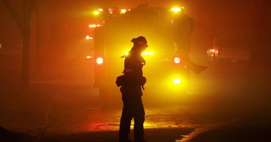
This may have left Altadena at a disadvantage. With all aircraft grounded within an hour of the Eaton fire’s start, fire officials lost significant situational awareness and were forced to rely almost exclusively on ground observations. That became increasingly difficult as night fell, smoke intensified and powerful winds pushed flames and embers farther and more rapidly into neighborhoods.
The county has faced months of criticism after The Times revealed in January that officials did not order evacuations for west Altadena until nine hours after the fire started. All but one of the 19 people who died in the Eaton fire were found in west Altadena, among them a 54-year-old woman whose family has claimed she died because of the delayed evacuation alerts.
Not having access to FireGuard during the Eaton fire appears to have made the L.A. County Fire Department an outlier among large fire agencies in California, as the majority of those contacted by The Times confirmed that they have used it for years. The findings raise further questions about how the county fire agency prepared for and responded to the deadly blaze, particularly with how officials failed to issue timely evacuation alerts for west Altadena and appeared completely overwhelmed as embers and flames marched westward.
Some experts say it’s possible FireGuard satellite mapping could have better informed incident commanders, particularly on evacuation decisions, though it’s far from clear how it might have changed the response — if at all.
Mapping from FireGuard, reviewed months after the fire, showed it did track the fire’s steady progression west for several hours before flames overran west Altadena — and well before the evacuation alerts went out.
“Did they not know that it shifted to [west Altadena]? That then could have been information that would have been helpful,” said Michael Gollner, an associate professor of mechanical engineering at UC Berkeley who leads its Fire Research Lab. “Or maybe they knew, but they said we couldn’t do anything about it,” due to overtaxed resources.
FireGuard “could have been useful … in terms of life safety and evacuating people out of the way,” he added. “It depends on what they knew, and when they knew it.”
Some county officials agree.
“It’s something that they should have had, but now they’ve put that into play,” said L.A. County Supervisor Kathryn Barger, who represents the unincorporated town of Altadena.
In the aftermath of the fire, the L.A. County Fire Department has moved to integrate FireGuard into its operating platforms. Fire Chief Anthony Marrone said the program, along with plans for other technological improvements, will “aid in future wildfires but will never replace the primary source of situational awareness such as by air and reporting back from the field.”
Barger wouldn’t go so far as to say the Fire Department missed an opportunity by not having FireGuard in place, but focused on how volatile the conditions were that night.
“Between the wind and the fire … it was like all of a sudden it was on top of them out of nowhere,” Barger said. “The fire chief has said that, quite frankly, they were outpaced on this fire because it was moving so rapidly.”
But some recent analyses of the fire have confirmed that there were earlier signs that the fire was shifting west, though it’s unclear how well they were realized by fire officials. At least one suggestion to expand evacuation orders to the west went unheeded around midnight on Jan. 7.
The first evacuation alert for west Altadena was issued at 3:25 a.m. on Jan. 8, well after several fires had been reported in the area. Some sections of the town weren’t ordered to evacuate until just before 6 a.m. No part of west Altadena was issued an evacuation warning. Residents have recalled harrowing escapes from smoke-filled homes and under raining embers.
West Altadena, home to a more racially diverse population than the town’s eastern side, stemming from historical redlining, would end up the hardest hit by the fire.
L.A. County officials have repeatedly failed to provide a detailed explanation into why the evacuation alerts for west Altadena came so late, or who was responsible, but a Times review of the process makes clear that county officials were several steps behind the fire as it spread west.
In an independent review of the county’s evacuation system, completed by McChrystal Group in September, investigators found that some officials didn’t realize how far west the fire had spread until well into the morning of Jan. 8, as late as around 3 a.m. — when fire had started to spread into west Altadena but evacuation orders still hadn’t gone out.
The report noted there was a “sudden shift” in the direction of the fire and an increase in winds around 3 a.m., prompting “an urgent need to assess and coordinate priorities.” The report also found that around this time county fire officials believed that all areas “directly impacted by or at risk from the Eaton fire had already received an evacuation warning order.”
That narrative doesn’t appear in sync with available FireGuard mapping and a timeline of the fire compiled last month by state-hired investigators.
As early at 9:30 p.m. on Jan. 7, the fire was moving west toward North Lake Avenue, the unofficial east-west divider for the town, according to the state report. FireGuard images from around that time also showed the fire clearly moving west in the San Gabriel foothills north of Altadena, though it was also simultaneously expanding on an eastern edge close to Sierra Madre.
Between 10 and 11 p.m., however, there continued to be increased fire in the “north section of the western front,” the state report found. And just before midnight, L.A. County firefighters reported a fire west of Lake Avenue on East Calaveras Street, the report found.
By 1:30 a.m., “multiple structure fires were reported on Lake Avenue,” around which time a firefighter tried to investigate the extent of the fire west of Lake but was stopped by “intense fire conditions that worsen,” the state report found.
It would be two more hours before west Altadena would be ordered to evacuate.
“Unified command did their very best to identify evacuation zones to be alerted based on the information available to them at that time,” Heidi Oliva, a spokesperson for the L.A. County Fire Department, said in a statement. “When unified command learned that the fire was seen north of Lake and moving west, it validated and acted to issue the orders that were sent out.”
Although Oliva acknowledged that the FireGuard maps showed the fire moving northwest the night of Jan. 7, she said that “to be clear, the FireGuard imagery or data was not available to us at the time of the incident.”
“Any information that would help improve situational awareness would be beneficial to unified command,” she said. “We believe that FireGuard is an additional tool that will better inform unified incident commanders of a fire’s movement thus providing greater situational awareness to enhance decision-making on all aspects of a fire, evacuations included, especially when aircraft is grounded.”
But she was adamant that the program will not be a panacea.
“FireGuard does not pick up spot fires caused by ember cast or downed power lines, so it is important this tool is used in conjunction with other tools to increase situational awareness,” she said. Oliva did not explain why the department hadn’t implemented the program in the years before the fire, when it had been made widely available to local agencies through different operating platforms.
“The Department was neither aware of, nor had access to, FireGuard until after the January 2025 fires,” Oliva said. She said in August the agency worked with the federal government to incorporate the program as a layer within the department’s electronic incident command platform, Tablet Command. Before that, she said, the agency didn’t have the ability to incorporate FireGuard.
Shawn Tyrie, a partner with McChrystal Group who reviewed the FireGuard maps, said they provide some helpful information, but he noted the maps didn’t pick up smaller spot fires and aren’t very detailed. He didn’t find the data “good enough to say definitively that you can make decisions … based on FireGuard data alone.”
Still, his consulting firm recommended the county implement FireGuard to better inform future firefighting.
The FireGuard program has been operating since 2019 but has been widely available to agencies across the nation over the last few years. The California Governor’s Office of Emergency Services said FireGuard data have been available to any agency in the state through several common operating platforms, including one that the office made accessible to all local government agencies in May 2023, according to Matt Notley, a spokesperson for the office.
FireGuard’s constant mapping of “fire-affected areas” has proved a reliable and helpful backup, especially when air resources aren’t available, according to several officials who have used the program. Federal officials cited the technology as key in helping facilitate the evacuation of about 35,000 people during the 2021 Marshall fire in Boulder, Colo., during which aircraft were grounded for the first eight hours of the blaze.
The Times reached out to more than 10 of the largest firefighting agencies in California, the majority of which confirmed that they had access to FireGuard as of January and had implemented the data into their systems and processes. A few officials with the California Department of Forestry and Fire Protection who spoke about FireGuard were surprised or confused that L.A. County hadn’t been using the program.
Phillip SeLegue, staff chief of CalFire’s intelligence program, noted that while FireGuard still has some shortcomings — it doesn’t provide a full fire perimeter and requires internet connectivity to access — it has still become a game changer for “early detection and ongoing assessment.”
“It’s very valuable to us…. It’s dramatically improved our fire spread prediction,” SeLegue said. “What FireGuard gives us is 24/7, persistent coverage.”
In addition to CalFire (which includes its many cooperative jurisdictions such as unincorporated San Diego and Riverside counties), the fire departments for Ventura, San Bernardino, Orange, Kern and Santa Clara counties and the Angeles National Forest confirmed to The Times that they have used FireGuard data for years, and most said it’s used for early detection, situational awareness or both.
The fire departments for Santa Barbara and Alameda counties said they did not use FireGuard; nor did the San Francisco Fire Department.
The Los Angeles Fire Department, responsible for fires in the city and the lead agency responding to the Palisades fire, did not respond to several questions about its FireGuard use or access.
Operated by California and Colorado National Guard troops, FireGuard uses Department of Defense satellites to detect and track wildfires, distributing unclassified information among firefighting networks, according to the National Guard. Specific intelligence specialists work to map hot areas of active fire on approximately 15-minute intervals, providing imaging at about a 400-meter resolution, SeLegue said.
Though CalFire and the Angeles National Forest both were using the program during the Eaton fire and were in unified command with L.A. County, Oliva said, the county fire agency was “not aware that it was an available tool that could accurately track a fire’s progression and no other agencies that responded to the Eaton fire … shared any Fireguard data with us.”
Officials with agencies that have been using FireGuard described it as a helpful application in a growing landscape of fire technology, mostly used for higher-level decision-making.
“FireGuard can be one piece of this,” said Andrew Dowd, a spokesperson for the Ventura County Fire Department. He called it “one small tool in the toolbox.”
While some helicopters were grounded during the 2024 Mountain fire, Dowd said, fixed-wing aircraft were still able to fly, so FireGuard wasn’t relied on for situational awareness.
“On certain fires, when I’m not getting anything else, I have definitely used it,” said Erin Opliger, a special projects leader with the San Bernardino County Fire Department, who works on geographic information systems and data analytics for the agency. “It does show [a fire’s] general spread.”
Suzann Leininger, who works on intelligence with CalFire-San Diego County, said the maps from the FireGuard program don’t show exact perimeters but still provide useful progression information.
“It’s certainly helpful when you don’t have any kind of flight available and when it’s too windy to fly,” Leininger said.
But understanding the program and making sure it’s actually useful — not just installed — is perhaps the most important part, UC Berkeley’s Gollner said.
“A lot of the planning has to be done before the fire ever started,” Gollner said. “There needs to be a process, because there’s a lot of radio traffic, a lot of things [going on] and you’re already in an intense situation…. It’s great to have new data, but you also have to be skilled at how to use it, and to make that plan in advance.”
Tyrie agreed that will be the challenge.
“There’s a million data sources that you could layer into a common operating picture,” he said. “How do you make decisions based on that in the moment?”
This story was published with support from the Institute for Journalism & Natural Resources.
The post With Altadena burning, L.A. County lacked satellite mapping tool used by other agencies appeared first on Los Angeles Times.