A storm was drenching Washington State and British Columbia for a fourth day early Thursday after prompting evacuations and road closures, as parts of the Pacific Northwest endured what could be some of the region’s worst flooding in decades.
Evacuation orders were in place for some residents along the Skagit River, northeast of Seattle, and along the Puyallup River, southeast of Tacoma, among other areas. The office of Gov. Bob Ferguson of Washington said in an email that up to 100,000 residents in the state could face such orders.
The rain began to weaken early Thursday. But rivers across the region were continuing to swell, with the Nooksack, Skagit, and Snohomish expected to take several more days to crest and recede.
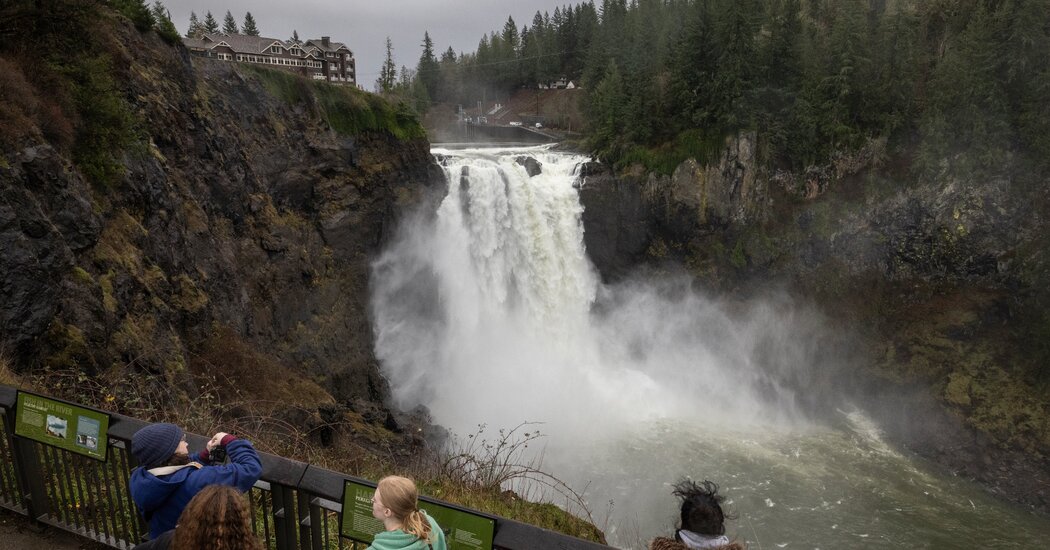
Forecasters reported that some rivers were moving with a force and swiftness never before recorded. The National Weather Service has warned of “locally catastrophic” river flooding, with the Skagit and Snohomish rivers predicted to crest at or near record levels.
Mr. Ferguson signed an emergency declaration on Wednesday afternoon and said he had activated the National Guard. He said that 300 Guard members would be ready to handle requests for help with the state’s flood response by Thursday.
Major highways were closed in British Columbia early Thursday as the rain set off flooding and falling rocks, posing avalanche hazards.
Unusually heavy rain has soaked the Pacific Northwest since Monday, as a sopping wet storm has draped across the region and British Columbia.
Officials issued an evacuation order and a local state of emergency on Wednesday in a part of Fraser Valley, in southwestern British Columbia, as flood warnings were in effect throughout the region.
East of Seattle, along the Snoqualmie river, emergency crews worked overnight to rescue several people stranded in cars by rising floodwaters. Separately, a landslide on Wednesday evening closed parts of Interstate 90. A section of the highway’s eastbound lanes outside Seattle remained closed early Thursday.
And in Snohomish County, north of Seattle, several people were rescued by helicopter after they were trapped by floodwaters in their homes, according to the County Sheriff.
With more rain falling on Wednesday, forecasters urgently expanded flood warnings, as many areas that were already experiencing some flooding braced for more.
“I’m very concerned,” Steve King, the hydrologist in charge at the Northwest River Forecast Center in Portland, Ore., said on Wednesday.
“It’s as serious of a situation as I’ve seen in my history here,” he said.
The storm’s impacts are far-reaching.
The storm is pulling a plume of moisture off the Pacific Ocean and sending downpours of rain across Oregon and Washington and into British Columbia. There officials warned of flooding in the Fraser Valley east of Vancouver, and heavy snow in the mountains prompted warnings of a high risk of avalanches.
The storm’s reach has spread into Idaho, where some rivers are expected to flood in the state’s north panhandle, and even as far as the eastern United States, where the moisture sent through the upper atmosphere is supercharging the chance of heavy snow this week.
But it is Western Washington that is facing the most severe and widespread effects, as the storm’s moisture is sent flowing up the Cascades before being wrung out like a sponge and spilling down the mountainsides as water.
The resulting rain has been slowly overflowing the region’s rivers, causing flooding that is expected to continue through the end of the week.
By Wednesday morning, eight rivers in Western Washington had reached major flood stage, which typically means flooding is widespread and threatening transportation, businesses and residences. Nearly 20 more rivers were poised to reach that stage before the end of the weekend, forecasters said, though they warned that the forecast was constantly evolving.
The hazards are not expected to cease with the arrival of clearer weather. The risk of dangerous landslides will continue throughout the week and into the weekend because of the saturated ground, even as clearer weather is forecast for Saturday.
The flood risk is especially high on two rivers in Washington.
The Skagit and Snohomish Rivers are both located north of Seattle, meandering through the valleys between the Cascades and Puget Sound.
The watersheds received four to 10 inches of rain in an initial round of rain on Monday and were expected to get just as much again by Thursday morning, according to Jason Ellis, service coordination hydrologist at the National Oceanic and Atmospheric Administration’s National Water Center.
Mr. Ellis said that waters were expected to top multiple levees along these rivers and would likely surpass, by several feet, records that have stood since 1990. Devastating flooding in 1990 caused damage to farms, homes, roads, bridges and other infrastructure, with the estimated damage exceeding $100 million, according to a report from the National Weather Service.
While the Snohomish passes mostly through farmland and small towns, the Skagit runs through some more populated areas. Multiple towns are threatened including, Burlington, Sedro-Woolley, Concrete and Mount Vernon, which are together home to about 60,000 people.
“This is a particularly widespread major event for this part of the country,” Mr. Ellis said. “It has been 35 years since anything close has been observed in this area.”
It is not possible to draw a connection between any particular heavy rainstorm and climate change in real-time. But in general, a warmer atmosphere holds more moisture and moisture is the fuel for atmospheric rivers like the ones affecting the Pacific Northwest this week. Scientists are studying how the changing climate is impacting these moisture plumes that are the foremost source of water on the West Coast.
Judson Jones, Ali Watkins and John Yoon contributed reporting.
Amy Graff is a Times reporter covering weather, wildfires and earthquakes.
The post Washington State Flooding Intensifies, Prompting Rescues and Evacuations appeared first on New York Times.