The U.S. Navy has routinely been positioning warships near Venezuela’s coast in locations far from the Caribbean’s main drug-smuggling routes, suggesting that the buildup is focused more on a pressure campaign against Venezuela than on the counternarcotics operation the Trump administration says it’s waging.
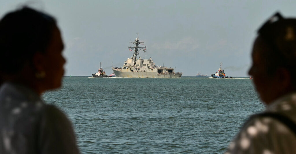
Cruisers and destroyers have consistently been sailing in an area 50 to 100 miles off Venezuelan shores, according to an analysis of satellite imagery provided to and verified by The New York Times. Though some cocaine is trafficked in this area, it is several hundred miles east of the busiest smuggling routes, which, according to U.S. government data, are off the coast of neighboring Colombia.
The vessels are part of the largest U.S. military deployment in the Caribbean since the Cuban Missile Crisis in 1962, a show of force that has included a series of heavy bomber aircraft flying along Venezuela’s coast.
Although the Trump administration has highly publicized its military activities in the region and touted its airstrikes on suspected smuggling boats, the locations of naval assets have largely been kept secret. The satellite data pinpoints nearly 100 positions of at least eight vessels over the past two and a half months, as they traversed the Caribbean Sea.
Some warships are equipped with powerful surveillance radars to identify surface and aerial targets, and are loaded with long-range missiles capable of striking deep within Venezuela.
“The naval presence that we’re seeing here is aimed at Venezuela, and they can see it,” said Mark Cancian, a retired Marine Corps colonel and military expert at the Center for Strategic and International Studies.
The United States has said its military forces are in the region to stop the flow of illicit drugs, while accusing Nicolás Maduro, the Venezuelan president, of playing a key role in their exportation to the United States. At least 83 people have been killed in 21 known strikes on boats in the Caribbean and the eastern Pacific that U.S. officials said were transporting drugs.
The U.S. government has not provided any evidence that the targeted boats were carrying drugs, and many legal experts argue that they were not legitimate military targets — and that the strikes may violate international law.
At the same time, aides to President Trump have been working to oust President Maduro from power, and Mr. Trump has signed off on C.I.A. plans for covert measures inside Venezuela.
“If the goal is to use the drug war, the drug justification, as a Trojan horse to put pressure on Venezuela, then that would point to that,” Adam Isacson, a defense expert at the Washington Office on Latin America, said, referring to the ships’ positions.
In the past week, U.S. Navy vessels have been spotted sailing closer to Venezuela than has been seen since the start of the buildup. On Tuesday, a destroyer and a large amphibious vessel sailed through the gulf that separates Trinidad and Venezuela, a mere seven miles from Venezuela’s territorial waters. The moves were first reported by ABC News.
“U.S. naval forces conduct operations in international waters following international law, focusing on counternarcotics efforts with regional partners,” a U.S. Southern Command spokesperson told The Times. “We will not comment on or disclose details of specific operations or routes.”
To track the U.S. Navy ships, Ollie Ballinger, a lecturer in geocomputation at University College London’s Center for Advanced Spatial Analysis, wrote a computer program that can search for specific vessels in free, publicly available satellite images.
Mr. Ballinger provided his findings to The Times, which were then manually corroborated by comparing the vessels found in satellite imagery to verified known photographs of those ships and their specifications, such as dimensions and colors.
While there were nearly 100 verified detections of U.S. Navy ships from early September through mid-November, the data itself is incomplete. There were no detections on cloudy days or when satellites weren’t positioned over the Caribbean, for example. The Times verified additional vessel locations that were first identified by several online researchers who also track naval activity.
Even as the Navy appears to intensify its intimidation campaign, The Times found that some ships included in the analysis had also traversed a corridor between Venezuela and the Dominican Republic known for drug smuggling. Navy vessels were spotted in this area at least eight times, the satellite data shows. For traffickers, “that’s a pretty typical route,” said Corey Ranslem, the head of the maritime risk management firm Dryad Global and a Coast Guard veteran who served on counternarcotics missions in the region.
In any case, smuggling routes in the Caribbean are dwarfed by those in the eastern Pacific, which has not seen a comparable influx of American military assets.
Not all the ships Mr. Ballinger and The Times located were positioned near Venezuela or along less trafficked smuggling routes. Other vessels, including three large amphibious ships carrying thousands of U.S. Marines, have rarely strayed far from the coast of Puerto Rico. These ships, said Mr. Cancian, the military expert, “have essentially zero capability” against drug trafficking.
They are, however, ideal for landing troops ashore. Over the last three months, Marines on these vessels have carried out mock landing operations on Puerto Rico’s beaches, according to photos and videos the Department of Defense released. Mr. Cancian said the vessels and the troops onboard were insufficient to mount an invasion of Venezuela, but, on Monday, Mr. Trump did not rule out sending U.S. ground forces there.
Those vessels were recently joined by the Navy’s largest and most modern aircraft carrier, the Gerald Ford, which entered the Caribbean Sea on Sunday.
Riley Mellen is a reporter on The Times’s Visual Investigations team, which combines traditional reporting with advanced digital forensics.
The post Satellite Data Reveals How the U.S. Navy Is Deployed Near Venezuela appeared first on New York Times.