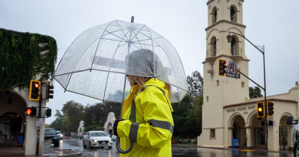
As the final rains of a storm-filled week moved over Southern California, heavy precipitation was already causing some flooding and trapped some cars in the snow overnight. Scattered showers from the third in a series of storms could last into Saturday.
In Orange County, a possible tornado or waterspout moved ashore around 10:15 p.m. Thursday in the eastern Dana Point Harbor, a witness reported to the National Weather Service. The wind “lofted a 12-foot segment of chain link fence with privacy fabric and threw it 70 feet across parking lot,” the weather service said.
There were numerous calls of flooding in the city of Westminster, police said, where an astonishing 1.84 inches of rain fell in a single hour, between 9:30 and 10:30 p.m. Thursday, according to the National Weather Service. One gauge in Garden Grove recorded 1.5 inches over the same hour.
In Huntington Beach, a three-mile stretch of Pacific Coast Highway was closed — between Warner Avenue and Seapoint Street, just southwest of the Bolsa Chica Ecological Reserve — due to roadway flooding. Inches of rain also covered a section of Artesia Boulevard in Redondo Beach and a road in a Huntington Beach neighborhood, KABC-TV Channel 7 reported.
In Big Bear Lake, a dozen vehicles were trapped in the snow along Highway 18 at Bear Valley Dam, authorities said.
By the time most Angelenos wake up Friday, however, the heaviest rain could be behind them — although some might be dealing with a big mess. The most severe rain was expected overnight, late Thursday into early Friday, the weather service said.
A flood watch, indicating flooding is possible from heavy rain, was in effect for much of Los Angeles County as well as eastern Riverside County and Imperial County through Friday morning. Other areas at risk for heavy rain overnight included a large swath of the Inland Empire and northern San Diego County.
One area of particular concern on Friday morning was a severe weather threat for southern L.A. County. The weather service office in Oxnard said the storm could rotate counterclockwise in that area, which could produce a small tornado. An area between Pasadena and the L.A. County-Orange County border was at risk, the weather service said late Thursday, although the area of risk could shift.
There’s a 10% to 20% chance of rain rates that could reach 1 inch per hour. Rain rates of half an inch or more per hour are enough to generate landslides. “This will be a much more scattered heavy rain event than the last event,” the weather service said, “so not all areas will get these rates, but the areas that do will could have significant hydrologic impacts,” such as flooding.
Later on Friday, there is a risk of a “semi-wet Santa Ana event” across parts of Los Angeles and Ventura counties. Typically, Santa Ana winds come from the north and east and are dry, capable of spreading wildfires; with this event, winds would come from the same direction, but with rain.
In Los Angeles County, there will be a 60% to 70% chance of rain Friday morning, and a 30% to 50% chance on Friday afternoon and evening, with a 10% to 20% chance through Saturday morning.
In Ventura County, there will be a 30% to 50% chance of rain Friday morning and afternoon, and a 10% to 20% chance Friday night.
In Orange County, San Diego County and the Inland Empire, the heaviest rainfall is also expected Thursday night into Friday morning. But light to moderate showers could continue through Friday, with some “wrap-around precipitation” into Saturday, referring to rain that could head from the south and from the east after the main cold front pushes through from the west.
A winter storm warning was in effect for the San Bernardino County and Riverside County mountains through Friday afternoon, including in Big Bear. Heavy, wet snow was expected to fall at elevations above 6,500 feet. Snowfall of 4 to 8 inches was expected from 6,000 to 7,000 feet; 7 to 11 inches from 7,000 to 7,500 feet; and 12 to 16 inches above 7,500 feet. The city of Big Bear Lake is at an elevation of 6,752 feet above sea level.
Scattered snow showers were expected into Saturday, with an additional 2 to 5 inches expected, the weather service office in San Diego said.
A winter weather advisory was in effect for the San Gabriel Mountains in Los Angeles County, including Mt. Baldy and Wrightwood. Snowfall of 3 to 6 inches was expected above 6,000 feet; and 1 to 3 inches from 5,000 to 6,000 feet. The Grapevine section of the 5 Freeway is not expected to see snow; its highest point is the Tejon Pass, which rises to 4,144 feet in elevation.
Once the storms finally move out sometime on Saturday, the rest of the weekend is expected to be dry but cool. For the rest of the week, including Thanksgiving, temperatures are expected to warm up to seasonal norms and be rain-free through Black Friday, the weather service said.
It’s possible another storm could come sometime between Nov. 29 and Dec. 2.
The post Flooding, a tornado, even the risk of a ‘semi-wet Santa Ana’ before storms finally leave L.A. appeared first on Los Angeles Times.