A storm set to sweep Southern California from Thursday into Saturday would not normally be worrisome, but it is bringing some concern to residents and officials because it is arriving just days after an earlier, more powerful storm left the region saturated.
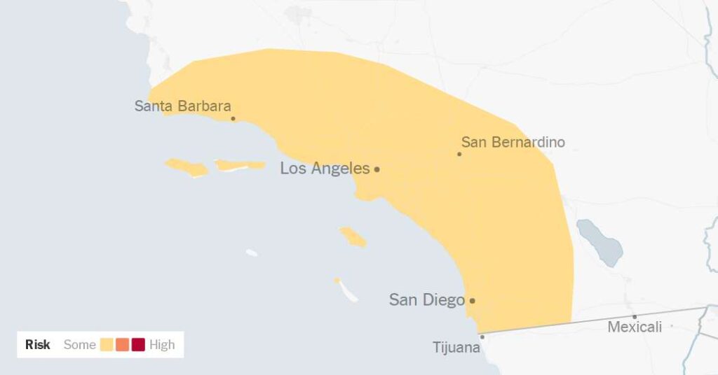
Because of last week’s rain, the soil across the area is soggy and less able to absorb additional rainfall, leaving the landscape more prone to flooding. As a result, forecasters said there’s some flood risk in the area between Santa Barbara and San Diego Counties and eastward into the coastal mountains. This includes the Los Angeles area, and the National Weather Service warned rain there could bring minor flooding on roadways and rock slides and mudslides on canyon roads.
The risk of debris flows in burn scars left by wildfires, such as the Eaton and Palisades fires, is very low with this storm, but Bryan Lewis, a meteorologist with the Weather Service office that covers Los Angeles, warned that one could still occur “if a thunderstorm develops and parks itself over one of those burn areas.”
This won’t be as strong as last week’s storm.
Rainfall totals through Saturday are projected to be up to one and a quarter inches across coastal and valley areas and up to two inches in the coastal mountains, far less than last week’s storm, which brought over two inches of rain to downtown Los Angeles and over nine inches of rain to the highest peaks in the Santa Ynez Mountains of Santa Barbara County.
This storm, however, will be colder than the last storm with snow levels expected to reach as low as 6,500 feet on Thursday. Elevations above 7,000 feet in the San Bernardino Mountains could pick up 14 inches of snow.
The bulk of the rain is expected to fall on Thursday and Friday, but it could continue into Saturday, particularly in San Diego. There, the storm could linger and bring additional rounds of rain because of what meteorologists call “wraparound moisture,” which is additional precipitation that arrives on the back end of a storm.
“We may end up getting the most rainfall in Southern California with this storm because of this wraparound moisture on Saturday,” said Sam Zuber, a meteorologist at the Weather Service’s San Diego office. “There’s still some uncertainty in the forecast.”
Southern California has seen an unusually wet start to the rainy season with Downtown Los Angeles recording 4.89 inches of rain since Oct. 1. This is a stark contrast to last year when the city had seen only 0.07 inches as of this time last year. The dry conditions in Southern California persisted into January, when catastrophic wildfires tore through neighborhoods in Los Angeles County. This year, the recent soaking rains have put an end to the wildfire risk.
Amy Graff is a Times reporter covering weather, wildfires and earthquakes.
The post More Rain on the Way to Los Angeles, Already Saturated by Recent Storms appeared first on New York Times.